Destinations
Explore parks, forests, trails, and wild places across the American West.
Angeles National Forest
CA
When 20 million people need wilderness within driving distance, they head to the Angeles. This 700,176-acre forest stretches from the Mojave Desert's edge to 10,064-foot Mount Baldy, creating Los Angeles County's unlikely mountain backdrop. Desert chaparral gives way to pine forests, year-round snow patches exist two hours from Venice Beach, and the Pacific Crest Trail threads through it all. The forest handles over 3 million visitors annually, but its sheer size and elevation range mean solitude still exists for those who know where to look.
 National Forest
Cleveland National Forest
CA
Cleveland National Forest isn't what most people picture when they think "national forest." Sprawling across 460,000 acres of Southern California's drylands, it's a patchwork of chaparral-covered mountains, oak woodlands, and pine forests that rises from desert scrub to 6,000-foot peaks. This is where San Diego County residents come to escape the coast's crowds, where PCT hikers start their 2,600-mile journey north, and where the Santa Ana Mountains offer surprising waterfalls just an hour from Orange County sprawl. Three separate mountain ranges — Santa Ana, Palomar, and Laguna — make up this forest, each with its own character and challenges.
 National Forest
Eldorado National Forest
CA
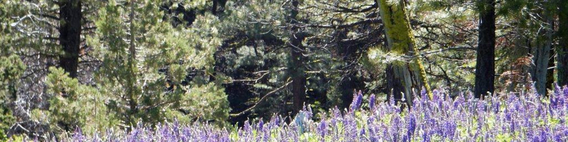
The central Sierra Nevada's workhorse forest, Eldorado sprawls from oak-dotted foothills at 1,000 feet to the granite spine of the Sierra crest above 10,000 feet. Two major highways slice through its 678,000 acres, making it the most accessible high-country escape for Sacramento and Bay Area residents. While Desolation Wilderness draws the heaviest traffic, the forest's 40 campgrounds and 400 miles of trails offer everything from family car camping at Union Valley Reservoir to serious alpine routes in the Mokelumne Wilderness. It's Sierra Nevada recreation without the Yosemite crowds—if you know where to look.
 National Forest
Inyo National Forest
CA
The eastern escarpment of the Sierra Nevada rises with shocking abruptness from sagebrush flats, climbing 10,000 vertical feet in just a few miles. Inyo National Forest claims this dramatic transition zone, stretching 165 miles along the California-Nevada border and encompassing nearly 2 million acres of terrain that ranges from desert basins at 3,900 feet to the summit of Mount Whitney at 14,494 feet. This is where backpackers chase permits for legendary wilderness routes, day hikers test themselves on alpine approaches, and anyone with functioning eyes pulls over to stare at the most dramatic mountain wall in the lower 48. The crowds are real, especially at the famous trailheads, but the forest's sheer size and elevation diversity offer escape routes for those willing to look beyond the Instagram favorites.
 National Forest
Klamath National Forest
OR
Nearly two million acres of rugged mountains and deep river canyons straddling the California-Oregon border, Klamath National Forest feels like the Pacific Northwest's forgotten stepchild. This is a working forest where serious hikers come for solitude in five wilderness areas, anglers chase steelhead on 152 miles of Wild and Scenic rivers, and OHV riders have 2,800 miles of roads and trails largely to themselves. The terrain ranges from 450 feet along the Klamath River to 8,900-foot peaks in the Marble Mountains, creating a landscape that's part temperate rainforest, part high desert, and entirely uncrowded compared to the Sierra Nevada to the south.
 National Forest
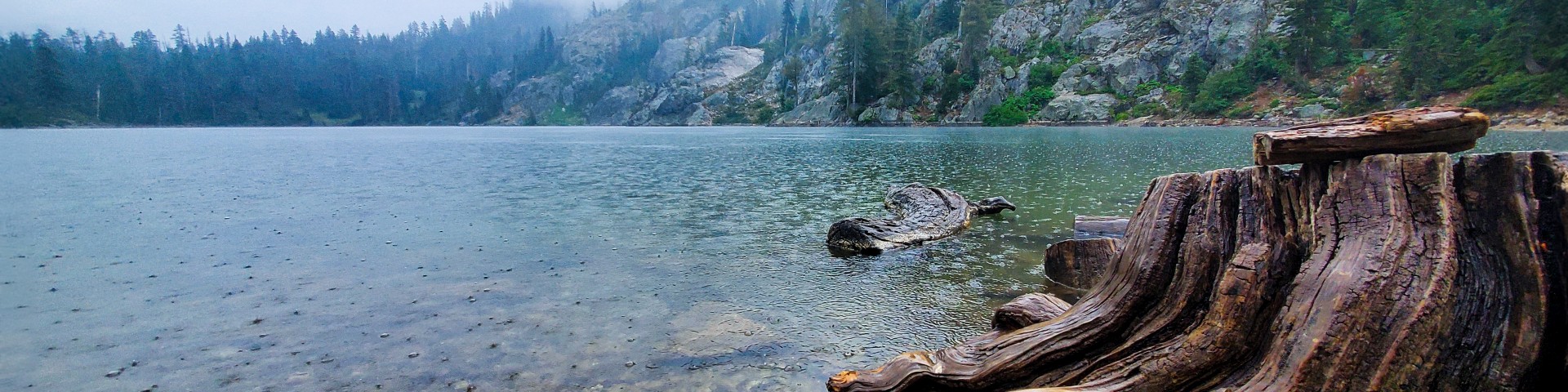
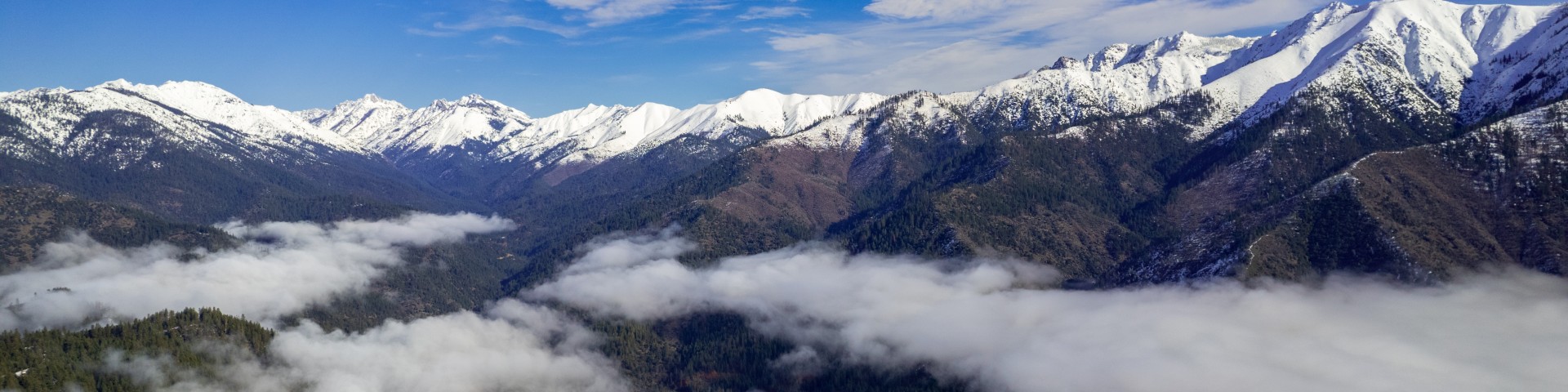
Lake Tahoe Basin Management Unit
CA
Straddling the California-Nevada border, this 154,851-acre national forest unit wraps around one of the Sierra's most famous alpine lakes like a protective collar. Unlike typical national forests sprawling across multiple counties, the Lake Tahoe Basin Management Unit exists for a single purpose: managing recreation pressure around a 22-mile-long body of water that draws millions annually. The terrain climbs from Tahoe's 6,225-foot shoreline to 10,881-foot Freel Peak, encompassing granite domes, subalpine meadows, and some of California's most regulated wilderness. Day hikers chase waterfalls and summit views, backpackers disappear into Desolation Wilderness, and car campers claim spots in a dozen developed campgrounds that book solid all summer.
 National Forest
Lassen National Forest
CA
Lassen National Forest occupies a geological crossroads where Sierra Nevada granite crashes into Cascade lava flows, creating 1.2 million acres of diverse terrain across northern California. This is where sagebrush flats meet alpine lakes, where volcanic cinder cones rise from pine forests, and where you can hike through three distinct ecosystems in a single day. The forest attracts everyone from weekend car campers at Eagle Lake to serious backpackers heading into the Caribou Wilderness, though it remains refreshingly less crowded than the marquee forests to the south.
 National Forest
Los Padres National Forest
CA
Los Padres sprawls across nearly two million acres of California's Coast Ranges and Transverse Mountains, running 220 miles from the Monterey Peninsula down to the edges of the Los Angeles basin. This is a forest of extremes: redwood canyons dropping to Pacific surf, chaparral-covered peaks pushing toward 9,000 feet, and some of the most remote wilderness in the lower 48. Day hikers come for waterfall hikes and hot springs soaks, while serious backpackers disappear into roadless country that can feel more like Montana than coastal California. The geography is so varied that you might camp in fog-shrouded Big Sur one night and wake up in high desert the next.
 National Forest
Mendocino National Forest
CA
The only national forest in California without a major paved road crossing it, Mendocino sprawls across 927,650 acres of North Coast Range mountains, deep canyons, and oak-dotted foothills. Three hours north of San Francisco, this is where Bay Area hikers come to escape the Tahoe crowds — and where they discover that solitude has a price. Dirt roads, scarce water, and minimal trail maintenance keep the casual visitors away, leaving the backcountry to those willing to work for it.
 National Forest
Modoc National Forest
CA
Modoc National Forest occupies California's far northeastern corner, where volcanic plateaus meet high desert and the Warner Mountains rise from sagebrush country. This is where California begins to feel like Nevada — big skies, wild horses roaming 500 square miles of territory, and trails where you might not see another soul all day. While other Sierra forests draw crowds, Modoc's 1.6 million acres remain largely unknown, attracting hunters, obsidian collectors, and hikers seeking the kind of solitude that's increasingly rare in California's public lands.
 National Forest
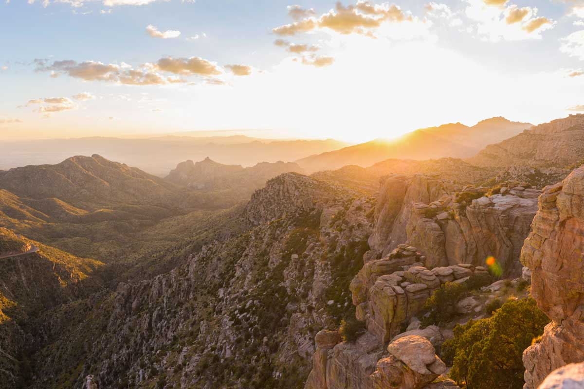
Mount Lemmon: Arizona’s Sky Island Adventure
AZ
Mount Lemmon rises from the Sonoran Desert floor to a forested summit over 9,000 feet high.
 National Forest
Plumas National Forest
CA
The Lost Sierra lives up to its name. Plumas National Forest sprawls across more than a million acres of northern California's forgotten mountains, where granite peaks rise from dense forests and dozens of alpine lakes reflect sky instead of selfie sticks. This is where the Sierra Nevada begins its long march south, but the crowds haven't caught on yet. PCT thru-hikers know it for two major river canyon crossings. Anglers know it for trout-filled reservoirs. Everyone else drives past on Highway 70, missing one of California's most accessible wilderness experiences.
 National Forest
San Bernardino National Forest
CA
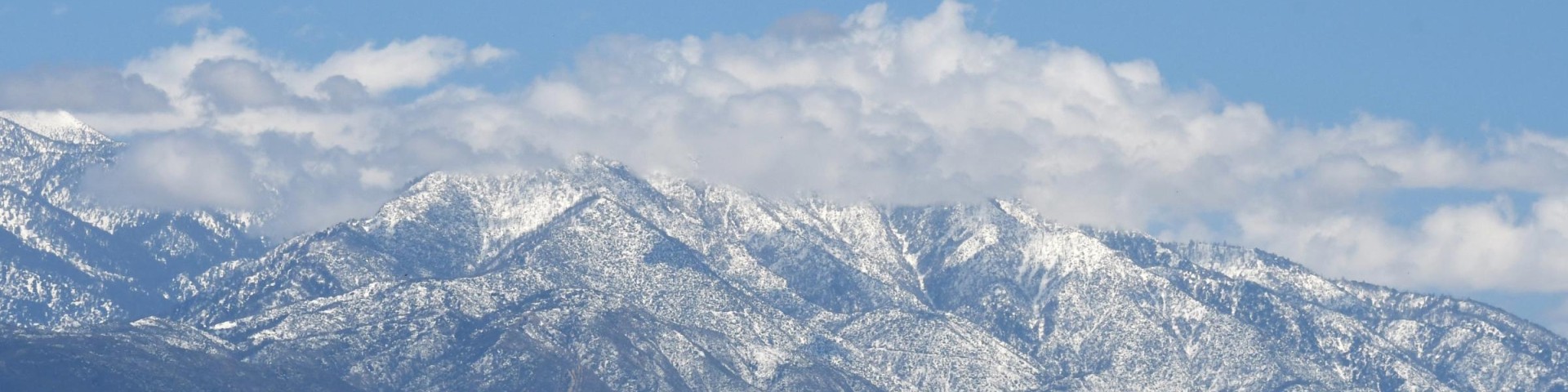
San Bernardino National Forest sprawls across 823,816 acres of Southern California mountain country, making it the closest substantial wilderness to some 20 million people. This proximity breeds both opportunity and chaos — you can be hiking through pine forests at 10,000 feet within two hours of downtown LA, but you'll share popular trails with half the Inland Empire on weekends. The forest splits into two distinct mountain ranges: the San Bernardino and San Gabriel ranges to the north, and the San Jacinto and Santa Rosa ranges to the south, each offering vastly different experiences from desert washes to subalpine meadows.
 National Forest
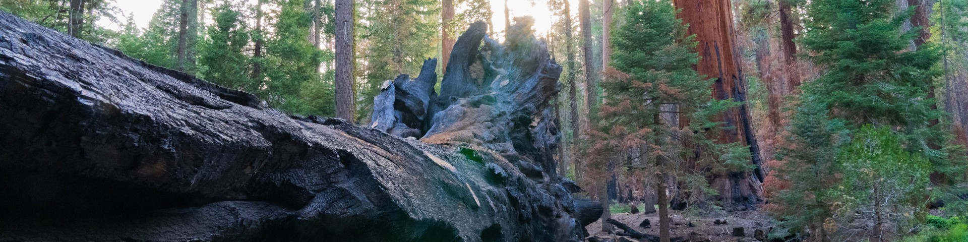
Sequoia National Forest
CA
The largest national forest in California sprawls across 1.1 million acres of the southern Sierra Nevada, from rolling oak foothills at 1,000 feet to granite peaks pushing 12,000 feet. This is working forest country where giant sequoias share space with OHV trails, wilderness backpackers cross paths with whitewater rafters, and you can camp beside the Kern River after driving logging roads that see more pickup trucks than Subarus. Three ranger districts manage everything from the world's largest trees to some of the West's best trout water, making this the Sierra Nevada for people who want options beyond the crowded national parks next door.
 National Forest
Shasta-Trinity National Forest
CA
Northern California's Shasta-Trinity spans 2.1 million acres from the Sacramento Valley's edge to the Oregon border — the largest national forest in the state. This isn't one landscape but several: the volcanic cone of 14,162-foot Mount Shasta rising from surrounding plains, the granite spires and alpine lakes of the Trinity Alps, the oak woodlands and rushing rivers of the western slopes. Day hikers come for Castle Crags' dramatic towers, backpackers disappear into the Trinity Alps for weeks, and climbers test themselves on Shasta's glaciated flanks. The forest absorbs crowds across its vastness, offering everything from roadside camping at massive reservoirs to genuine wilderness solitude in places most Californians have never heard of.
 National Forest
Sierra National Forest
CA
The western slope of the Sierra Nevada packs five wilderness areas into 1.3 million acres, making Sierra National Forest a launching pad for some of California's most remote backcountry. This isn't Yosemite — it's the working landscape next door, where wilderness permits are easier to get and the high country stretches from Huntington Lake clear to the John Muir Wilderness boundary. Day hikers cruise the scenic byways to alpine lakes, while backpackers disappear for weeks into granite basins that see a fraction of the crowds found in neighboring parks. At elevations spanning 900 feet to nearly 14,000 feet, the forest delivers everything from Central Valley heat to high Sierra solitude.
 National Forest
Six Rivers National Forest
CA
Six Rivers National Forest sprawls across nearly a million acres of northwestern California's most diverse terrain, from fog-shrouded coastal ranges to the bone-dry interior mountains of the Klamath region. This is where the Pacific temperate rainforest meets the arid mountains, creating a landscape of old-growth redwoods, alpine lakes, and some of California's last wild rivers. Backpackers come for four wilderness areas and 250 miles of trails, while rafters and anglers chase salmon runs on the Smith, Trinity, and Klamath. It's the forest locals know but visitors often miss, tucked between the Redwood National Parks and the Trinity Alps.
 National Forest
Stanislaus National Forest
CA
Stanislaus spreads across 898,000 acres of Central Sierra terrain — from oak-studded foothills to alpine cirques scraping 11,000 feet. This is where Highway 108 climbs to 9,623-foot Sonora Pass, one of the highest paved crossings in California, and where three wilderness areas hold some of the Sierra's most reliable solitude. Established in 1897, it's old enough to have weathered every boom-and-bust cycle of Sierra recreation, yet it still flies under the radar compared to its famous neighbors. Day hikers circle Pinecrest Lake, backpackers disappear into Emigrant Wilderness for weeks, and anyone seeking a less-crowded taste of High Sierra granite finds it here.
 National Forest
Tahoe National Forest
CA
Tahoe National Forest sprawls across 1.2 million acres of Sierra Nevada terrain, from oak-dotted foothills to granite peaks along the California-Nevada border. This is the forest that cradles Lake Tahoe's northwest shore while extending deep into the high country — a landscape of glacial lakes, granite slabs, and dense conifer forests that draws everyone from weekend car campers to serious wilderness backpackers. With 371 trails threading through everything from the quota-free Granite Chief Wilderness to the permit-heavy Desolation Wilderness, it's a forest that rewards both spontaneous adventures and carefully planned expeditions. The proximity to major population centers means crowds in the obvious places, but also means you can drive from Sacramento and be on a trail in two hours.