Tahoe National Forest
CA
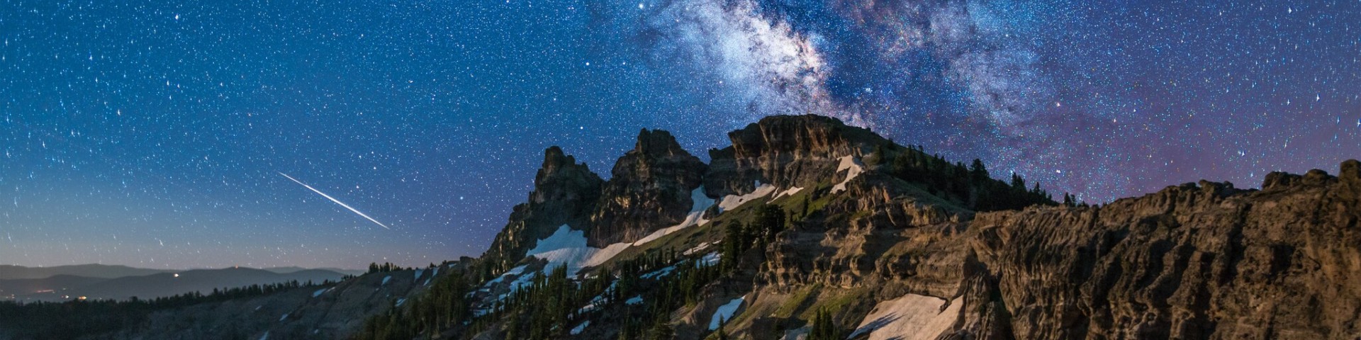
Tahoe National Forest sprawls across 1.2 million acres of Sierra Nevada terrain, from oak-dotted foothills to granite peaks along the California-Nevada border. This is the forest that cradles Lake Tahoe's northwest shore while extending deep into the high country — a landscape of glacial lakes, granite slabs, and dense conifer forests that draws everyone from weekend car campers to serious wilderness backpackers. With 371 trails threading through everything from the quota-free Granite Chief Wilderness to the permit-heavy Desolation Wilderness, it's a forest that rewards both spontaneous adventures and carefully planned expeditions. The proximity to major population centers means crowds in the obvious places, but also means you can drive from Sacramento and be on a trail in two hours.
Details
- 🏞️Type
- National Forest
- 🏛️Managed by
- USDA Forest Service
- 📍State
- CA
- 🗺️Address
- 631 Coyote Street, Nevada City, CA, 95959
- 📞Phone
- (530) 265-4531
- 📡GPS
- 39.43000, -120.57800
The Place
Tahoe National Forest occupies a vertical world that spans nearly 8,000 feet of elevation, from chaparral-covered foothills in the west to alpine peaks above 10,000 feet along the Sierra crest. The landscape shifts dramatically as you gain elevation: oak woodlands give way to mixed conifer forests of pine, fir, and cedar, which eventually yield to granite expanses dotted with glacial lakes and cirques.
The forest encompasses several distinct wilderness areas, each with its own character. Granite Chief Wilderness covers 25,680 acres of high-alpine terrain west of Lake Tahoe, featuring the jagged peaks and lake-filled basins typical of the Sierra. The 63,960-acre Desolation Wilderness straddles the forest's southern edge, containing some of the most heavily visited backcountry in California. These wilderness areas preserve the classic Sierra Nevada experience: granite domes, crystalline lakes, and forests of red fir and lodgepole pine.
Water defines much of the forest's appeal. The Truckee River flows through the northern sections, while countless creeks drain the high country, feeding reservoirs like Stampede and Boca. The forest holds a piece of the North Fork American Wild and Scenic River, accessible only on foot through steep canyon terrain.
Getting There
Interstate 80 serves as the forest's primary artery, connecting the Bay Area and Sacramento to Truckee in about two hours. From Truckee, Highway 89 runs north and south, providing access to numerous trailheads and campgrounds. Highway 49 cuts through the forest's western sections, while Highway 20 accesses the northern portions near Nevada City.
The main travel corridors include the Foresthill Divide Road, Mosquito Ridge Road, Bowman Road, Marysville Road, and Gold Lakes Road — many of which close seasonally or require high-clearance vehicles. Some unpaved roads are very rocky and rough, with 4x4 clearance strongly recommended. Several roads close to wheeled traffic from January through March according to Motor Vehicle Use Maps.
Truckee anchors the forest's recreational access, sitting at 6,000 feet with full services. Nevada City provides another gateway town on the forest's western edge. Cell coverage varies widely — reliable near major highways and towns, spotty to nonexistent in wilderness areas and remote valleys.
When to Go
The forest's elevation range creates distinct seasonal windows. Lower elevations around 3,000-5,000 feet offer year-round access, though winter brings occasional snow. The prime hiking and camping season runs from late May through October in mid-elevations, with higher alpine areas often snow-free only from July through early September.
Summer temperatures climb into the 80s and 90s at lower elevations, dropping 3-5 degrees for every 1,000 feet of elevation gain. High-country nights can dip below freezing even in summer. Fire season typically spans May through October, with campfire restrictions varying by elevation and conditions. Year-round campfire restrictions apply in the Lake Tahoe Basin, where wood and charcoal fires are prohibited except in designated iron rings at developed campgrounds.
Winter transforms the landscape, particularly around Donner Summit, where many areas become part of the sno-park system for snowshoeing and backcountry skiing. The best backpacking window for high-elevation areas like Mt. Rose Wilderness runs from July through early September.
Permits & Regulations
Tahoe National Forest operates under a relatively simple permit system compared to other Sierra forests. Wilderness permits are not required for overnight camping in most areas, including Granite Chief Wilderness — one of the few wilderness areas in California without entry quotas.
The major exception is Desolation Wilderness, which requires permits for both day use and overnight camping. Day permits are free and self-issued at trailheads, but overnight permits cost money and operate under a quota system. Permits can be reserved up to six months in advance through recreation.gov, or obtained in person at the Lake Tahoe Basin Management Unit office in South Lake Tahoe. Zone 46 (Tahoe Rim Trail Zone) allows only 10 permits per night.
Campfire permits are required for all fires and portable gas stoves anywhere within the forest boundary outside designated recreation sites. These permits are free and available at ranger stations. Wood and charcoal fires are completely prohibited in Desolation Wilderness.
Bear-resistant food storage became mandatory throughout the Tahoe Rim Trail system in January 2024. All food and scented items must be stored in approved hard-sided bear canisters.
Hiking & Routes
The forest's 371 trails offer options from easy lakeside strolls to multi-day wilderness expeditions. Five Lakes Trail from Alpine Meadows provides one of the easiest entries into Granite Chief Wilderness — a 2-mile climb gaining 1,100 feet to reach the first of several alpine lakes at 7,600 feet elevation.
For a less demanding option, try the Loch Leven Trail, a 3.5-mile hike gaining 1,200 feet to reach High Loch Leven at 6,900 feet. The trail levels out after 2.3 miles among a cluster of lakes, making for good day hiking or easy backpacking.
Serious backpackers gravitate toward the Pacific Crest Trail corridor, which traverses the forest's high country. Anderson Peak, at 8,683 feet, offers expansive views along the PCT route. The Western States Endurance Run follows a 100.6-mile route with 18,310 feet of total elevation gain — giving a sense of the terrain's scale and difficulty.
The most popular backpacking areas along the Donner Summit corridor include Grouse Ridge (accessed from Bowman Lake Road trailheads), Granite Chief Wilderness, and various PCT access points along Interstate 80. For the ultimate cheat, the Palisades Tahoe Aerial Tram can save nearly 2,000 feet of elevation and 3.5 miles of hiking when accessing Granite Chief Wilderness.
Shorter options include the 2.36-mile Beacroft Trail beginning at Forest Road 88-036 off Foresthill Divide, and various trails around Shirley Canyon, including a 4-mile route with 1,374 feet of elevation gain.
Camping
The forest operates 63 campgrounds ranging from developed sites with amenities to primitive areas with vault toilets only. Reservations through recreation.gov are highly recommended for peak season, with bookings opening several months in advance. All campgrounds maintain some first-come, first-served sites.
Silver Creek-Truckee Campground sits directly on the Truckee River with single-family sites and seven tent-only spots. RVs longer than 24 feet face restrictions due to limited turnaround space. Bear lockers measure 48 inches wide by 28 inches deep by 35 inches tall.
Logger Campground at Stampede Reservoir sits 30 minutes from Truckee with standard campground amenities. Additional vehicle fees run $10 per night, with a maximum of two dogs per site. Boca Campground, 15 minutes northeast of Truckee, provides vault toilets but no drinking water.
Granite Flat Campground, one mile south of Truckee on Highway 89, offers seven walk-in tent sites (#69-75) with parking outside the actual campsites. Bear locker dimensions here are 28 inches tall by 47 inches wide by 36 inches deep.
Dispersed camping is permitted anywhere within the forest boundary with standard Leave No Trace practices. In wilderness areas, camp 100-300 feet from the Tahoe Rim Trail, at least 200 feet from water sources, and 100 feet from other trails.
Other Activities
The forest accommodates OHV users with designated trails and areas, though specific route information requires checking current Motor Vehicle Use Maps. Mountain biking is popular on forest roads and designated trails, particularly in the Truckee area.
Fishing opportunities abound in the numerous lakes and streams, with special kids' fishing events held at locations like Packer Lake. The forest's nine historic fire lookouts include two available for rent, offering unique overnight experiences.
Winter brings cross-country skiing and snowshoeing, particularly around Donner Summit where the sno-park system provides organized winter recreation access.
Water, Weather & Hazards
Water availability varies dramatically by season and elevation. High-country lakes and streams typically run full through summer but may be frozen or snow-covered into July. Lower elevation streams can dry up by late summer. Always verify current conditions with ranger districts before depending on natural water sources.
Fire danger runs moderate to high through much of the summer and fall. Lightning-sparked fires are common during afternoon thunderstorms, which build frequently over the high peaks from June through September.
Black bears are present throughout the forest, necessitating proper food storage. The mandatory bear canister requirement along the Tahoe Rim Trail reflects the severity of bear encounters in popular areas.
Temperature swings can be dramatic, especially at higher elevations where summer nights may drop below freezing. Weather changes rapidly above timberline, with afternoon thunderstorms posing lightning risks.
Finding Solitude
The forest's proximity to major population centers creates predictable crowd patterns. Desolation Wilderness sees heavy use despite permit requirements, particularly on weekends and holidays. Popular day hikes like Five Lakes Trail and areas accessible from Interstate 80 trailheads fill up quickly during peak season.
For fewer crowds, explore the forest's northern sections accessed via Gold Lakes Road or venture into Grouse Ridge areas off Bowman Lake Road. Mid-week visits dramatically reduce encounters, even on popular trails.
The forest's sheer size provides ample opportunity for solitude — 371 trails can't all be crowded. Lesser-known wilderness access points and the many trails that don't lead to Instagram-famous destinations often provide peaceful experiences within an hour's drive of major cities.
Winter offers the ultimate solitude experience, when snow limits access to all but the most determined visitors. Even popular summer areas become quiet winter playgrounds for those equipped with snowshoes or skis.