Field Guide to America's Wild Places
America's Wild Places
Detailed guides to national parks, BLM lands, national forests, wilderness areas, and more across all 50 states.
Save guides to your phone and take them into the backcountry. No cell service required.
Save guides for offline access — install from your browser menu.
Browse by Type
IndexRecently Added
View all →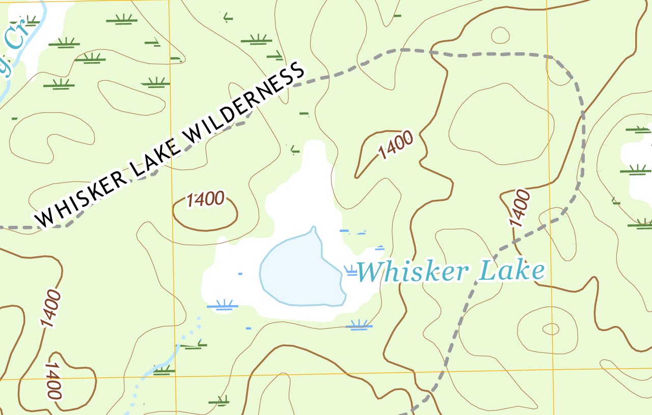 Wilderness Area
WI
Whisker Lake Wilderness Outdoors Guide
Whisker Lake Wilderness is a small, quiet 7,500-acre tract of north-woods forest and water on the Wisconsin-Michigan border, managed by the U.S. Forest Service within the Chequamegon-Nicolet National Forest, about 11 miles west of Florence, Wisconsin. It takes its name from a stand of old white pines along the lakeshore, the 'chin whiskers' that survived the wildfires and railroad logging that swept the region a century ago. The wilderness holds six small lakes, trout streams, beaver wetlands, and rolling forest, with a handful of primitive trails and no developed facilities. For paddlers, anglers, and hikers who want a low-key Northwoods backcountry escape, it is a peaceful, uncrowded pocket of the north.
 Wilderness Area
MO
Irish Wilderness Outdoors Guide
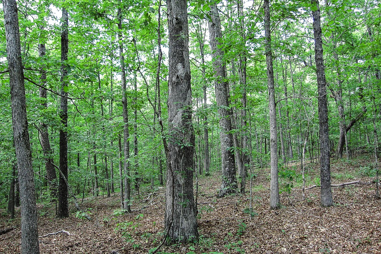
The Irish Wilderness is a 16,000-acre swath of remote Ozark forest in southern Missouri, managed by the U.S. Forest Service within the Mark Twain National Forest. It is the largest designated wilderness in the state, a rolling expanse of oak and hickory, spring-fed creeks, and limestone bluffs near the Eleven Point National Wild and Scenic River. The name comes from a community of Irish immigrants that a Catholic priest settled here in the 1850s, who vanished amid the chaos of the Civil War when the area became a lawless no-man's-land. Today it is quiet backcountry threaded by the 18-mile White's Creek Trail. For hikers and backpackers who want solitude, water, and deep Ozark woods rather than mountains, it delivers.
 Wilderness Area
CO
Weminuche Wilderness Adventure Guide
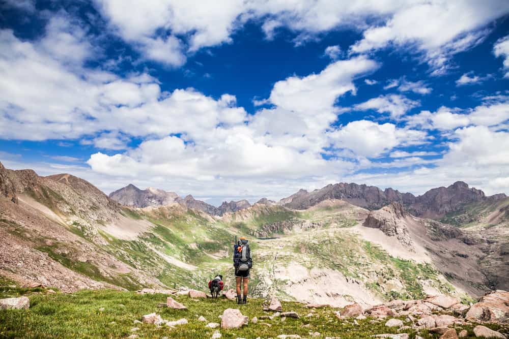
The Weminuche Wilderness is the largest designated wilderness in Colorado, nearly 500,000 acres of high San Juan Mountains in the state's rugged southwest, managed by the U.S. Forest Service within the San Juan and Rio Grande National Forests. This is serious high country: alpine basins above treeline, jagged peaks topping 13,000 and 14,000 feet, and roughly 470 miles of trail, including about 80 miles of the Continental Divide Trail. It is best known for Chicago Basin, a backpacking destination reached by a historic narrow-gauge steam train, where three of Colorado's fourteeners cluster within a day's climb of camp. For experienced backpackers and peak-baggers willing to earn it, the Weminuche is one of the wildest stretches of the Rockies in the Lower 48.
 National Monument
AZ
Tuzigoot National Monument: Discover Arizona's Sinagua History
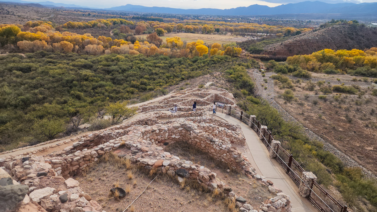
Tuzigoot National Monument preserves a 1,000-year-old hilltop pueblo in Arizona's Verde Valley, managed by the National Park Service, near the town of Clarkdale about 90 miles north of Phoenix. Built and occupied by the Sinagua people between roughly 1000 and 1400 CE, the pueblo crowns a ridge above the Verde River with the partially reconstructed walls of some 110 rooms. This is a short, accessible, history-focused stop rather than a hiking destination: a quarter-mile loop trail through the ruins, a museum of Sinagua pottery and tools, and a long view over the river marshes. For travelers exploring the Verde Valley or Sedona nearby, it is an easy and worthwhile hour with deep human history.
 Wilderness Area
AZ
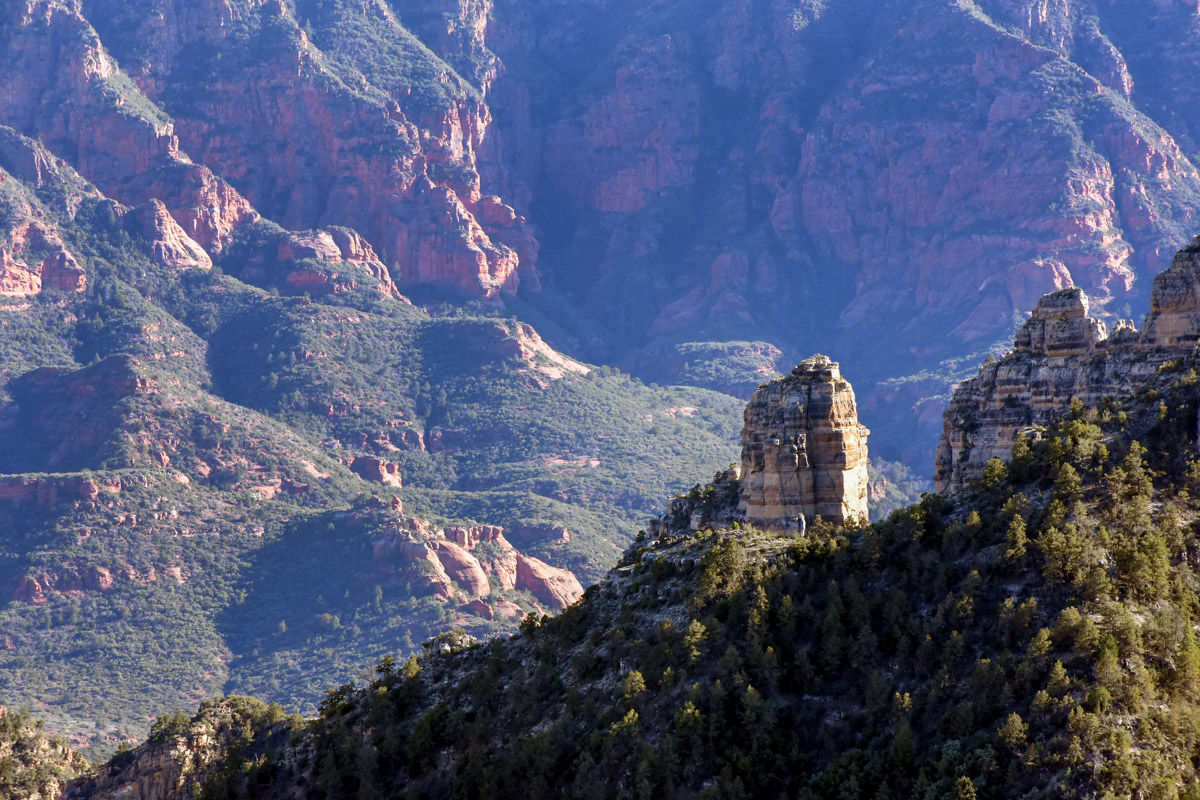
Sycamore Canyon Wilderness: Exploring Arizona's Hidden Red Rock Haven
Sycamore Canyon Wilderness protects the second-largest red-rock canyon in Arizona, a roughly 56,000-acre gorge managed by the U.S. Forest Service where the Kaibab, Coconino, and Prescott National Forests meet, northwest of Sedona. It has the same vivid red sandstone that draws crowds to Sedona, with almost none of the development or traffic: no scenic drive runs through it, no shuttle, just a deep wild canyon with a spring-fed creek, blue pools, and cottonwood-shaded riparian corridors set against red walls. A stretch of the Arizona National Scenic Trail crosses it. For hikers who want Sedona-grade scenery in a quiet, primitive, self-reliant setting, this is the antidote to the crowds an hour and a half south.
 BLM Land
UT
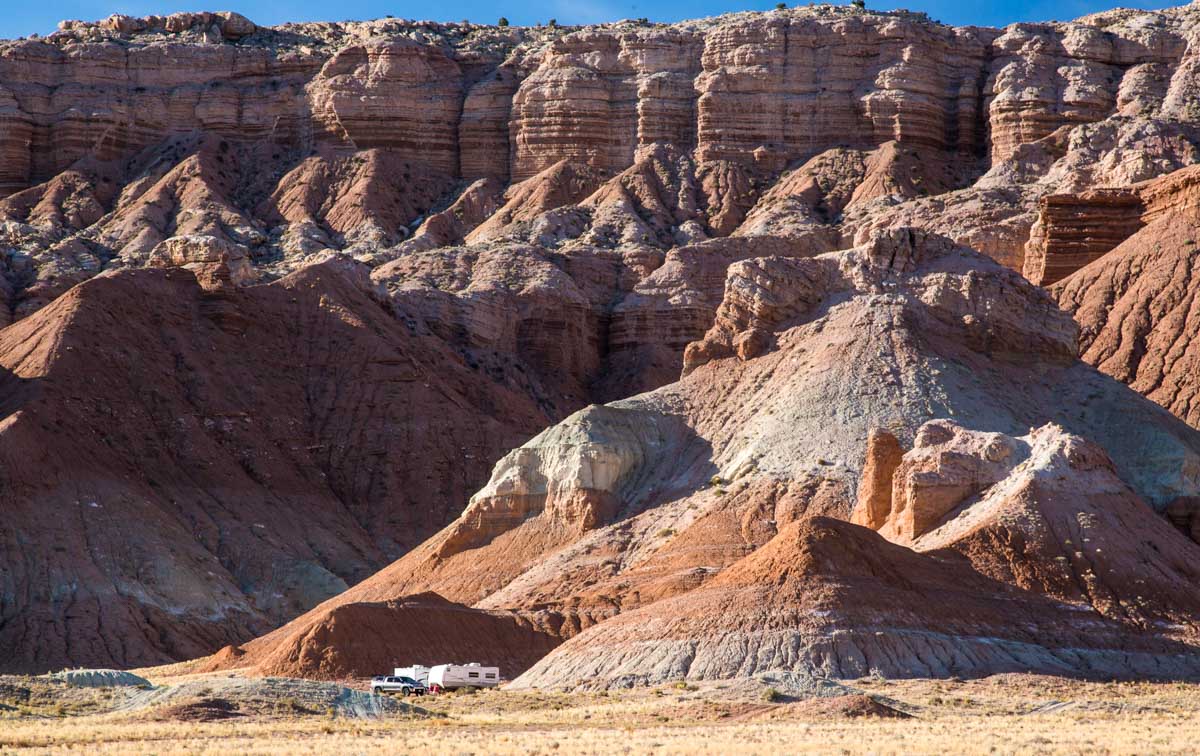
San Rafael Swell
The San Rafael Swell is a vast dome of uplifted desert rock in central Utah, mostly public land managed by the Bureau of Land Management, sprawling across the high country between the towns of Price, Green River, and Hanksville. There are no entrance gates and few signs: this is wide-open BLM country of slot canyons, sandstone reefs, buttes, and a river-cut gorge nicknamed the Little Grand Canyon. For hikers, canyoneers, mountain bikers, OHV riders, and free dispersed campers who want raw, undeveloped desert and almost total solitude, the Swell is one of the best and least-managed playgrounds in the state. It is largely free, and largely up to you to navigate.