Destinations
Explore parks, forests, trails, and wild places across the American West.
 State Park
Ahjumawi Lava Springs State Park
CA
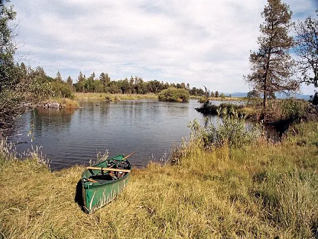
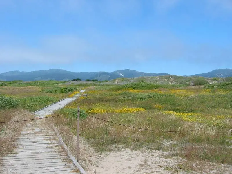
Ahjumawi Lava Springs requires more planning than almost any other California state park. It is accessible only by boat, with no roads and no services, in a corner of Shasta County most Californians have never thought to visit. Once you're in, you're paddling through one of the country's largest freshwater spring systems, over lava flows three to five thousand years old, past channels so clear the basalt bottom is visible in detail. The Achomawi people called this place "where the waters come together," and that remains the most accurate description of what makes it unlike anything else in the state park system.
 State Park
Albany State Marine Reserve
CA
Albany State Marine Reserve sits at the north end of McLaughlin Eastshore State Park, where the eastern edge of San Francisco Bay meets the Albany shoreline. Free to enter and 10 minutes from the Bay Bridge, it's more productive for wildlife than its urban setting suggests. Harbor seals haul out on the rocks, shorebirds work the tidal mudflats, and the rocky shoreline opens up at low tide for tidepooling. The no-take reserve designation means nothing comes home with you, not even shells.
 State Park
Anderson Marsh State Historic Park
CA
Anderson Marsh sits at the southeastern corner of Clear Lake, California's largest natural freshwater lake, in Lake County. The 870-acre park protects a mix of tule marsh, riparian woodland, and oak savanna along Cache Creek, with 14,000 years of continuous human occupation by the Koi people. For birders, it's one of the best wetland sites in the North Coast Ranges.
 State Park
Angel Island State Park
CA
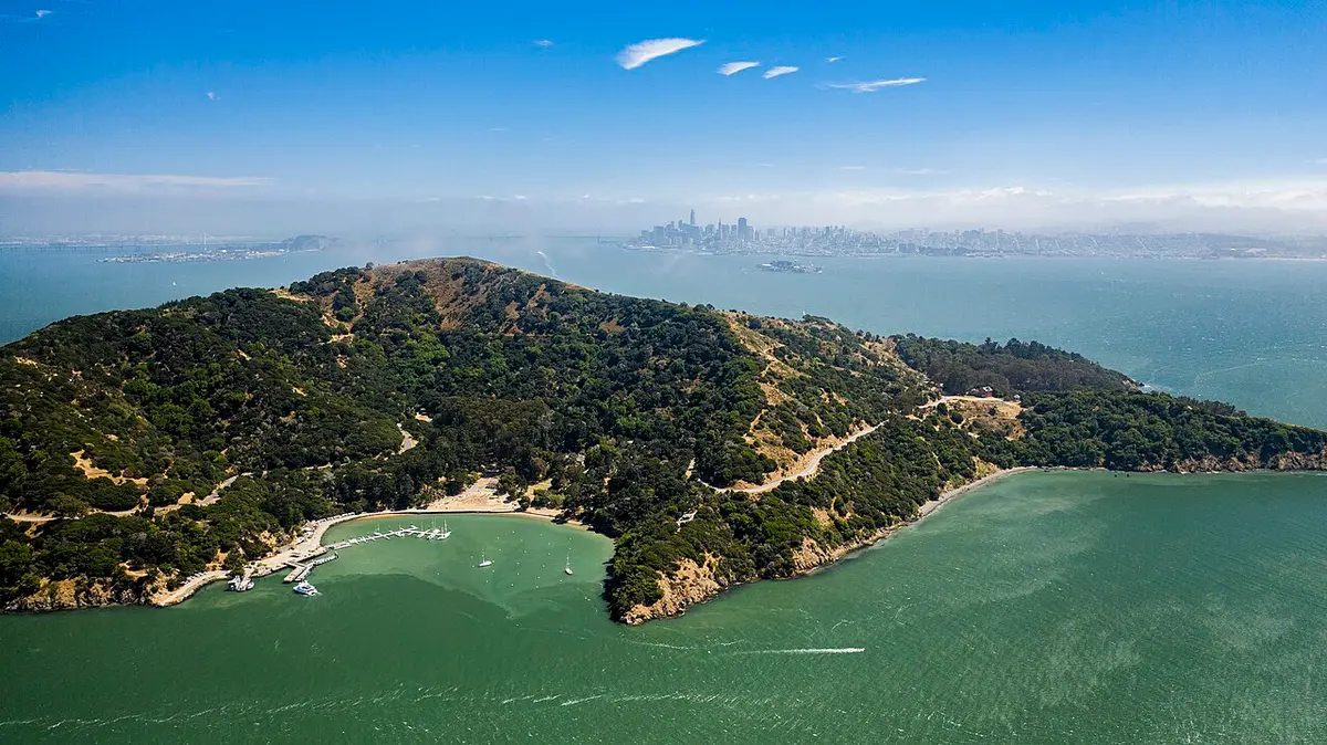
Angel Island is the largest natural island in San Francisco Bay, sitting between the city and Marin County with 360-degree views from its 781-foot summit. It has been Coast Miwok territory, a Civil War fortification, and an immigration processing station for hundreds of thousands of arrivals; now it's a state park you reach by ferry, with trails, history, and campsites that book six months out.
 State Park
Año Nuevo State Park
CA
Año Nuevo hosts one of the largest mainland elephant seal colonies in the world, with up to 10,000 animals showing up annually to breed, give birth, and molt on the beaches and offshore island north of Santa Cruz. This is not passive wildlife viewing; you will hear, smell, and almost certainly be startled by a two-ton bull making his feelings known from twenty-six feet away.
 State Park
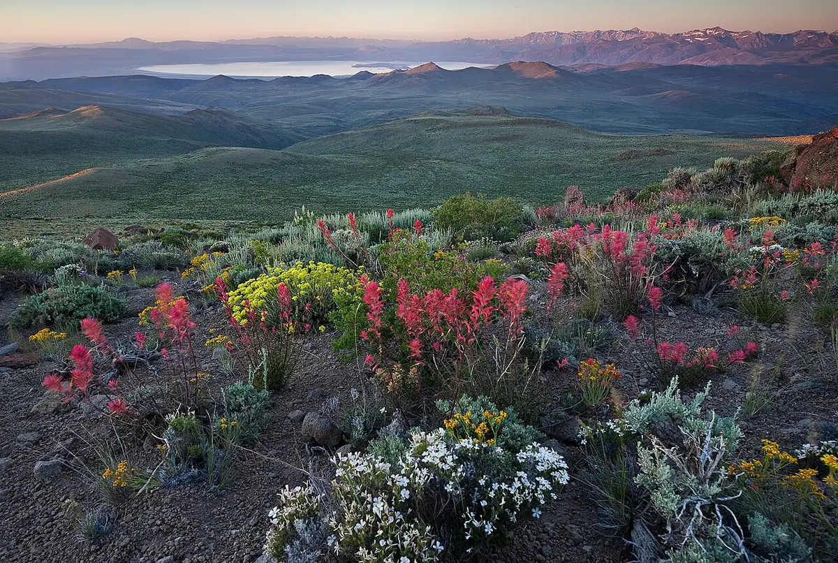
Antelope Valley California Poppy Reserve State Natural Reserve
CA
The Antelope Valley California Poppy Reserve is 1,781 acres of Mojave Desert grassland where California's state flower blooms in extraordinary concentration each spring. In a good year, the hills turn orange from Lancaster Road to the San Gabriel Mountains on the horizon; in a poor year, the fields are still interesting. The trick is knowing when to go.
 State Park
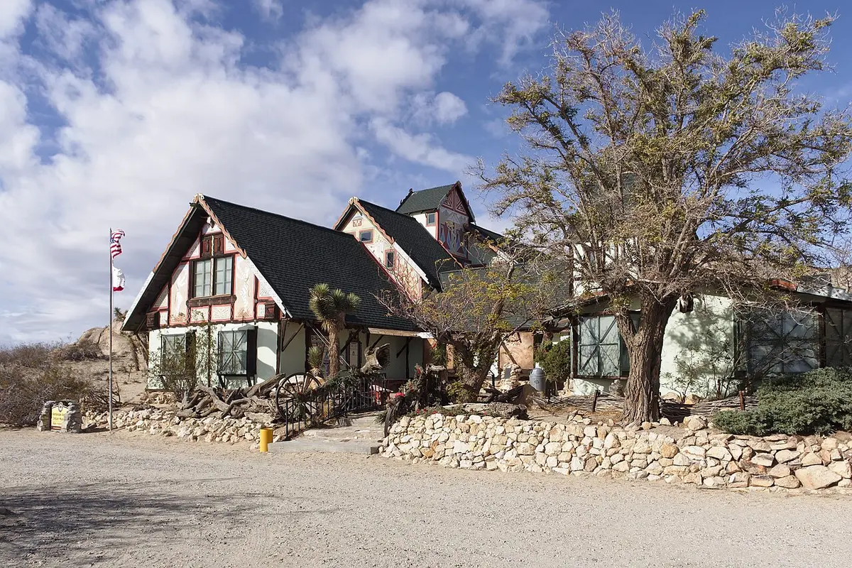
Antelope Valley Indian Museum State Historic Park
CA
The Antelope Valley Indian Museum occupies a chalet-style building constructed in 1928 directly over a rock formation called Piute Butte, in the eastern Antelope Valley. It's open only on weekends, admission is $3, and it holds over 4,000 objects representing Native American cultures from coastal California, the Great Basin, and the Southwest.
 State Park
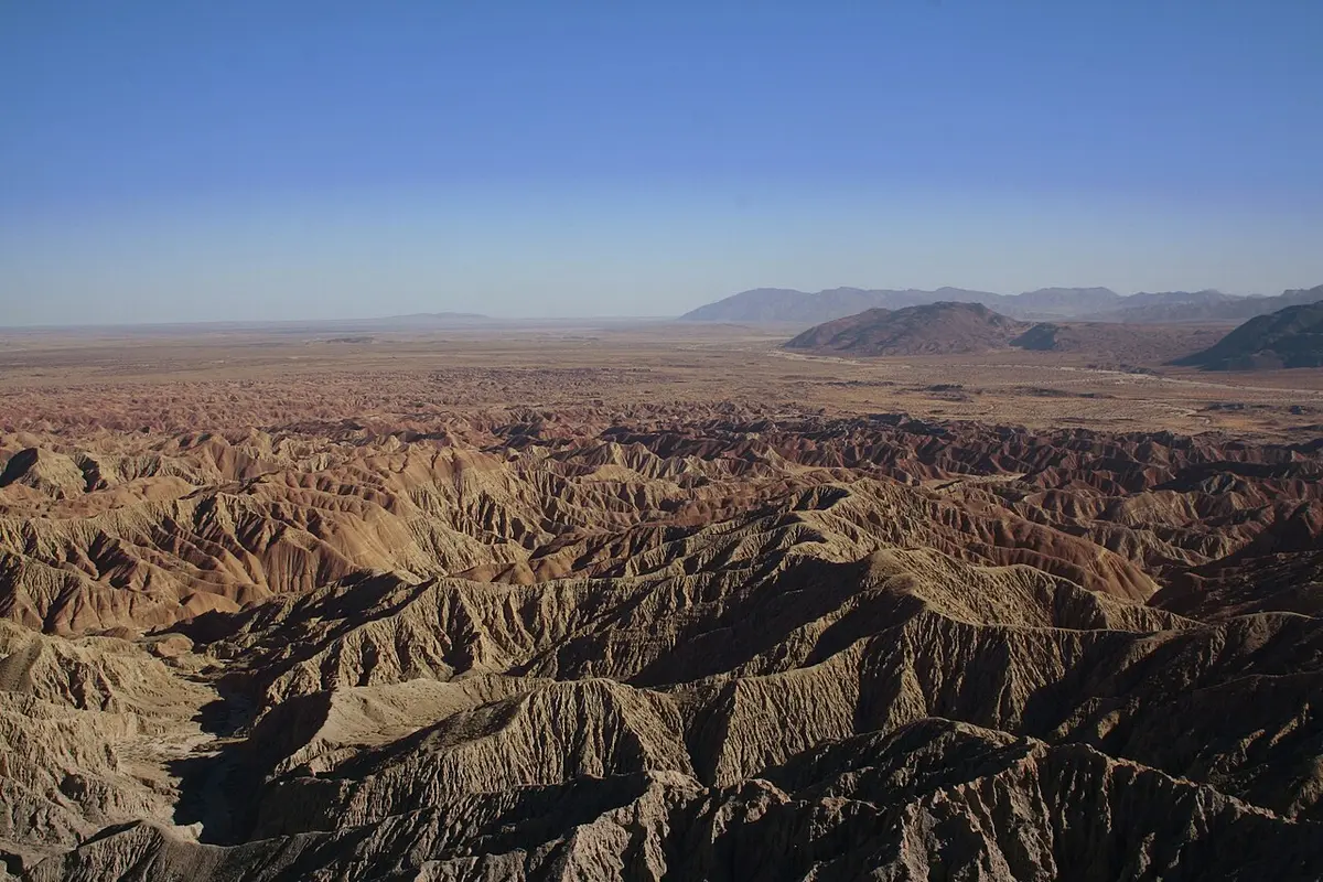
Anza-Borrego Desert State Park®
CA
Anza-Borrego is California's largest state park at 600,000 acres, covering most of eastern San Diego County in the Colorado Desert. It has 500 miles of dirt roads, 12 wilderness areas, and a designated International Dark Sky park centered on Borrego Springs. Most visitors come in spring for wildflowers; the regulars come back in October when the desert cools and they have the canyons to themselves.
 State Park
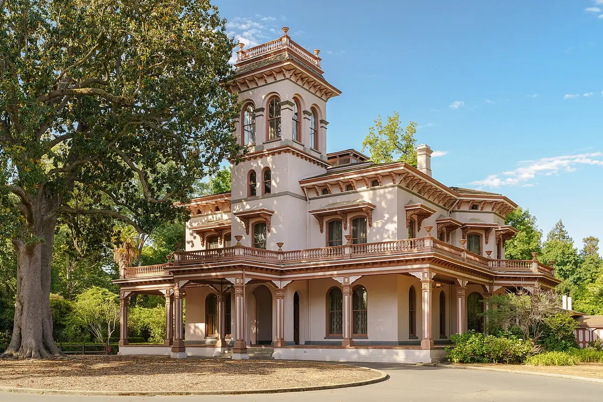
Bidwell Mansion State Historic Park
CA
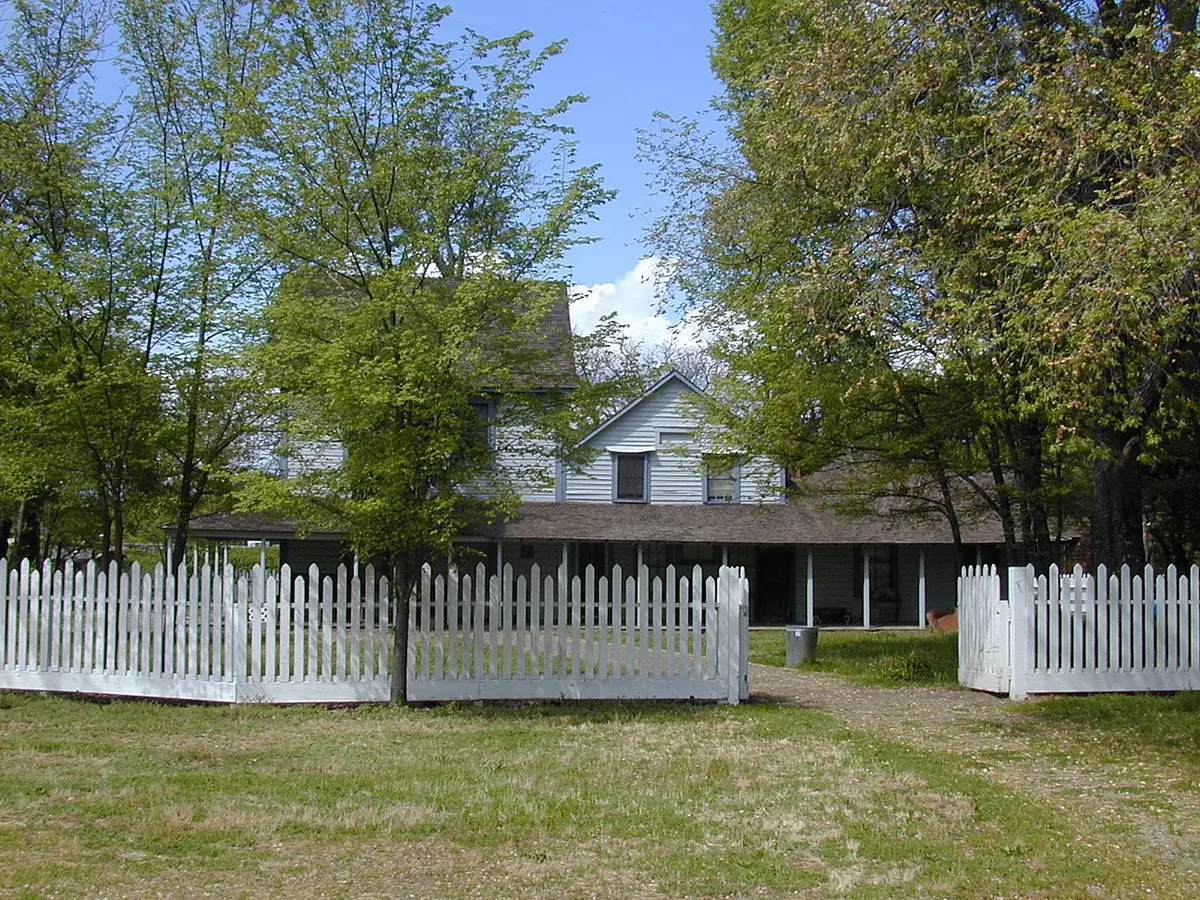
The Bidwell Mansion at the north end of Chico's Esplanade is a 26-room Victorian house museum that tells the story of John and Annie Bidwell: pioneer, farmer, statesman, and one of the more interesting couples to have shaped 19th-century California. It's a house tour in the truest sense, with knowledgeable docents and rooms that feel lived-in rather than staged.
 State Park
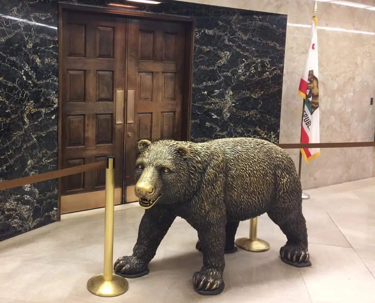
California State Capitol Museum
CA
The California State Capitol has housed the state legislature since 1869, and the museum component means you can walk through the restored 19th-century offices of the Secretary of State, Treasurer, and Governor without paying admission. The building underwent a major seismic retrofit completed in 1982, and the interior restoration returned the historic wings to their original 1906 appearance with obsessive period accuracy. On any given weekday, the legislature may actually be in session while you're there.
 State Park
California State Mining and Mineral Museum Park Property
CA
The California State Mining and Mineral Museum in Mariposa holds over 13,000 objects tracing the state's mining history from the 1848 Gold Rush forward, anchored by the Fricot Nugget, a 13.8-pound mass of crystalline gold that is the largest intact specimen of its kind from 19th-century California. The museum sits at the Mariposa County Fairgrounds on Highway 49, 1.8 miles south of town, which puts it squarely on the logical route between Yosemite and Gold Country. The $4 admission is not a misprint.
 State Park
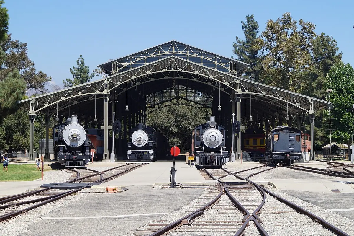
California State Railroad Museum Point of Interest
CA
The California State Railroad Museum in Old Sacramento is the kind of place that earns its reputation rather than just claiming it. Twenty-one restored locomotives and cars fill a massive climate-controlled hall at 125 I Street, and the sheer scale of the equipment, some of it dating to 1862, tends to recalibrate your sense of what 19th-century industrial ambition actually looked like. Over 500,000 people visit annually, which means weekends in Old Sacramento can get crowded fast, so plan accordingly.
 State Park
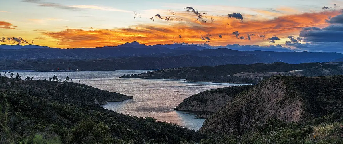
Castaic Lake State Recreation Area
CA
Castaic Lake sits 41 miles northeast of downtown LA via Interstate 5, and on a hot summer weekend it can feel like everyone in the San Fernando Valley had the same idea. The 425-foot Castaic Dam backs up 29 miles of shoreline split into two distinct zones, each with its own rules and its own crowd. It's a Los Angeles County-operated water-sports complex as much as a state park, and you should walk in with that expectation.
 State Park
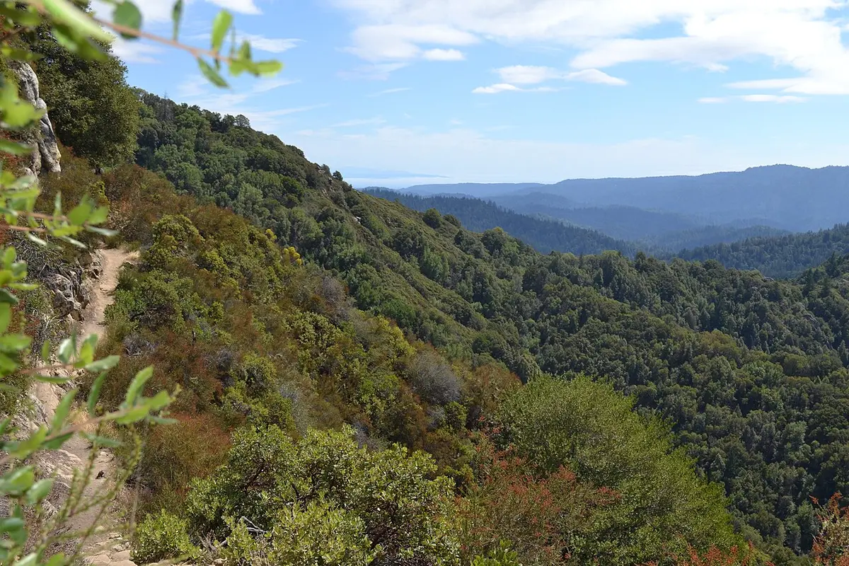
Castle Rock State Park
CA
Castle Rock sits on the Skyline Ridge above Los Gatos and Saratoga at roughly 3,000 feet, where the Santa Cruz Mountains are high enough to catch fog from both sides. The 5,300-acre park has 34 miles of trails through sandstone formations, knobcone pine forests, and redwood drainages, and it connects directly to the Skyline to the Sea Trail for anyone wanting to walk all the way to the coast. No dogs, no cell service, no store inside the park.
150,000 acres
 State Park
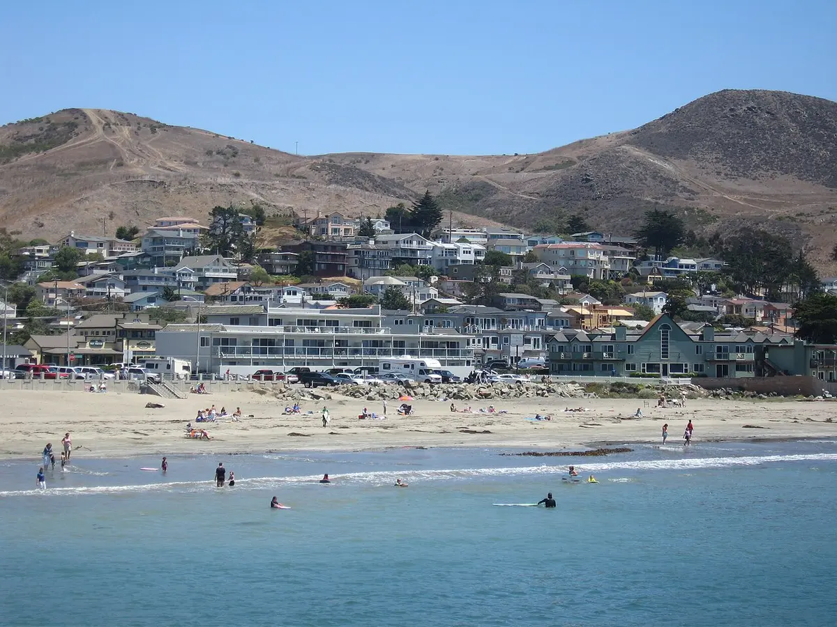
Cayucos State Beach
CA
Cayucos is the small coastal town on Highway 1 that hasn't been fully discovered yet, which is either a selling point or a temporary condition depending on when you read this. The state beach fronts a quarter-mile of sand anchored by a nearly thousand-foot wooden pier built in 1872, and the town behind it has antique stores, a handful of good restaurants, and a surf shop. No overnight camping, no day-use fee, and summer temperatures run about 30 degrees cooler than the inland Central Valley.
 State Park
Chino Hills State Park
CA
Chino Hills is 14,000 acres of rolling grassland, oak woodland, and sage scrub sitting in the gap where Orange, Riverside, and San Bernardino counties collide, and its existence as open space in the middle of one of the most densely developed corners of California is the whole story. More than 90 miles of trails cross the ridges and canyons, and on a clear winter day the views from San Juan Hill stretch from the Pacific to the San Gabriel Mountains. The tradeoffs are real: no campfires, no dogs on trails, and the high-clay soil means the park shuts down after meaningful rain.
14,000 acres
 State Park
Clay Pit SVRA
CA
Clay Pit SVRA is 220 acres of former mining land two miles west of Oroville in Butte County, now managed as a free OHV riding area for motorcycles, ATVs, and 4x4s. The site was created when clay was excavated for the construction of Oroville Dam; what got left behind was a lumpy, road-laced landscape that turns out to be a decent informal riding area, particularly for beginners. It is not a destination you drive four hours to reach, but if you are in the Oroville area with a dirt bike or a side-by-side, it is a legitimate option.
220 acres
 State Park
Clear Lake State Park
CA
Clear Lake is California's largest natural freshwater lake, located entirely within the state, and it has been designated the top bass fishing lake in the country by multiple professional fishing organizations. Clear Lake State Park occupies a section of the lake's southeastern shore near Kelseyville in Lake County, with 147 campsites across four campgrounds, eight rental cabins, a swim beach, boat launch, and about three miles of trail. The fishing is the main event, but the park holds its own as a general family camping destination in a part of California that does not get nearly enough traffic.
 State Park
Columbia State Historic Park
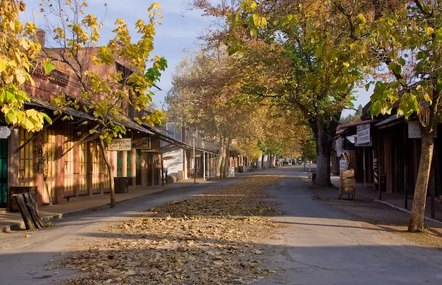
CA
Columbia State Historic Park preserves the best-surviving Gold Rush town in California, a place that by 1853 was among the largest cities in the state and somehow avoided the fires and decay that erased most of its peers. The park sits at roughly 2,100 feet in Tuolumne County, three miles north of Sonora off Highway 49, and the main street still functions, with working saloons, a blacksmith, a candy kitchen, and stagecoach rides that depart on a real schedule. It is one of the stranger places in California state parks, part living museum and part actual town, and it earns a full day if you let it.
 State Park
Crystal Cove State Park
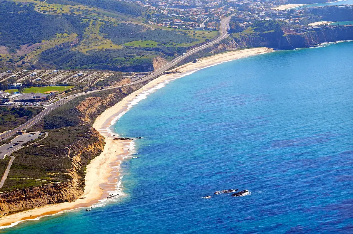
CA
Crystal Cove State Park covers 2,791 acres between Corona del Mar and Laguna Beach in Orange County, with 3.2 miles of beach, 2,400 acres of backcountry wilderness, and a federally-listed historic district of 46 Depression-era cottages that you can actually rent. It is the largest remaining open space on the Orange County coast, and the trail system goes far enough inland that you can get genuinely away from the PCH noise if you are willing to climb. The parking lot fills by 9 a.m. on summer weekends, the cottage reservations open six months out and disappear fast, and the backcountry camps require at least a 3-mile hike. Plan accordingly.
2,791 acres
 State Park
D. L. Bliss State Park
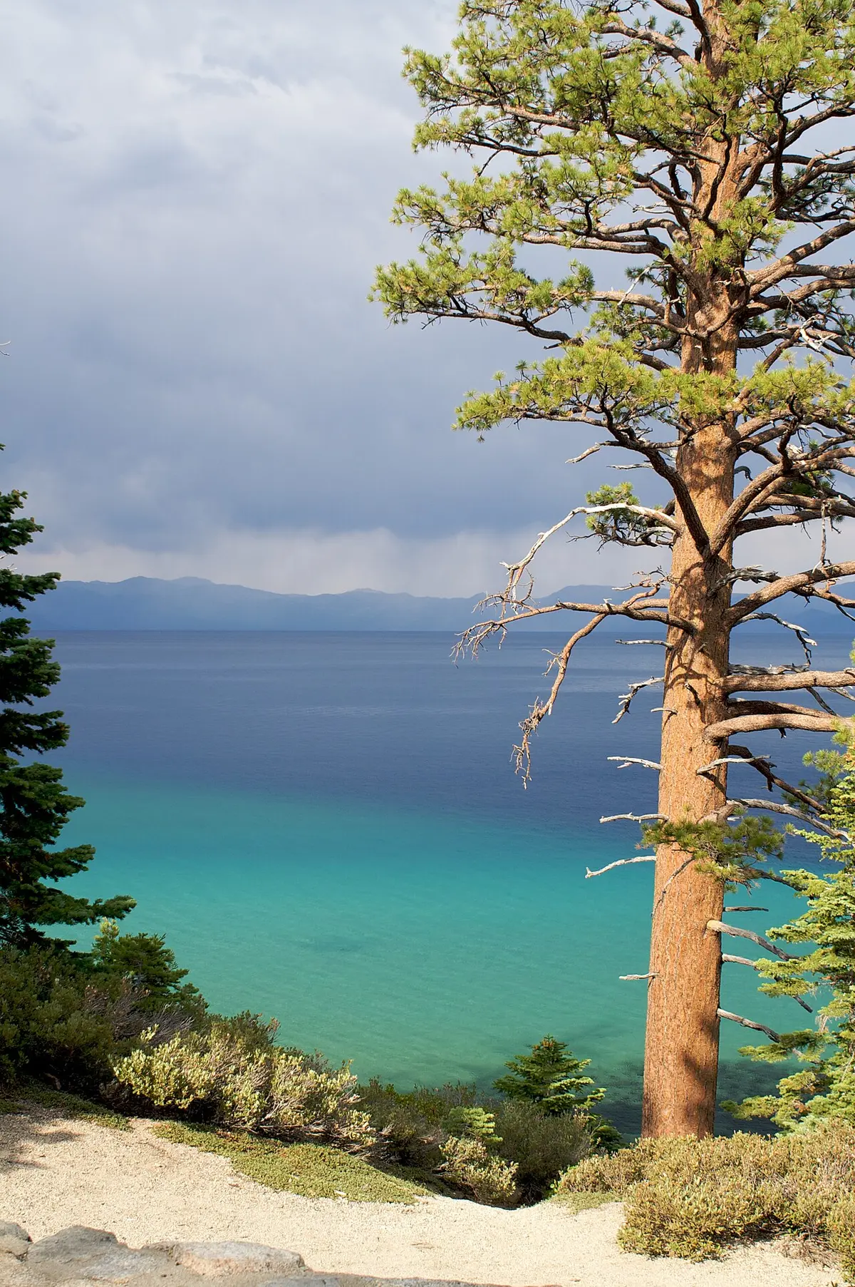
CA
On Lake Tahoe's west shore, D.L. Bliss sits where granite slabs meet water so clear you can see 100 feet to the bottom at Rubicon Point. Two of Tahoe's most popular beaches — Lester Beach and Calawee Cove — anchor the park's shoreline, while the Rubicon Trail connects 7.4 miles of rugged lakeshore to neighboring Emerald Bay State Park. The park closed in June 2023 for a major infrastructure overhaul and reopens for the 2026 summer season on May 21.
744 acres
 State Park
Del Norte Coast Redwoods State Park
CA
Seven miles south of Crescent City, Del Norte Coast Redwoods protects 6,400 acres of coast — half of it old-growth redwood — where the trees grow so densely and tall that daylight struggles to reach the forest floor. Eight miles of wild Pacific coastline back the park, and the Damnation Creek Trail drops 1,100 feet through old-growth groves to a rocky beach that most coastal visitors never reach. This is part of a four-park complex that collectively protects 45 percent of California's remaining old-growth redwoods.
 State Park
Dockweiler State Beach
CA
Dockweiler is a 3-mile urban beach in Playa del Rey, directly beneath the LAX flight path, and one of the last places in Los Angeles where you can legally have a beach bonfire. The noise is real and constant. So is the appeal — wide sandy beach, roughly 40 free bonfire pits, and one of the only campgrounds on the LA coast.
 State Park
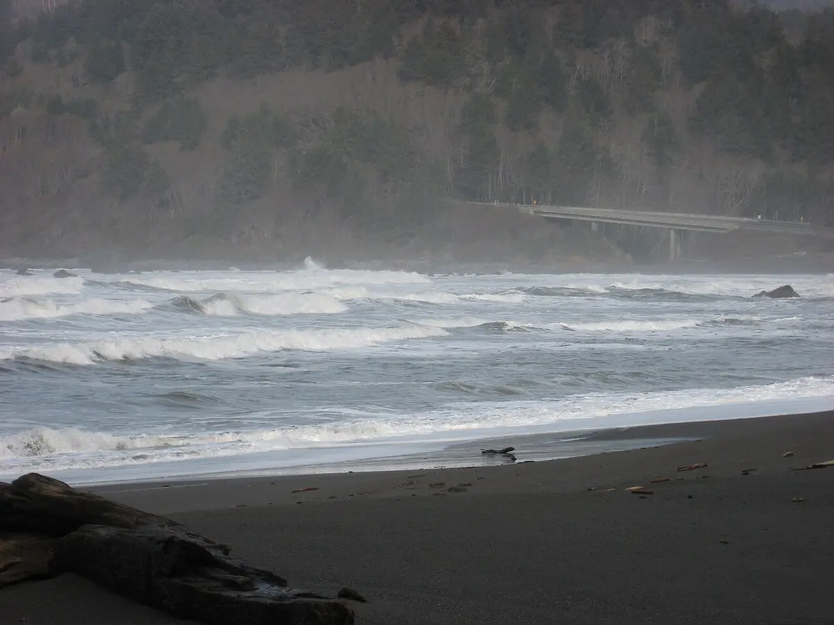
Emma Wood State Beach
CA
Emma Wood State Beach runs 2 miles along Highway 101 at the western edge of Ventura, where the Ventura River meets the Pacific. The estuary end provides the most interesting habitat — great blue herons, occasional dolphins offshore — and the park's signature is primitive RV camping directly on the water. The North Beach day-use area and camping are closed through June 2026 for construction; the Ventura River Group Camp status should be confirmed separately.