The Zig Zag Loop earns its name from a climbing trail segment that switchbacks up to Prairie Creek's ridgetops, then drops back down through old-growth forest. It's a solid half-day option that gets you away from the Newton B. Drury Scenic Parkway crowds while staying entirely within ancient redwood groves.
Trail Details
- 🏃Activities
- Hiking
- 📊Difficulty
- Hard
- 🔁Trail Type
- loop
- 📏Distance
- 3.9 miles
- ⬆️Elevation Gain
- 600 ft
- ⬇️Elevation Loss
- 600 ft
- 🪨Surface
- compact dirt
- 📍Location
- CA
- 🐕Dogs Allowed
- No
- 💵Fee
- Free
Overview
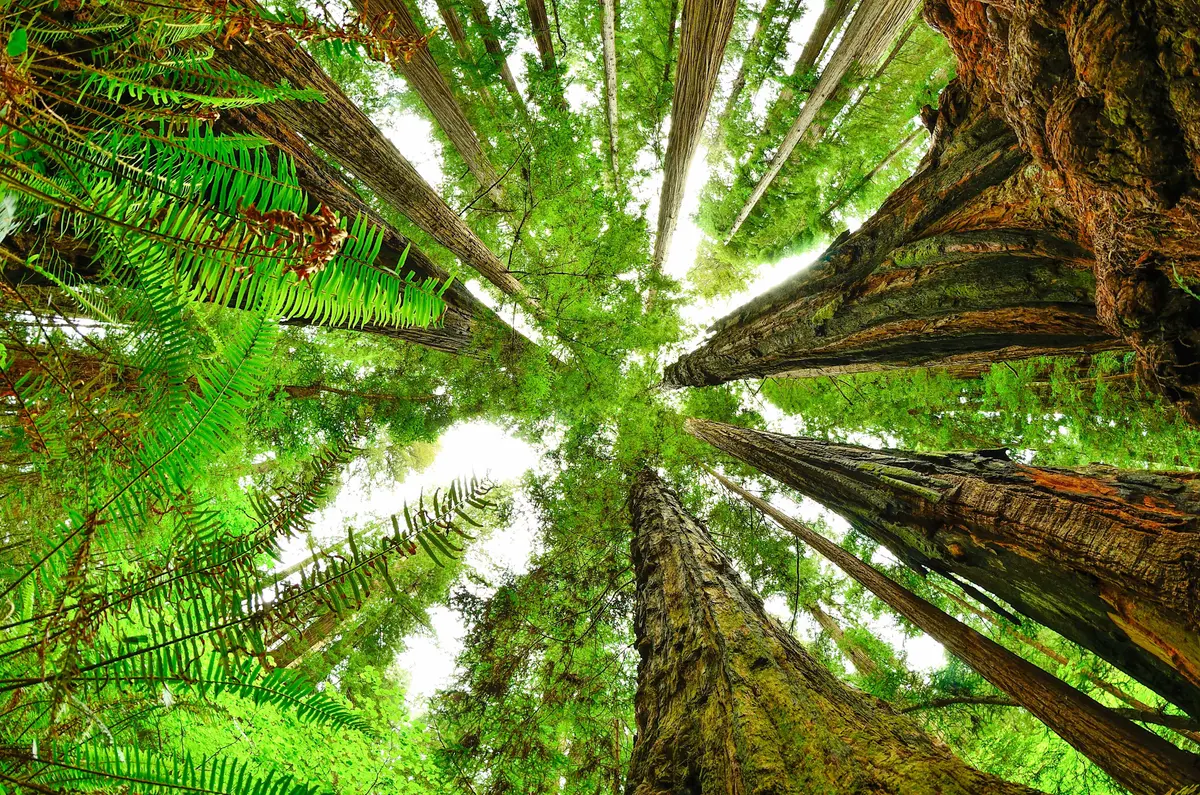
This loop combines Prairie Creek's riparian corridor with ridgetop perspectives, connected by the steep Zig Zag No. 1 trail segment that climbs 600 feet to the West Ridge Trail. The terrain shifts from creek-level walking among spawning gravels to ridge walking with glimpses through the canopy. The entire route stays within old-growth forest, so you're trading dramatic vistas for the cathedral experience of walking among trees that predate European settlement by centuries.
The loop works in either direction, but most hikers tackle it clockwise, starting south on Prairie Creek Trail before hitting the climb. The payoff comes on the descent along Karl Knapp Trail, where the final 3.1 miles back to the visitor center roll out relatively flat through prime old-growth stands.
What to Expect
Prairie Creek Trail starts the loop with easy walking alongside flowing water and gravel bars where salmon spawn in season. The creek views don't last long — this section is more about getting positioned for the real work ahead.
Zig Zag No. 1 is where the loop earns its difficulty rating. The loose terrain on these switchbacks slows most hikers down, and the 600-foot climb comes in a concentrated dose over half a mile. Expect to work for the elevation gain, especially if conditions are muddy. The trail's reputation for loose footing is well-earned.
Once you reach West Ridge Trail at the 2.2-mile mark, the character shifts. You'll follow this for a short segment before picking up the descent on Karl Knapp Trail. The ridgetop section offers occasional views through the forest, though the towering redwoods limit long sightlines even from elevated positions.
The Karl Knapp descent and return traverse represents the trail's most rewarding section. Here the old-growth corridor shows off its best characteristics — massive trunks, filtered light, and the sound-dampening effect that makes redwood forests feel like natural cathedrals. This final stretch runs flat enough to appreciate the surroundings without fighting the terrain.
Tips & Logistics
The loop starts from Prairie Creek Visitor Center, accessible via Newton B. Drury Scenic Parkway. From Highway 101, head 4.5 miles north of Orick, then turn left on Newton B. Drury Parkway for 4.7 miles to Edward C. Wagner Memorial Grove. Prairie Creek Redwoods State Park charges an entrance fee.
Plan for 2 to 2.5 hours, though the loose terrain on Zig Zag No. 1 can add time if you're not expecting it. The trail stays at relatively low elevation — well under 1,000 feet — so weather concerns focus more on coastal moisture than mountain conditions. Expect muddy spots and overgrown sections, especially after winter storms.
Water isn't an issue on this short loop, but carry enough for the climb. The terrain stays shaded, but the loose footing and elevation gain will work up a sweat.
One scheduling note: Newton B. Drury Scenic Parkway closes to vehicles the first Saturday of each month from October through May for hike and bike days. If you're planning around those dates, factor in the road closure for access timing.