Redwood National and State Parks
CA
Redwood National and State Parks is a 60-mile-long patchwork of federal and California state land running up the Del Norte Coast, managed jointly by the NPS and California State Parks out of Crescent City. The backcountry here is different from what most people expect: this isn't a high-route alpine traverse but rather old-growth creek corridors, fog-soaked ridge walks, and a handful of small designated camps spread across more than 200 miles of trail. The permit system is free and relatively low-friction — the bigger challenge is timing your trip around Redwood Creek's seasonal closures and the park's reliable winter soaking.
Details
- 🏞️Type
- National Park
- 🏛️Managed by
- National Park Service
- 📍State
- CA
- 🗺️Address
- 1111 Second Street, Crescent City, CA, 95531
- 📞Phone
- 7074646101
- 🕐Hours
- The national and state parks are always open to enjoy. Roads, trails and public access remain open year round. Some campgrounds and visitor centers are closed - or have reduced hours - in the off-season (October-May)
- 🐾Pets Allowed
- No
- ♿Accessibility
- limited
- 🥾Activities
- arts and culture, cultural demonstrations, auto and atv, scenic driving, biking, mountain biking, road biking, camping, backcountry camping, car or front country camping, horse camping (see also horse/stock use), rv camping, fishing, saltwater fishing, food, picnicking, guided tours, self-guided tours - walking, self-guided tours - auto, hiking, backcountry hiking, front-country hiking, horse trekking, horse camping (see also camping), horseback riding, paddling, canoeing, kayaking, stand up paddleboarding, whitewater rafting, junior ranger program, surfing, swimming, saltwater swimming, wildlife watching, birdwatching, park film, shopping, bookstore and park store
- 📡GPS
- 41.37237, -124.03181
The Place
The trees are real. The tallest living thing on earth, Hyperion, is somewhere in this park — the NPS doesn't publicize the location to protect it, and that's probably the right call. What's more immediately useful to know is that the park stretches from just north of Orick in Humboldt County up to the Oregon border near Crescent City, straddling US-101 and split into units that don't always feel connected. The national park proper interleaves with three California state parks — Prairie Creek Redwoods, Del Norte Coast Redwoods, and Jedediah Smith Redwoods — and they share a single permit system and management framework.
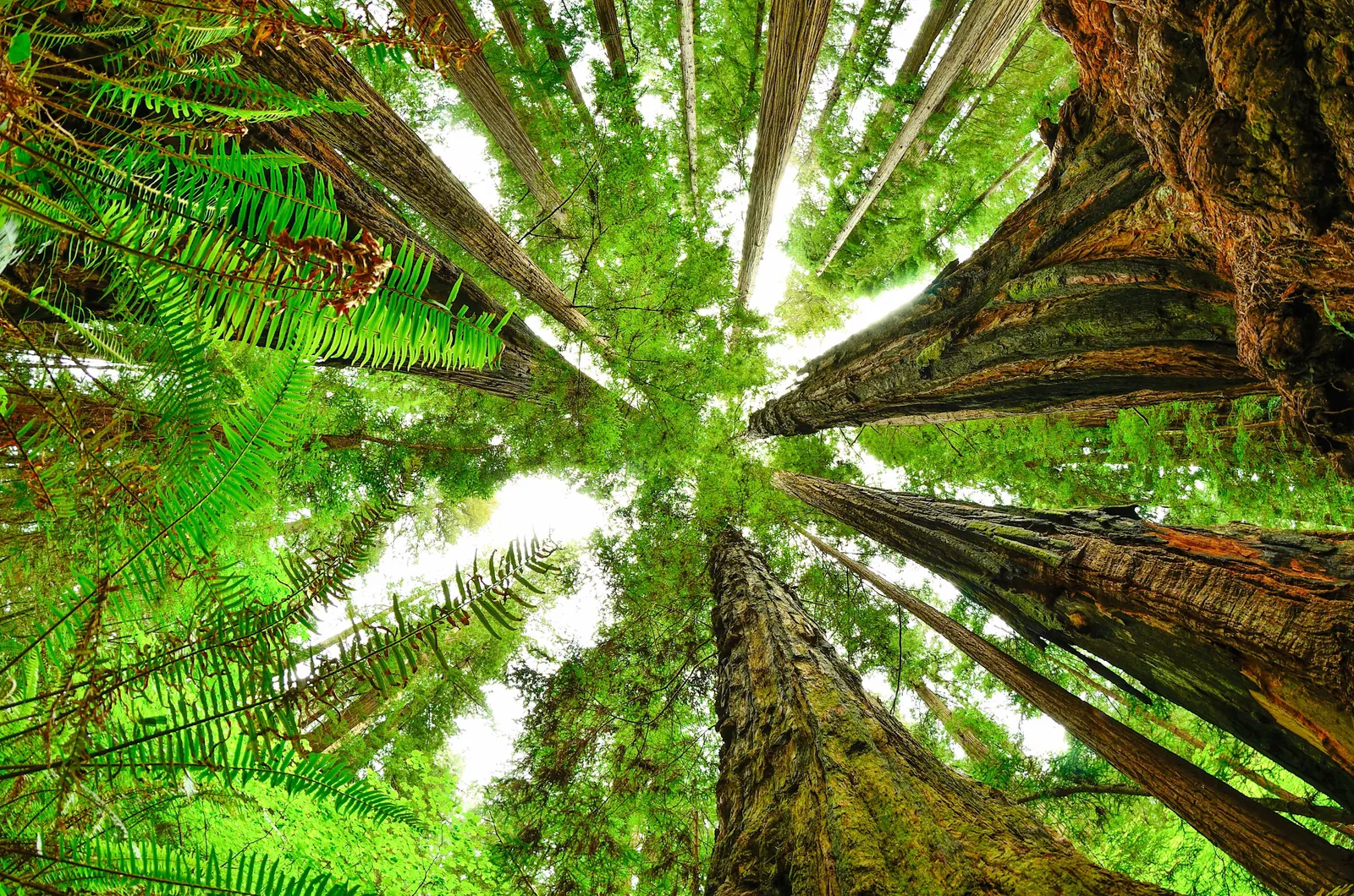
The backcountry isn't vast by Sierra or Cascades standards. There are seven designated backcountry camps, plus dispersed camping along Redwood Creek's gravel bars. The terrain is low-elevation by western standards — most trails top out well below 2,000 feet — but that doesn't mean easy. Coastal ridges get steep and slick, and the creek corridors mean constant moisture, downed trees, and trail conditions that can change fast between November and May. The forest is genuinely old and genuinely dark in places. This isn't a destination for people chasing summit selfies. It's for people who want to spend two days walking through trees that were standing when Rome fell.
Solitude is achievable. The park draws millions of day-visitors along the coastal highway, but almost none of them go more than a mile from their cars. The DeMartin and Little Bald Hills camps in the northern section see light use most of the year. Even Redwood Creek, the most popular backpacking route, rarely fills its 50-person nightly quota outside of peak summer weekends.
Getting There & Getting In
The park's four visitor centers run north-to-south: Hiouchi (near Jedediah Smith, northeast of Crescent City), Crescent City, Kuchel (at Orick, on US-101 near the southern end), and Prairie Creek. Crescent City is the main gateway town, roughly 25 miles north of the Klamath River and about 80 miles south of the Oregon border. Orick, a small town at the park's southern end, is the closest base for Redwood Creek trips.
US-101 is the spine. Most trailheads branch off it or off secondary roads like Bald Hills Road (accessed just north of Orick) and Howland Hill Road (a narrow, unpaved scenic drive through Jedediah Smith). Bald Hills Road climbs steeply from 101 and is unsuitable for RVs and trailers — it's also gravel for much of its upper section. The Redwood Creek trailhead is 0.9 miles off 101 via Bald Hills Road.
Cell coverage is marginal throughout most of the park and nonexistent in the creek drainages. Don't count on navigation from your phone once you're in the trees.
When to Go
The honest backcountry season runs from roughly June 1 through early October. Here's why:
Redwood Creek dispersed camping is officially closed October 15 through April 1, and for good reason — winter rainfall averages 60–80 inches in this region, and Redwood Creek can run high enough to make crossings dangerous or impossible from November through May. The seasonal footbridge near Tall Trees Grove is typically in place June through September. Outside that window, creek crossings on the lower trail are a wade or a turnaround.
The fog situation deserves a frank mention: the North Coast runs socked-in from June through August most mornings, sometimes all day. Temperatures stay in the 50s and low 60s. This isn't a reason to avoid summer — the fog keeps the forest cool and the moss green — but if you need sunshine, September and early October are the sweet spot. The forest is drier, the bridge is still in, crowds have thinned, and you'll get real afternoon light.
Spring shoulder (April–May) is possible for the designated camps in the northern section, which don't require creek crossings, but trails will be muddy and you should expect rain. Winter offers the designated camps at DeMartin, Little Bald Hills, and Flint Ridge with essentially no competition for permits. Bring serious rain gear and accept that you're going to be wet.
Permits & Regulations
All backcountry camping — at designated sites and along Redwood Creek — requires a free permit. Permits can be booked online up to 160 days in advance and no later than 24 hours before your trip. The park's permit system runs through the NPS website; there is no walk-up counter option. Computers at visitor centers can help if you don't have internet access.
Designated campsites cap at 8 people per site (20 for group sites). Redwood Creek gravel bar camping has a 50-person total nightly limit — not 50 per campsite, but 50 across the entire zone. That quota is sufficient that you're unlikely to be shut out except on holiday weekends in July and August.
Food storage: the park does not mandate hard-sided bear canisters, but you must use one of the approved methods — canister, bear box (provided at designated sites), vehicle, or a proper food hang (10 feet up, 4 feet horizontal). The designated sites all have bear-proof lockers. On Redwood Creek gravel bar trips, bring your own canister or plan your hang carefully. Bears are present and active in this park.
Campfires are permitted in the provided fire rings at designated sites. On Redwood Creek gravel bars, fires are allowed on the gravel itself, not in vegetation. Standard restrictions apply during high fire danger periods, which are less common here than in drier parts of California but do occur in late summer. Day hikers visiting Tall Trees Grove also need a separate free permit, required May 15 through September 15.
Routes Worth Knowing
Redwood Creek Gravel Bar — Out and Back From the Redwood Creek Trailhead off Bald Hills Road, it's 7.6 miles one-way to Tall Trees Grove, with minimal elevation gain along the creek corridor. Dispersed camping on the gravel bars begins at the first crossing (1.6 miles in). The route is flat and straightforward; the crux is the seasonal bridge — plan this trip for June through September. A common approach is to camp one or two nights on the gravel bars and walk the loop through Tall Trees Grove before heading back. The most-used backcountry option in the park and still relatively quiet.
Elam Camp and 44 Camp — Orick Horse Trail System From the Orick Horse Trailhead, Elam Camp is 7.5 miles in and 44 Camp is 13 miles. This is a longer, more committing trip than Redwood Creek, and the camps are more isolated. Water at both camps is non-potable creek water only — filter everything. 44 Camp has no toilet; Leave No Trace waste management is required. This route sees very light use and is a legitimate option for people who want to actually be alone.
Little Bald Hills Camp — Del Norte Area 3.3 miles from the Howland Hill Road trailhead with 1,800 feet of gain. Five sites with bear-proof lockers and horse facilities. Water must be packed in entirely. The ridge walk passes through tanoak and Douglas fir before the redwood zone. Gets occasional horse-packer use but is very quiet outside summer weekends.
DeMartin Camp — North Section 3.4–3.5 miles in from two possible access points, with 10 sites, bear-proof lockers, and fire pits. Water must be brought in. Located in the northern section near Del Norte Coast Redwoods State Park, accessible year-round when the trail isn't flooded. A solid shoulder-season option when the creek-corridor routes are closed.
Flint Ridge Camp Notable for having two very different access options: 0.25 miles in from the west (easy) or 4.5 miles from the east (strenuous). Eight sites, no water on-site. The short approach makes this the most accessible designated camp in the park and, consequently, the least wilderness-feeling of the seven.
Water, Weather & Hazards
Water is abundant in winter and spring — sometimes too abundant. Most designated camps require you to bring your own water or treat creek and stream sources. Elam and 44 Camp have non-potable creek water nearby; Gold Bluffs Beach Hike and Bike has water on-site. Redwood Creek itself is filterable during the camping season but can run silty after rain.
The primary weather hazard is prolonged rain from November through April. The region receives 60–80 inches annually. Hypothermia risk is real on multi-day trips in wet conditions — coastal temperatures rarely drop below the mid-40s, which is the genuinely dangerous zone: cold enough to pull heat from your body, warm enough that you don't feel urgency about it. Cotton is a bad idea here in any season.
Creek crossing hazards are seasonal and real. Redwood Creek runs fast and cold in early season. The seasonal bridge at Tall Trees Grove typically goes in around late May or early June and comes out in September or October. Outside that window, crossing requires honest assessment of water level and your ability to manage a cold wade with a loaded pack.
Roosevelt elk are throughout the park — large, unpredictable animals that have charged visitors. Give them at least 25 yards, more if calves are present. Bears are active around the creek drainage; proper food storage is not optional. Mountain lions are present but sightings are rare. Virtually the entire creek corridor and northern trail system has no cell coverage; file a trip plan before you go.
Finding Solitude
The crowds at Redwood are almost entirely car-based. Most visitors do Prairie Creek's Fern Canyon loop (0.9 miles, consistently busy May–September), the Lady Bird Johnson Grove loop (1.3 miles off Bald Hills Road), or pullouts along the Newton B. Drury Scenic Parkway. None of those people are going more than a mile from pavement.
The 50-person nightly limit on Redwood Creek sounds low, but the quota rarely fills outside of summer weekends. The northern designated camps — DeMartin, Little Bald Hills — are even quieter. For a genuine wilderness experience, Elam and 44 Camp on the Orick Horse Trail system are the answer: 7–13 miles in, essentially no foot traffic, and 44 Camp has no amenities to attract casual visitors.
September and early October offer the best combination of accessible trails, reasonable weather, and low permit competition. By mid-September the summer crowds are gone, the seasonal bridges are still in, and the forest is at peak atmospheric gloom — which, on the North Coast, is a feature, not a bug.