This is Death Valley's high country hike — a steep climb through pinyon pine and juniper forest to a 9,064-foot summit with sweeping views across the valley floor and Sierra Nevada. The trail gains 2,200 feet over 4.2 miles, trading the park's typical desert exposure for shaded forest and mountain air. It's one of the few official trails in Death Valley where you'll actually find trees.
Trail Details
- 🏃Activities
- Hiking
- 📊Difficulty
- Hard
- 🔁Trail Type
- out and back
- 📏Distance
- 8.4 miles
- ⬆️Elevation Gain
- 2,200 ft
- 📍Location
- CA
- 🐕Dogs Allowed
- No
- 💵Fee
- Free
Overview
Wildrose Peak sits in the Panamint Mountains, offering a completely different Death Valley experience from the valley floor attractions. Starting at the historic Wildrose Charcoal Kilns at 6,800 feet, the trail climbs steadily through high desert forest to a summit with 360-degree views. The ascent is relentless but manageable, following a clear path through terrain that feels more like the Eastern Sierra than the Mojave Desert.
The charcoal kilns themselves are worth the drive — ten beehive-shaped stone furnaces built in the 1870s to produce fuel for silver mining operations. They mark both the trailhead and a reminder of Death Valley's industrial past, before the area became a national monument.
What to Expect
The first two miles offer steady but reasonable grades through pinyon pine and juniper woodland. The forest provides welcome shade, making this one of the few Death Valley hikes where sun exposure isn't the primary concern. About 1.9 miles in, the trail steepens considerably for the final push to the summit.
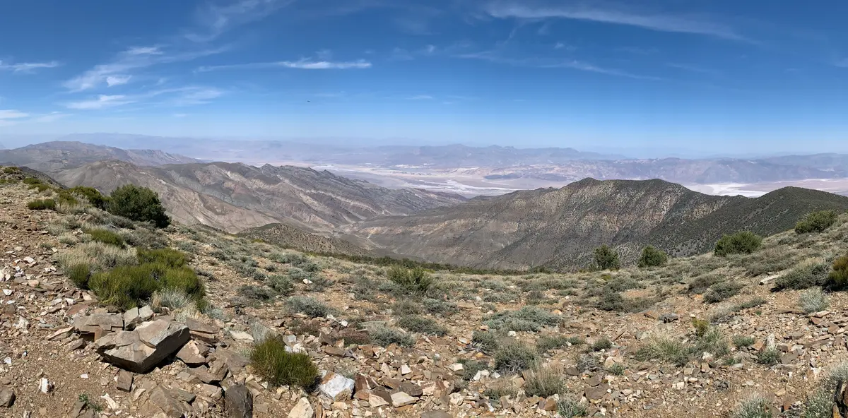
The upper sections demand attention to footing and pacing. The elevation and grade combine to make this a legitimate workout, even for strong hikers. The summit plateau offers broad views east across Death Valley's salt flats and west toward the Sierra Nevada. On clear days, the contrast between the valley floor at 282 feet below sea level and the surrounding peaks is particularly stark.
Tips & Logistics
Access requires a 30-mile drive from Stovepipe Wells, with the final 7 miles on graded gravel road to the charcoal kilns. The road is generally passable by passenger cars, though high clearance helps on the unpaved sections. Winter snow can close the upper road entirely, making this primarily a fall through spring objective.
The trailhead parking area includes a vault toilet but no water. Carry more than you think you'll need — the elevation and sustained climbing increase consumption, even in cooler weather. The forest canopy helps with temperature regulation, but the exposure above treeline can be intense.
Plan for 5-6 hours round trip. The descent is hard on knees due to the sustained steepness, so trekking poles are worthwhile. Morning starts are preferable to avoid afternoon heat, though the forest keeps conditions more tolerable than valley floor hikes.
Cell service is nonexistent, and this is remote country. Let someone know your plans and carry emergency supplies accordingly. The nearest services are at Stovepipe Wells, an hour's drive from the trailhead.
This trail works best October through April, avoiding the brutal summer heat that makes most Death Valley hiking impossible. Winter brings the possibility of snow and ice on the upper mountain, along with road closures. Spring offers the most reliable access and comfortable hiking conditions.