Death Valley National Park
CA
Death Valley is 3.4 million acres of basin and range desert straddling the California-Nevada border, holding both the lowest point in North America and summer temperatures that regularly exceed 120°F. The backcountry here is defined by extremes of scale, heat, and remoteness: slot canyons with no water for miles, 11,000-foot peaks visible from 282 feet below sea level, and dirt roads that wash out faster than the park can fix them. This is not a place that forgives poor planning, but for desert travelers who know what they're doing, it is one of the most rewarding landscapes in the American West.
Details
- 🏞️Type
- National Park
- 🏛️Managed by
- National Park Service
- 📍State
- CA
- 🗺️Address
- PO Box 579, Death Valley, CA, 92328
- 📞Phone
- 7607863200
- 🕐Hours
- The park is open daily all year.
- 💵Entrance Fee
- $30 / vehicle
- 🐾Pets Allowed
- No
- ♿Accessibility
- limited
- 🥾Activities
- astronomy, stargazing, biking, mountain biking, road biking, camping, backcountry camping, car or front country camping, canyoneering, food, flying, golf, guided tours, hiking, backcountry hiking, front-country hiking, horse trekking, living history, first person interpretation, junior ranger program, wildlife watching, birdwatching, park film, museum exhibits, shopping, bookstore and park store, gift shop and souvenirs
- 📡GPS
- 36.48754, -117.13439
The Place
Death Valley occupies a long, narrow graben between the Panamint Range to the west and the Amargosa Range to the east. The valley floor sits at or below sea level for roughly 80 miles. Telescope Peak, the park's high point at 11,049 feet, rises directly above Badwater Basin at -282 feet. That vertical relief, compressed into about 15 horizontal miles, creates one of the most dramatic elevation gradients on the continent.
The geology is exposed and legible in a way that vegetated landscapes never allow. Alluvial fans, salt pans, volcanic craters, marble canyons, and sand dunes coexist within a single day's drive. The park is larger than Connecticut, and most of it is empty. Not empty as in "uncrowded." Empty as in: no water, no shade, no cell service, no one coming to find you if something goes wrong.
The backcountry character is self-selecting. There are almost no maintained trails. Most travel follows washes, canyon bottoms, and old mining roads. Navigation is by GPS, topo map, and terrain reading. The commitment level is high, the margin for error is thin, and the rewards are proportional.
Getting There & Getting In
The park has multiple entry points, but most backcountry travelers approach from the west via Highway 190 through Panamint Springs, or from the east via Highway 190 through Death Valley Junction. Las Vegas is about two hours east. The nearest full-service towns are Lone Pine (west, 1.5 hours), Beatty, Nevada (east, 40 minutes to Stovepipe Wells), and Panamint Springs (a gas station and motel on Highway 190).
Water and fuel are available at Furnace Creek, Stovepipe Wells, and Panamint Springs. That's it. Fill up whenever you can.
Backcountry access depends heavily on road conditions. Many of the best areas require high-clearance or 4WD vehicles, and roads wash out regularly. As of 2026, several major roads remain closed from flood damage years ago: Titus Canyon Road (closed since 2023, reopening not expected until 2027), Lower Wildrose Road (impassable, 2027 at earliest), and Darwin Falls Road (gone in many places). Check current conditions with the ranger station before committing to any dirt road. The NPS recommends carrying two full-size spare tires on backcountry roads. That is not an exaggeration.
Cell service is essentially nonexistent outside of Furnace Creek and Stovepipe Wells. A satellite communicator is not optional for backcountry travel here.
When to Go
The valley floor is a viable backcountry destination only from November through March. Summer temperatures exceed 120°F with nighttime lows near 90°F. NPS does not recommend low-elevation hiking from May through October, and they mean it. Most heat-related medical rescues happen between 10 AM and 4 PM.
Mid-elevations (3,000 to 5,000 feet) open up from October through April. This is the window for canyon routes, alluvial fan exploration, and the Panamint foothills.
The high Panamints, including Telescope Peak, are accessible year-round but require crampons and an ice axe in winter. Summer at 8,000 to 11,000 feet is far more tolerable than the valley floor, with temperatures 50 to 60 degrees cooler.
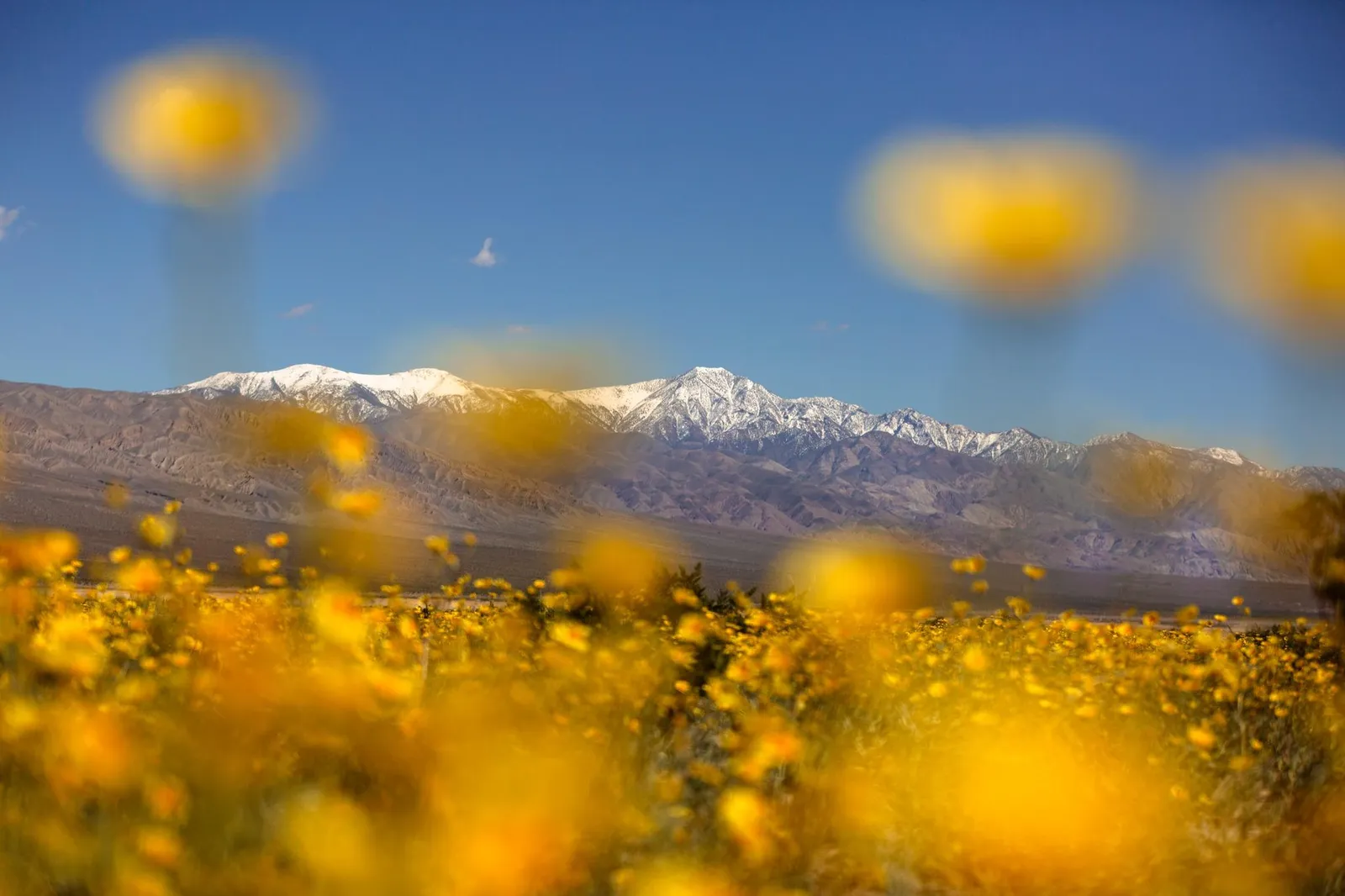
Spring wildflowers are best at low elevations from mid-February through mid-April, moving uphill through May and into July at higher elevations. Superbloom years happen roughly once a decade when fall and winter rains align. 2026 was a strong bloom year.
The sweet spot for most backcountry travelers: November through early March for canyons and low-elevation routes, April through May for the Panamint high country.
Permits & Regulations
Backcountry camping along dirt roads is allowed without a permit, but the rules are specific. Camp at least one mile down any dirt road from its junction with pavement. Use previously disturbed areas only. Park your vehicle immediately adjacent to the road. The wilderness boundary is 50 feet from the center of most dirt roads.
The Cottonwood-Marble Canyon loop requires a mandatory permit ($10, available on recreation.gov up to six months out). A handful of other designated backcountry sites (Echo Canyon, Hole in the Wall) also require paid permits. For all other backpacking, canyoneering, and backcountry travel, a free voluntary permit is available at the Furnace Creek Visitor Center or the Stovepipe Wells ranger station.
No campfires in the backcountry. Camp stoves are fine. No gathering wood. Group size is capped at 12 people and 4 vehicles. No dogs on trails or in the wilderness. Entrance fee is $30 per vehicle.
The gotcha: many roads that look campable on a map are designated day-use only. Titus Canyon Road, Mosaic Canyon Road, the first eight miles of Cottonwood Canyon Road, Racetrack Road from Teakettle Junction to Homestake, and a dozen others prohibit overnight parking. Check the NPS backcountry camping page before assuming you can pull off and camp.
Routes Worth Knowing
Cottonwood-Marble Canyon Loop (26 miles, 3,900 feet gain, 2-3 days). The park's only maintained backpacking loop, though "maintained" is generous. Follow Cottonwood Canyon upstream to seasonal springs, cross a pass into Deadhorse Canyon, and descend through Marble Canyon narrows back to the start. Requires permit. High-clearance vehicle to the trailhead. Flash flood risk is real. NPS provides GPS waypoints for key obstacles.
Telescope Peak (14 miles round trip, 3,000 feet gain, day hike or overnight). The park's high point at 11,049 feet, reached by the park's only real maintained trail from Mahogany Flat campground. No water on the route. Camp at Arcane Meadows between Rogers Peak and the summit for an overnight. High-clearance vehicle required to reach the trailhead. Winter requires crampons and ice axe.
Surprise Canyon to Panamint City (5 miles, 4,000 feet gain). A wet canyon hike up an old jeep road washed out in the 1980s, ending at a ghost town. Springs and waterfalls throughout. Bighorn sheep sightings are common. The ambitious version continues 7 miles over a trailless pass to Johnson Canyon, making a through-route with a vehicle shuttle.
Fall Canyon (6 miles to the second dry fall, 2,460 feet gain). Enter from the west end of Titus Canyon (when accessible). Narrow canyon walls, day-hiker traffic below the first dry fall, solitude above. No water.
Eureka Dunes (variable distance, 700 feet of elevation to the summit). The tallest dunes in Death Valley, possibly North America. Climbing soft sand for an hour to reach the crest. Free primitive campground at the base. Best at dawn. Accessible from Big Pine (38 miles, mostly paved) or via Ubehebe Crater (35 miles of gravel).
Water, Weather & Hazards
Water is the defining constraint. Municipal water exists at three locations in the entire park: Furnace Creek, Stovepipe Wells, and Panamint Springs. Backcountry springs are seasonal, frequently dry, and heavily used by burros and bighorn sheep. Always filter. Always confirm current spring conditions with a ranger before depending on any natural water source.
NPS recommends at least one gallon per person per day. For active hiking in warm conditions, one liter per hour is more realistic. On canyon routes without water, you carry everything. For the Cottonwood-Marble loop, springs in upper Cottonwood Canyon and Deadhorse Canyon are seasonal and cannot be relied on in dry years.
Flash floods are the other serious hazard. They arrive fast, fill canyons with debris-laden water, and reshape the landscape overnight. Do not hike canyons when rain is forecast anywhere in the watershed. The storm does not need to be directly overhead.
Hundreds of abandoned mine shafts dot the park. Do not enter them. Unstable ground, hidden vertical shafts, bad air, and hantavirus risk from rodent activity make mines a genuine danger.
Rattlesnakes are present near water and old structures. Scorpions hide in holes and rock crevices. The leading cause of death in the park is actually single-vehicle rollover accidents on long, winding backcountry roads.
Finding Solitude
Badwater Basin, Zabriskie Point, and Mesquite Flat Sand Dunes absorb most of the park's 1.7 million annual visitors. Leave the pavement and solitude arrives quickly.
The Panamint Dunes, a three-mile walk across open desert from an unmarked turnoff, see a fraction of the traffic that Mesquite Flat gets. Ibex Dunes, in the far south, require either an 8.5-mile hike or a serious 4WD road through deep sand. Visitors report having the entire dune field to themselves.
Saline Valley, on the park's western edge, is one of the most isolated areas in any national park. Natural hot springs, low dunes at the base of the Inyo Mountains, and almost nobody. Racetrack Valley draws some traffic for the sailing stones, but the 27 miles of rough road from Ubehebe Crater thin the crowd considerably.
The canyon backcountry above the first dry fall on any route is reliably empty. Most day hikers turn around at the first obstacle. Keep going.