The West Side Loop traces a wide arc through the Black Rock area's Joshua tree woodland, climbing steadily through ridges and sandy washes on the cooler, less-traveled northern edge of the park. This is Joshua Tree without the crowds — a moderate loop that delivers the classic high-desert experience with stands of mature Joshua trees, pinyon-juniper forest, and clear-day views to San Gorgonio Peak.
Trail Details
- 🏃Activities
- Hiking
- 📊Difficulty
- Moderate
- 🔁Trail Type
- loop
- 📏Distance
- 4.7 miles
- ⬆️Elevation Gain
- 785 ft
- 🪨Surface
- deep sand, hard pack dirt, and uneven rocky surfaces
- 🌤️Best Seasons
- december, january, february, march, april, may, september, october, november
- 📍Location
- CA
- 🐕Dogs Allowed
- No
- 💵Fee
- Free
Overview
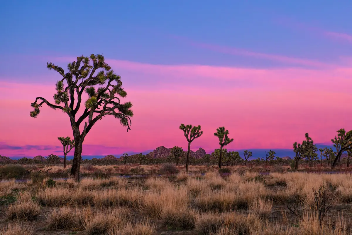
The Black Rock area sits at the ecological sweet spot where the Mojave Desert reaches its fullest expression. The West Side Loop capitalizes on this, winding through dense stands of Joshua trees that grow larger and more numerous than anywhere else in the park. The trail follows a logical circuit west of Black Rock Campground, using ridgelines and wash bottoms to create a varied route that showcases the high desert's range of terrain.
At 4,550 feet, this corner of Joshua Tree runs several degrees cooler than the main park areas around Jumbo Rocks. The difference matters on shoulder-season days when the thermometer pushes 90 degrees elsewhere. The elevation also supports a richer plant community — pinyon pines and junipers mix with the Joshua trees, creating actual patches of shade along the route.
The loop's moderate rating reflects sustained elevation gain rather than technical difficulty. The 785-foot climb spreads across several rises, with the most notable ascent hitting around mile 2.5 where stepped rock sections require some scrambling. Sand, hard dirt, and uneven rock surfaces make up the trail bed, typical for Joshua Tree backcountry routes.
What to Expect
Navigation requires attention in a few spots where the trail crosses open washes, but the route is generally well-defined. The rocky terrain creates natural landmarks, and the loop's design means you're never more than a couple miles from your starting point.
The trail's character changes as you move through different terrain. Ridge sections offer the best views and firmest footing, while wash bottoms feature deeper sand that slows your pace but showcases the area's largest Joshua trees. One section midway through the loop has been affected by washout conditions, creating steep, slick terrain where sand sits over underlying rock.
Wildlife sightings are common in the early morning and late afternoon. The area supports desert cottontails, ground squirrels, and the occasional coyote. Cholla gardens appear in scattered patches, requiring the usual desert awareness to avoid close encounters.
Tips & Logistics
Black Rock Campground serves as the primary access point, with two main parking options. The Black Rock Nature Center, located in the campground's center, provides the most direct access — park at the nature center and walk west to find the trailhead between campsites 20 and 21. The Hi-View Nature Trail trailhead offers an alternative starting point, reached by driving west from the campground entrance past the horse camp to a small dirt lot at road's end. The Hi-View lot can't accommodate vehicles over 20 feet.
On busy weekends, parking fills early. The horse camp area serves as overflow parking, but you can't park in actual campsites without a reservation.
Getting to Black Rock requires leaving Highway 62 in Yucca Valley — turn south on Joshua Lane about five miles west of the park's main entrance, follow it for five miles, then turn right on San Marino Drive, which becomes Black Rock Road.
Winter through early spring offers the best hiking conditions. Summer attempts should start before 8 AM, with extra water and the understanding that shade remains scarce throughout the route. Cell service is spotty to nonexistent, standard for Joshua Tree backcountry. The park's $30 weekly entrance fee applies, and pets aren't allowed on trails.