Joshua Tree National Park
CA
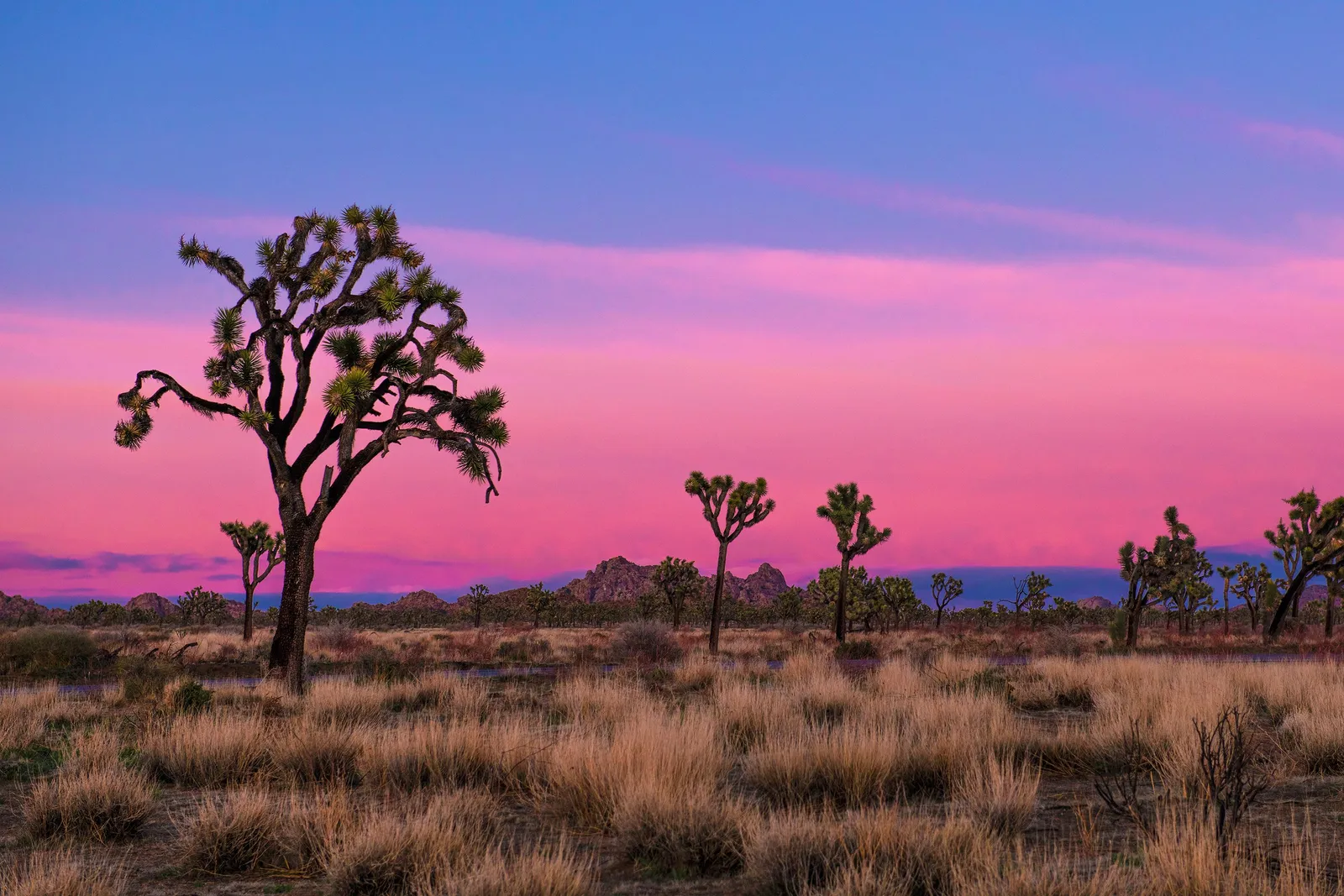
Joshua Tree National Park sits at the collision of the Mojave and Colorado deserts in southern California — 790,000 acres of granite monzogranite piles, creosote flats, and the namesake trees that give the higher elevations their alien silhouette. The backcountry here is open, waterless, and largely trailless, which means most visitors never leave the road corridor. For those willing to carry every drop and navigate by map, the solitude is immediate and the terrain is unlike anything else in the desert Southwest.
Details
- 🏞️Type
- National Park
- 🏛️Managed by
- National Park Service
- 📍State
- CA
- 🗺️Address
- 74485 National Park Drive, Twentynine Palms, CA, 92277-3597
- 📞Phone
- 7603675500
- 🕐Hours
- Joshua Tree National Park is open 24 hours a day, 7 days a week, 365 days a year. Visitation increases as temperatures moderate in the fall, peaks during the spring wildflower season, and diminishes during the heat of summer. Some areas of the park are designated for day use only. Visitor centers keep separate hours; please see descriptions.
- 💵Entrance Fee
- $30 / vehicle
- 🐾Pets Allowed
- No
- ♿Accessibility
- limited
- 🥾Activities
- auto and atv, scenic driving, astronomy, stargazing, biking, camping, backcountry camping, car or front country camping, horse camping (see also horse/stock use), group camping, climbing, rock climbing, food, picnicking, guided tours, self-guided tours - walking, self-guided tours - auto, hiking, backcountry hiking, front-country hiking, horse trekking, horse camping (see also camping), horseback riding, junior ranger program, wildlife watching, birdwatching, museum exhibits, shopping, bookstore and park store
- 📡GPS
- 33.91419, -115.83981
The Place
Joshua Tree occupies a geologic seam. The Mojave Desert, higher and cooler, dominates the park's western half — juniper, pinyon, and of course the Joshua trees themselves, rising out of sandy washes between house-sized monzogranite boulders. Drop below about 3,000 feet and you're in the Colorado Desert: sparse creosote, ocotillo, cholla gardens, and a different kind of emptiness. The transition between the two is one of the sharpest ecological boundaries you'll walk through in any national park.
What defines J-Tree's backcountry isn't difficulty in the alpine sense. There are no high passes, no river crossings, no real elevation problems. The challenge is desert logistics: water weighs eight pounds a gallon, shade doesn't exist, and navigation across open desert requires actual competence with a map and compass. The rock piles that make the Wonderland of Rocks famous also make cross-country travel disorienting — one granite dome looks like the next until you learn to read the terrain.
The park draws 3 million visitors a year, but the vast majority stay on paved roads and short nature trails. Step a mile off-road and you'll have the desert to yourself. That contrast — crowds at Skull Rock, absolute silence in Pinto Basin — is part of the place's character.
Getting There & Getting In
Joshua Tree has three entrances. The West Entrance, via Highway 62 through the town of Joshua Tree, is closest to the popular climbing areas and the Wonderland of Rocks. The North Entrance at Twentynine Palms accesses the Oasis Visitor Center and the eastern half of the park. The South Entrance, off I-10 at exit 168, drops you into the Colorado Desert near Cottonwood Spring — useful for Pinto Basin access and far less trafficked.
Gateway towns along Highway 62 — Joshua Tree, Yucca Valley, Twentynine Palms — have groceries, gas, and gear shops. The town of Joshua Tree has a decent outdoor community and a few places to eat. Don't expect much past Twentynine Palms heading east.
Cell service is unreliable inside the park. You'll get a signal at some higher-elevation points along Park Boulevard, but count on nothing in the backcountry. Download your maps before you leave pavement. The park's backcountry dirt roads — Geology Tour Road, Covington Flats, Old Dale Road — range from maintained gravel to rough 4WD. Check conditions at a visitor center before committing.
When to Go
The realistic backcountry season runs October through May. That's it. Summer temperatures exceed 100°F regularly and nighttime lows barely drop below 75°F. Carrying the water you'd need for a summer overnight — upwards of two gallons per day — makes the math punishing.
October–November: The sweet spot. Daytime highs in the 70s and 80s, cool nights, low humidity. Crowds pick up on weekends but weekday backcountry use is light.
December–February: Cooler days around 60°F, freezing nights that can dip into the 20s at higher elevations. Occasional snow dusts the Mojave section. Fewer visitors. Pack layers and a warmer sleep system than you'd think — desert cold catches people off guard.
March–April: Wildflower season brings peak crowds to the roads and day-hike trails. Backcountry use increases but remains manageable. Temperatures climbing back into the comfortable range. If the winter rains were good, the desert blooms are worth a detour through Pinto Basin.
May: Shoulder month. Tolerable for experienced desert travelers who start early and rest midday. By late May you're gambling with heat.
Permits & Regulations
Overnight backcountry camping requires a permit, implemented March 2023 through recreation.gov. Cost is $6 per group (up to 12 people), valid for 1–14 nights. Permits are available up to six months in advance and same-day until 2 PM — online, by phone at (760) 367-5554, or in person at park headquarters in Twentynine Palms.
Availability is rarely a problem outside peak spring weekends. This isn't a quota-limited wilderness permit — more of a registration system with a fee attached.
The camping rules are straightforward but specific: set up at least one mile from any backcountry trailhead, half a mile from any road, and 200 feet from any trail. The Boy Scout Trail corridor is the exception — camping there is limited to designated sites. No campfires in the backcountry, full stop. Stoves only. Pack out all waste.
Park entrance fee is $30 per vehicle, required to access all trailheads inside the park boundary.
Routes Worth Knowing
California Riding and Hiking Trail (CRHT): 37.5 miles, typically 3–4 days, point-to-point from Black Rock Canyon to the North Entrance. The signature backcountry route. Most hike west to east for a net downhill. No water on the entire route — you'll need to pre-cache water where roads cross the trail, which takes a couple hours of driving beforehand. Budget a gallon per day minimum; in warmer months, more like five liters. Mark your caches with GPS and a Sharpie (name, pickup date, contact). Rangers remove uncollected containers after 14 days.
Boy Scout Trail: 8 miles one-way (16 round-trip) from Keys West Trailhead to Indian Cove. The most popular backpacking route in the park, and the most accessible — designated campsites, relatively short distances, and terrain that's forgiving by J-Tree standards. Expect company on weekends October through April.
LOAR Loop: Roughly 32 miles with 5,100 feet of gain, starting and ending at Indian Cove. A serious multi-day route that links trail segments with cross-country desert navigation. Not marked. Requires map-and-compass skills and comfort with off-trail travel through rocky terrain.
3 Peaks Loop: Starts at Upper Covington Flats, links Ryan Peak and Queen Peak with cross-country travel including Class 2–3 scrambling. For experienced desert navigators who want to earn their views.
Off-trail in the Wonderland of Rocks: The Wonderland is a maze of monzogranite domes, narrow canyons, and hidden valleys. No trails, no signs, limited access points. Side canyons like Smith Canyon (Class 2) and Rattlesnake Canyon (Class 3) draw scramblers. Navigation is the crux — GPS helps, but you still need to read the rock.
Water, Weather & Hazards
There is no potable water in Joshua Tree's backcountry. None. Every drop you drink, you carry in. The park allows water caching for multi-day trips (14-day limit), and smart cache placement is the difference between a good trip and a miserable one on the CRHT or any route over two days.
Plan on a gallon per person per day as a minimum in cool weather. In spring, when afternoon temps hit the 80s and 90s, bump that to five or six liters. Dehydration in the desert is fast and unforgiving — by the time you feel thirsty, you're already behind.
Weather patterns are simple: dry and sunny most of the time. Rain is rare but when it comes, flash flooding in washes is real. Don't camp in a wash. Winter storms can drop temperatures 30 degrees in hours. Summer thunderstorms are infrequent but produce lightning — on exposed granite, that's a serious concern.
The less obvious hazards: abandoned mine shafts (the park has hundreds — stay out), cholla cactus (the "jumping cholla" nickname is earned), and rattlesnakes in warmer months, especially around rocky areas at dawn and dusk. Scorpions are common. Shake out your boots.
Finding Solitude
The crowds concentrate where the pavement goes: Hidden Valley, Skull Rock, Arch Rock, the campgrounds along Park Boulevard. The climbing areas around Ryan Mountain and Intersection Rock are busy October through April.
Head south into the Colorado Desert side and the people thin dramatically. Pinto Basin is the emptiest part of the park — miles of open creosote desert backed by the Eagle and Coxcomb mountains. The Cottonwood Spring area at the South Entrance sees a fraction of the traffic.
Covington Flats, in the park's western reaches, is accessible by dirt road and rarely visited. The Joshua trees here are some of the largest in the park.
Weekday visits help, but the real filter is distance from a trailhead. Most visitors won't walk more than two miles. At three miles off-trail in any direction, you're alone.