The Valley Loop Trail circles the floor of Yosemite Valley on what was once a bridle path from 1929, linking the park's most famous landmarks into a single walk. You can start anywhere and hike as much or as little as you want, making it the ultimate sampler platter of granite walls, waterfalls, and meadows.
Trail Details
- 🏃Activities
- Hiking, Mountain Biking
- 📊Difficulty
- Easy
- 🔁Trail Type
- loop
- 📏Distance
- 11.5 miles
- ⬆️Elevation Gain
- 200 ft
- ⬇️Elevation Loss
- 200 ft
- 🏔️Highest Point
- 4,050 ft
- 🚩Trailhead Elev.
- 3,980 ft
- 🪨Surface
- Paved and packed dirt
- 🌤️Best Seasons
- spring, summer, fall, winter
- 📍Location
- Yosemite Valley, CA
- 🐕Dogs Allowed
- No
- 💵Fee
- Free
- 💧Water Available
- Yes
Overview
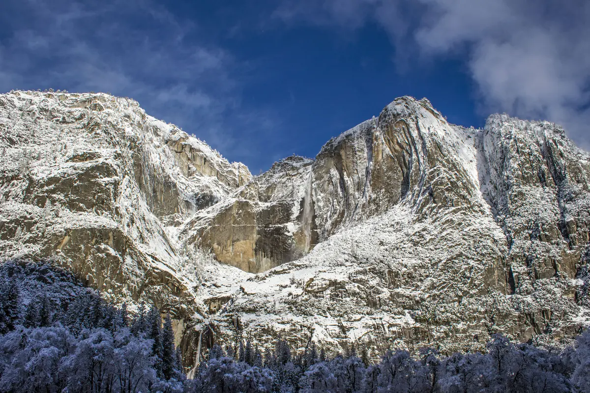
This isn't really one trail — it's a collection of old paths and paved sections stitched together into a rough circle around the Valley floor. The surface alternates between dirt, old pavement, rocks, and sand as you move through meadows, along the Merced River, and across talus slopes beneath the granite walls. The full loop covers the Valley's greatest hits: Yosemite Falls, El Capitan, Half Dome views, and Bridalveil Fall, all connected by relatively level walking.
The beauty of the Valley Loop is its flexibility. You can knock out the entire circuit for a full day of Valley immersion, or pick a section that connects the landmarks you most want to see. A half-loop from Yosemite Lodge to El Capitan Meadow and back makes a solid morning, while the stretch from Lower Yosemite Falls to Church Bowl offers waterfall views without committing to the full circuit.
What to Expect
Most of the walking is flat, but don't expect a sidewalk stroll. The trail surface changes constantly, and there are some hilly sections scattered throughout. You'll cross meadows that flood during spring snowmelt, navigate rocky sections at the base of the cliffs, and walk along stretches where the Merced River runs nearby.
The route can be confusing since it's not always a clear, single trail. Route-finding difficulties are real enough that bringing a Valley map is smart. The trail connects to numerous other paths, parking areas, and facilities, so it's easy to lose track of where the loop actually goes versus where side trails peel off to specific destinations.
From Yosemite Lodge, it's roughly three miles to reach El Capitan Meadow. From Bridalveil Falls footbridge, expect another three miles to the Four Mile Trail junction. These segments give you a sense of the distances involved, though the full loop stretches much longer.
Tips & Logistics
Start early if you're driving. Parking fills up quickly, especially at popular trailheads like Lower Yosemite Falls near Yosemite Village. Yosemite Lodge offers free parking even for non-guests, which can be a good backup option. The Visitor Center and Half Dome Village also serve as access points.
No permit is required for day hiking, but pets, bicycles, and strollers aren't allowed on the trail. Bring water — there's a drinking fountain at the Lower Yosemite Fall Trailhead, but no reliable water sources along most of the loop. Restrooms are available at Lower Yosemite Fall Trailhead, Bridalveil Fall parking area, and Swinging Bridge Picnic Area.
Winter changes the game entirely. The trail stays open year-round, but snow and ice are common, particularly on the south side of the Valley. What's normally an easy walk becomes a careful navigation exercise requiring traction devices and winter hiking experience.
Spring brings its own challenges with localized flooding near creeks as snowmelt runs off the Valley walls. Check conditions before heading out, especially if you're planning to complete the full loop during peak runoff season.
The Valley Loop works as both a destination hike and a connector between other Valley attractions. Use it to link shorter walks to specific waterfalls or viewpoints, or treat it as a way to see the whole Valley floor without the crowds that cluster around the most famous spots.