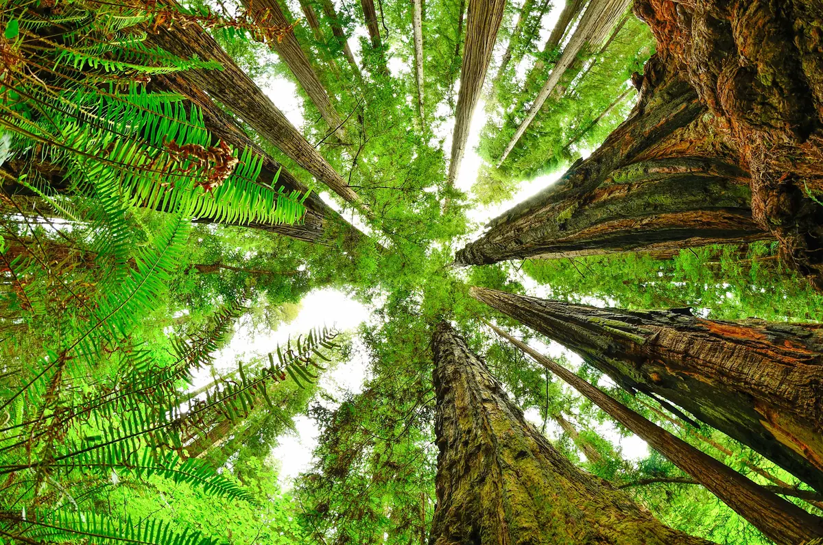
A dirt road drive through cathedral groves leads to one of the park's best moderate hikes. The Boy Scout Tree Trail threads between massive redwoods to a seasonal waterfall, with the namesake double-trunk giant marking the turnaround point for those who've had their fill of looking up.
Trail Details
- 🏃Activities
- Hiking
- 📊Difficulty
- Moderate
- 🔁Trail Type
- out and back
- 📏Distance
- 5.5 miles
- 🪨Surface
- wood and aggregate
- 🌤️Best Seasons
- january, february, march, april, may, june, july, august, september, october, november, december
- 📍Location
- CA
- 🐕Dogs Allowed
- No
- 💵Fee
- Free
Overview
This trail sits in Jedediah Smith's interior, away from the coastal fog and crowds that define much of the park experience. The 5.5-mile round trip unfolds as a gentle uphill walk through old-growth forest, crossing six bridges over seasonal creeks and following riparian corridors where ferns carpet the understory. The trail maintains a 4.3 percent grade for the first mile, then settles into easy terrain punctuated by occasional switchbacks and wooden stairs through small drainages.
The payoff comes in stages. First, the Boy Scout Tree itself — a massive double-stem coast redwood measuring over 238 feet tall and 23 feet wide, reached by a short 300-foot side trail about a mile before the official trail end. Then Fern Falls, where Jordan Creek tumbles down a rock face in a setting that feels more Pacific Northwest than California coast. The falls run strong through spring but often reduce to a trickle by late summer.
What to Expect
The trailhead sits along Howland Hill Road, itself an experience — 3.5 miles of winding dirt track that tunnels through groves so dense they block most daylight. RVs and trailers can't navigate the road's tight turns and low-hanging branches, which keeps foot traffic lighter than the park's roadside attractions.
The trail surface alternates between aggregate, wood planking, and natural forest soil. Width varies from four to six feet, wide enough for comfortable walking but narrow enough that you'll duck under occasional fallen branches. Root networks create persistent tripping hazards, especially in the softer light that filters through the canopy.
Water features define the route. The six bridges span seasonal drainages that flow hard during winter and spring rains but may dry to scattered pools by September. The riparian zones stay green year-round, supporting dense fern gardens and maintaining the humid microclimate that keeps these giants alive.
Tips & Logistics
The drive to the trailhead from US-101 takes about 30 minutes from Crescent City via Elk Valley Road. Turn east on Elk Valley Road for 1.1 miles, then right onto Howland Hill Road for the final 3.6 miles to the trailhead. The dirt road stays passable year-round for standard passenger cars, though winter storms occasionally bring down trees that block access temporarily.
Cell service disappears once you leave the highway, so download offline maps before heading out. The park recommends against relying on phone navigation — pick up a paper map at the Hiouchi visitor center if you're unfamiliar with the area.
Budget 3-5 hours for the full experience, though you can turn around at the Boy Scout Tree if time or energy runs short. The trail stays open through all seasons, but winter brings heavier rainfall that can make creek crossings more challenging and root networks slippery. Spring offers the best combination of flowing water features and manageable trail conditions.
No permits required, and the trailhead provides basic parking for about a dozen cars. Arrive early during summer weekends to secure a spot. Water sources exist along the route, but they're seasonal and not reliable for drinking without treatment. Pack what you need for the day.