Telescope Peak delivers the full Death Valley experience in reverse: instead of descending into heat and aridity, you climb out of it. The park's highest summit sits 11,049 feet above sea level, offering a 11,331-foot vertical contrast with Badwater Basin visible far below. It's one of the few Death Valley hikes that makes sense in summer, when elevation becomes your friend rather than your enemy.
Trail Details
- 🏃Activities
- Hiking
- 📊Difficulty
- Hard
- 🔁Trail Type
- out and back
- 📏Distance
- 14 miles
- ⬆️Elevation Gain
- 3,000 ft
- 📍Location
- CA
- 🐕Dogs Allowed
- No
- 💵Fee
- Free
Overview
The route follows a steady 8% grade for most of its 14 miles, starting the climb immediately from Mahogany Flat Campground. What begins in pinyon-juniper forest transitions through bristlecone pine territory before emerging onto the exposed summit ridge. The experience is less about dramatic terrain features and more about the elevation transition itself — desert floor to alpine conditions in a single day.
The trail character is straightforward: maintained path with consistent climbing, a mellower ridge section in the middle miles, then a final push to the summit. No technical terrain or route-finding challenges, but the sustained elevation gain and exposure make it a genuine test of fitness and preparation.
What to Expect
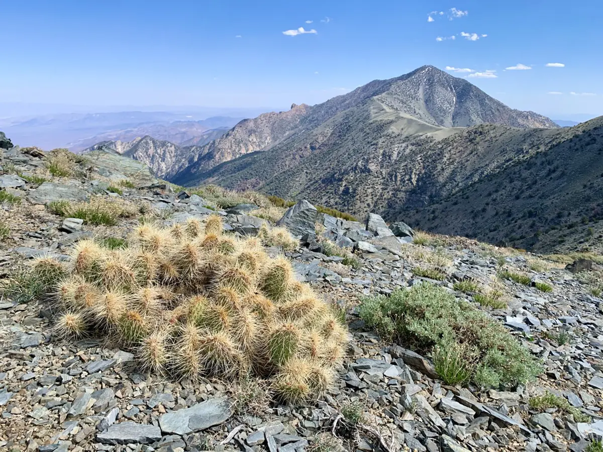
Early miles involve continuous climbing through increasingly sparse forest. Ancient bristlecone pines begin appearing as you gain elevation — some of these trees are over 1,000 years old. The ridge section provides the only real relief from climbing, though wind exposure increases significantly here.
Summit conditions can be 40-60 degrees cooler than the valley floor, with frequent wind. Snow is common from December through April, and winter ascents may require ice axe and crampons. The final summit push is exposed, with limited shelter if weather moves in.
Views from the top encompass the full Death Valley basin, from the salt flats of Badwater to the distant ranges that frame the valley. On clear days, you can see Mount Whitney and the Sierra Nevada crest to the west.
Tips & Logistics
Access requires driving to Mahogany Flat Campground via Emigrant Canyon Road from Highway 190. The final 1.5 miles may require high-clearance or 4WD depending on recent maintenance. Vehicle length is limited to 25 feet, and the road closes with snow accumulation.
Best hiking season runs November through March for most visitors, though the trail is one of the few in Death Valley that remains reasonable through summer due to elevation. Snow-free conditions typically occur late June through October, but even then, prepare for temperature swings.
No water sources exist along the trail. Carry 3-4 liters minimum, more in warmer conditions or if camping. The campground has pit toilets but no water, so fill up at Furnace Creek or Stovepipe Wells before heading up.
Mahogany Flat Campground offers 10 free sites on a first-come basis, with picnic tables and fire pits. Camping here cuts the drive time and allows for pre-dawn starts, which can be crucial in shoulder seasons when afternoon weather becomes unpredictable.
No permits required for the standard route, though backcountry camping permits are recommended if you plan to camp along the trail for emergency contact purposes. Standard Death Valley National Park entry fees apply.
Pets are prohibited on all Death Valley trails, including this one. Don't attempt to carry them — regulations are strictly enforced.
Plan for a full day: most hikers need around seven hours for the round trip. Start early to avoid afternoon winds on the exposed upper sections, and carry layers for the significant temperature variation between trailhead and summit.