The Panorama Trail delivers exactly what its name promises: sweeping views of Yosemite Valley from the south rim. This 8.5-mile descent from Glacier Point to Happy Isles strings together waterfalls and viewpoints, including Illilouette Falls and prime angles on Half Dome, Vernal Fall, and Nevada Fall. It's net downhill but don't let that fool you — several uphill sections will remind your legs they're still working.
Trail Details
- 🏃Activities
- Hiking
- 📊Difficulty
- Hard
- 🔁Trail Type
- point to point
- 📏Distance
- 8.2 miles
- ⬆️Elevation Gain
- 800 ft
- 📍Location
- CA
- 🐕Dogs Allowed
- No
- 💵Fee
- Free
Overview
This is Yosemite's showcase rim walk, trading the grunt work of climbing up from the Valley floor for the logistics of getting yourself to Glacier Point first. The trail follows the southern edge of Yosemite Valley, hitting multiple named viewpoints as it works its way east to west: Roosevelt Point, Taft Point, Dewey Point, Crocker Point, and Stanford Point. Each offers a different angle on the Valley's granite amphitheater.
The character changes as you progress. You start at 7,214 feet on polished granite with the full Valley spread below, then drop through mixed forest toward the Merced River drainage. The final section merges with the popular Mist Trail system, so expect company as you approach the finish at Happy Isles.
What to Expect
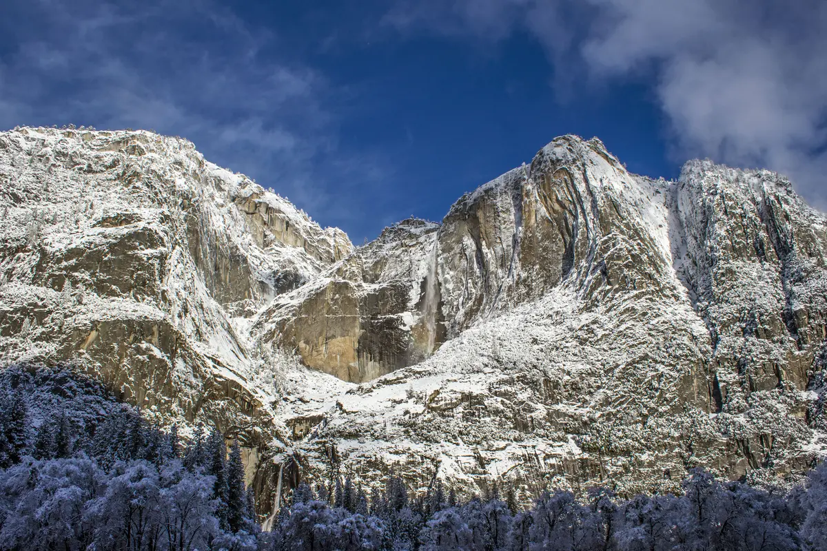
The first 2.6 miles drop 1,230 feet to the initial trail junction — a steady descent but not punishing. You'll cross Illilouette Creek on a bridge, with 380-foot Illilouette Falls as the main event. About half a mile past the creek crossing, you'll hit Panorama Point, one of the trail's signature viewpoints.
From here, the route connects with the John Muir Trail at the top of Nevada Falls before the final descent. This is where the crowds thicken, as you're now sharing trail with hikers who climbed up from the Valley floor via the Mist Trail. The granite staircases and switchbacks down from Nevada Fall are well-built but can be slick when wet.
Water is available at several points, but the creek crossings and fall viewpoints are your main reliable sources. The granite sections can be exposed and hot in summer, while the forested portions offer welcome shade.
Tips & Logistics
Note: This trail is currently closed. Check the NPS website for reopening status before planning your trip.
When open, the season typically runs May through October, with peak waterfall flows in late spring and early summer. Getting to the trailhead requires either driving Glacier Point Road (open seasonally) or taking the Glacier Point Tour bus service.
Parking at Glacier Point fills early in peak season. The trailhead sits on the right side of the stadium seating area if you're facing Half Dome. Since this is a point-to-point hike ending at Happy Isles, plan your return logistics carefully. The Valley shuttle system can get you back to your car if you parked in the Valley, but getting back to Glacier Point is trickier without the tour bus.
Allow 4-6 hours for the full route. The "net downhill" description undersells the effort — those uphill sections between viewpoints add up, and the final descent on granite steps demands attention. Bring more water than you think you need; the exposed rim sections and elevation loss can be deceptively draining.
This trail works best as a one-way adventure rather than an out-and-back. The logistics are worth sorting out for the payoff: you get Yosemite's greatest hits from above without the Valley crowds until the very end.