This loop through Joshua Tree's Black Rock area climbs 1,000 feet through three distinct desert ecosystems in 6.6 miles. It's the park's best introduction to high-desert hiking without the navigation challenges of cross-country routes, offering dense Joshua tree groves and pinyon-juniper woodland that most visitors never see.
Trail Details
- 🏃Activities
- Hiking
- 🔁Trail Type
- loop
- 📏Distance
- 6.6 miles
- ⬆️Elevation Gain
- 1,000 ft
- 🪨Surface
- deep sand, hard pack dirt, and uneven rocky surfaces
- 🌤️Best Seasons
- december, january, february, march, april, may, september, october, november
- 📍Location
- CA
- 🐕Dogs Allowed
- No
- 💵Fee
- Free
Overview
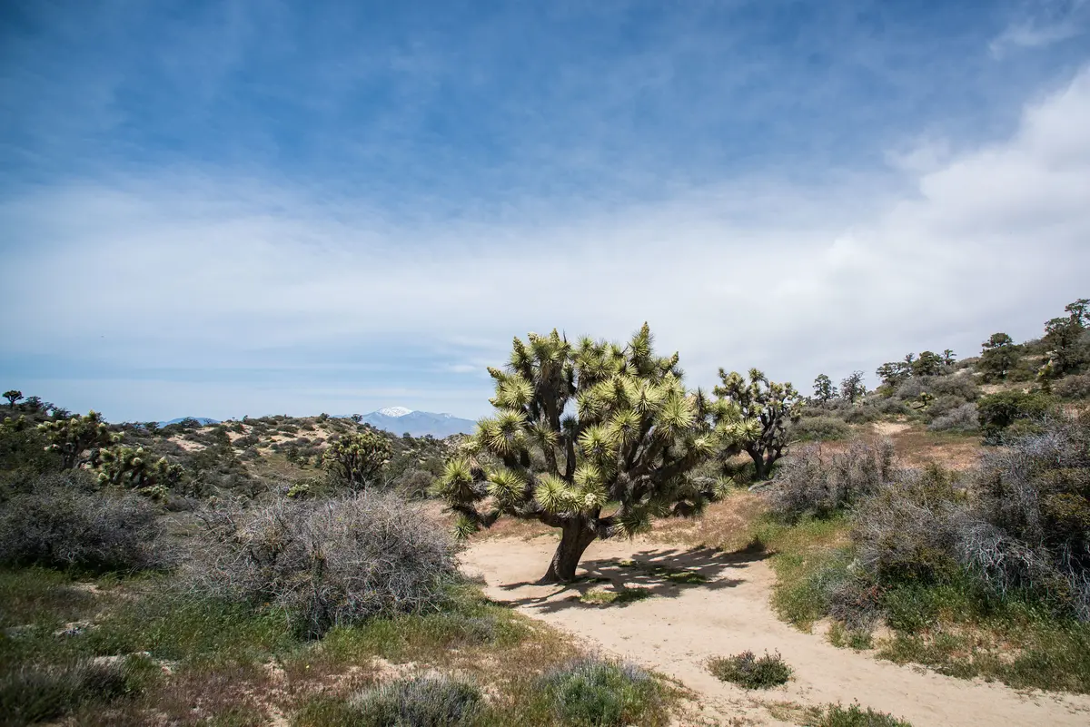
The Panorama Loop delivers on its name without the usual desert penalty of brutal exposure. Starting from Black Rock Canyon Campground in the park's northwestern corner, the trail climbs steadily through changing vegetation zones — from the familiar Joshua tree forest into higher pinyon-juniper woodland that feels more like the Eastern Sierra than the Mojave.
The route's character shifts with elevation. Lower sections wind through classic Joshua tree habitat with scattered granite outcrops. As you gain altitude, the trees thin and desert shrubs give way to actual woodland. The highest point at 5,168 feet offers views across the Morongo Valley toward the San Bernardino Mountains — a perspective most park visitors never earn.
Counter-clockwise is the standard approach, providing a more gradual climb on the front half. The trail stays well-marked throughout with Panorama Loop signs, a relief in terrain where washes and game trails can create confusion.
What to Expect
The surface alternates between deep sand that grabs at your boots, hard-packed sections that provide relief, and rocky stretches that demand attention to foot placement. Trail width varies from two to four feet, narrow enough that desert vegetation brushes your legs in places.
At 1.8 miles, watch for the Panorama Loop Trail marker where you turn left to continue the loop. This junction can be easy to miss if you're not paying attention. The trail climbs steadily from here, gaining most of its elevation in the middle third of the route.
Around the 4.2-mile mark, you'll hit the Warren Peak trail junction. The peak adds 1.4 miles round-trip if you're feeling ambitious, but the main loop already provides solid elevation and views without the extra commitment.
Black Rock Spring appears along the route — a small, muddy water source that's more of a biological curiosity than a reliable supply. Don't plan on it for drinking water.
The trail's well-engineered descent brings you back through different terrain than the ascent, completing the loop without retracing your steps. Total time runs 3 to 3.5 hours for most hikers.
Tips & Logistics
Summer heat makes this trail genuinely dangerous. The park service doesn't recommend it during summer months, and they mean it. October through April provides the best conditions, with December through March offering the most comfortable temperatures.
If you're hiking during shoulder season heat, reach the Black Rock Backcountry Trailhead before 9 AM. The elevation gain and exposed sections can become serious problems as temperatures climb.
Park at either the Black Rock Backcountry Trailhead or near the Black Rock Nature Center by campsite 30. Day-use spots are available near the visitor center if the campground's full.
Carry more water than seems reasonable — this isn't a short nature walk. The combination of elevation gain, variable terrain, and typical desert dehydration rates means a full day pack makes sense even for experienced hikers.
Cell service is unreliable throughout the route, so download maps beforehand and let someone know your plans. The trail's well-marked, but desert navigation always carries more consequences than forest hiking.
No permits required for day hiking, and the Black Rock area sees fewer crowds than the park's main attractions. You'll likely encounter other hikers, but it won't feel like a highway.