Mono Pass Trail delivers high Sierra granite scenery without the crowds that pack Yosemite's more famous routes. Starting at 9,500 feet near Tioga Pass, this 8-mile round-trip hike climbs gradually to a 10,600-foot divide where you can peer down into the Mono Basin and across to the jagged peaks of the Ansel Adams Wilderness.
Trail Details
- 🏃Activities
- Hiking
- 📊Difficulty
- Moderate
- 🔁Trail Type
- out and back
- 📏Distance
- 8 miles
- ⬆️Elevation Gain
- 1,000 ft
- 📍Location
- CA
- 🐕Dogs Allowed
- No
- 💵Fee
- Free
Overview
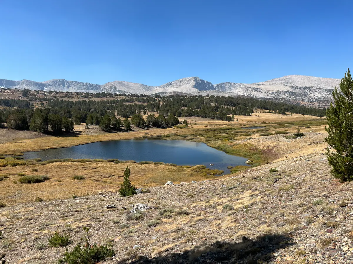
This is high-altitude hiking at its most accessible. The trail starts just inside Yosemite's eastern boundary and follows an old mining route through granite country dotted with alpine lakes and weathered cabins. The 900 feet of elevation gain spreads out over nearly 4 miles, making for a steady but manageable climb. At the pass, you're standing on the Sierra Crest with views stretching east to Mono Lake and the White Mountains.
The trail connects to the broader wilderness network — you can continue into the Ansel Adams Wilderness toward Mammoth Lakes or take side routes to alpine lakes tucked into cirques. But the pass itself makes a satisfying destination, especially if you're looking to sample Sierra high country without committing to a multi-day trek.
What to Expect
The first section crosses three streams within the opening miles. Early in the season, you might need to wade; by midsummer, rocks and logs provide dry crossings. The trail maintains a gentle grade through mixed forest before emerging into more open granite terrain as you gain elevation.
Around 2 miles in, a right fork leads toward Spillway Lake for those wanting a side trip. The main trail continues climbing more noticeably after this junction. Another right turn about a quarter-mile before the pass heads toward Parker Pass — stick left for Mono Pass unless you're planning a longer route.
The pass itself sits in a gap between granite ridges. On clear days, the eastern views take in Mono Lake's alkaline expanse and the volcanic domes scattered around its shores. Remnants of the 1879 Golden Crown Mine operation dot the landscape — cabins and mining debris from the Tioga Mining District's brief silver boom. These preserved structures add a historical dimension to what's otherwise pure Sierra wilderness.
If you have energy left, Upper Sardine Lake lies beyond the pass, though this extends your day considerably. Summit Lake, reached around the 3.8-mile mark at 10,621 feet, offers another destination option.
Tips & Logistics
Timing depends entirely on Tioga Road, which typically opens in late May to June and closes with the first significant snow in October or November. Even when the road is open, early and late season can mean snow on the trail above 10,000 feet. June through October offers the most reliable conditions.
The trailhead sits on Highway 120 about a mile west of the Tioga Pass entrance station. Parking holds roughly a dozen cars, so arrive early during peak season. From Yosemite Valley, it's a 56-mile drive via Crane Flat — plan over an hour each way.
The high starting elevation means you're jumping straight into thin air. Take the climb slow if you're coming from sea level. Water is available from the stream crossings early in the hike, but treat anything you drink. The elevation and exposed granite mean weather can change quickly; bring layers even on warm days.
No camping is allowed at Mono Pass within park boundaries. Backpackers planning to continue into the Ansel Adams Wilderness need to camp outside the park or secure permits for wilderness camping beyond the boundary.