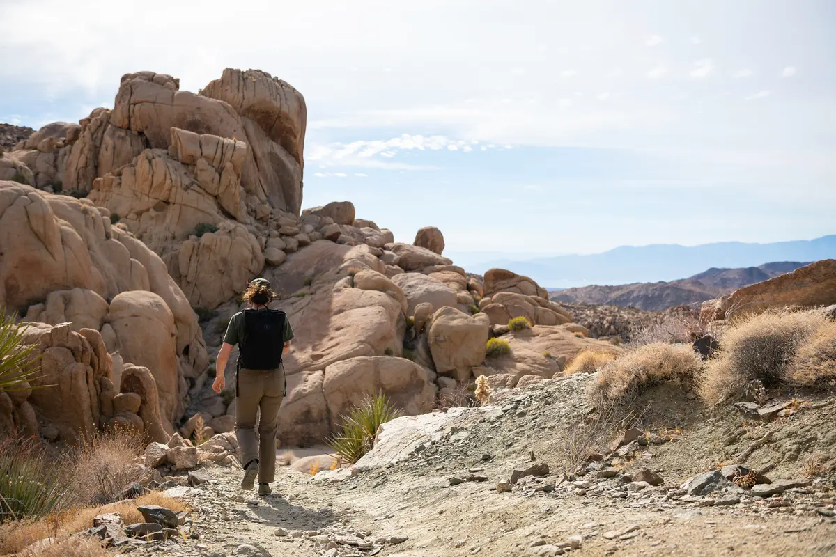
Mastodon Peak delivers a surprising amount of payoff for a relatively short desert hike — a working gold mine, panoramic summit views, and access to one of Joshua Tree's few reliable water sources. The three-mile loop from Cottonwood Spring combines straightforward desert walking with an optional scramble to a granite summit that opens up views across the Colorado Desert to the Salton Sea.
Trail Details
- 🏃Activities
- Hiking
- 📊Difficulty
- Moderate
- 🔁Trail Type
- loop
- 📏Distance
- 3 miles
- ⬆️Elevation Gain
- 375 ft
- 🪨Surface
- dirt, sand, and rock
- 🌤️Best Seasons
- october, november, december, january, february, march, april, may
- 📍Location
- CA
- 🐕Dogs Allowed
- No
- 💵Fee
- Free
Overview
This is Colorado Desert hiking — sparse creosote, scattered cholla, and the kind of open terrain where you can see your destination from miles away. The trail starts at Cottonwood Spring, one of the park's few natural water sources, before winding past the remnants of Mastodon Mine and up to the base of the namesake peak. The granite summit scramble is optional but recommended; it's a straightforward Class 2-3 climb up the eastern flank that adds genuine reward to an otherwise modest hike.
The loop format keeps things interesting without backtracking. You'll start on the Lost Palms Oasis Trail before splitting left at the first junction, about 0.7 miles from the trailhead. The terrain mixes dirt paths, sandy washes, and rocky sections — typical for this elevation in Joshua Tree, where you're solidly in Colorado Desert ecosystem rather than the Joshua tree forests of the park's higher elevations.
What to Expect
The first stretch follows a clear trail through typical desert scrub. Mastodon Mine appears along the route — a modest operation that ran from 1934 to 1971 with a 45-foot shaft. It's not spectacular ruins, but it adds historical context to the landscape and breaks up the walking.
The peak itself is the obvious granite outcrop you've been walking toward. Look for the worn path that curves around the eastern side — this is your route to the top. The scramble requires some basic rock navigation and decent footing, but it's nothing technical. Hiking shoes or boots help with traction, and trekking poles can be useful on the way up.
Summit views justify the effort. On clear days, you can see the Salton Sea shimmering in the distance, plus the full spread of the Colorado Desert stretching toward Mexico. It's one of the better vantage points in this section of the park for understanding the scale and character of the landscape.
Tips & Logistics
Access is straightforward: take I-10 exit 168, head north on Cottonwood Spring Road for seven miles, then turn right before the Cottonwood Visitor Center and continue one mile to the trailhead. Parking at Cottonwood Spring fills up quickly, especially on weekends, so start early or have a backup plan.
No shade exists anywhere on this route, and cell service is nonexistent. Bring at least one liter of water per person, more if temperatures are above 70 degrees. Summer hiking requires a pre-9 AM start and extra water reserves — the exposed terrain and lack of shade make afternoon desert hiking genuinely dangerous when temperatures climb.
The park entrance fee applies, and dogs aren't allowed on trails. This area is protected bighorn sheep habitat, so backcountry camping isn't permitted in this section of the park.
Winter through early spring offers the best hiking conditions. October through April gives you moderate temperatures and occasional wildflower displays if winter rains have been adequate. The trail can be combined with the Lost Palms Oasis Trail for a longer day, though most hikers find the Mastodon loop sufficient for experiencing this corner of Joshua Tree's Colorado Desert ecosystem.