This 22-mile loop follows an old logging road through recovering clearcuts and patches of old-growth redwood, climbing 3,000 feet to Holter Ridge before looping back via Bald Hills Road and Highway 101. It's one of the few substantial bike-friendly routes in the redwood parks, though the highway portion and steep grades make it more commitment than casual ride.
Trail Details
- 🏃Activities
- Hiking
- 🔁Trail Type
- loop
- 📏Distance
- 22 miles
- ⬆️Elevation Gain
- 3,000 ft
- 📍Location
- CA
- 🐕Dogs Allowed
- No
- 💵Fee
- Free
Overview
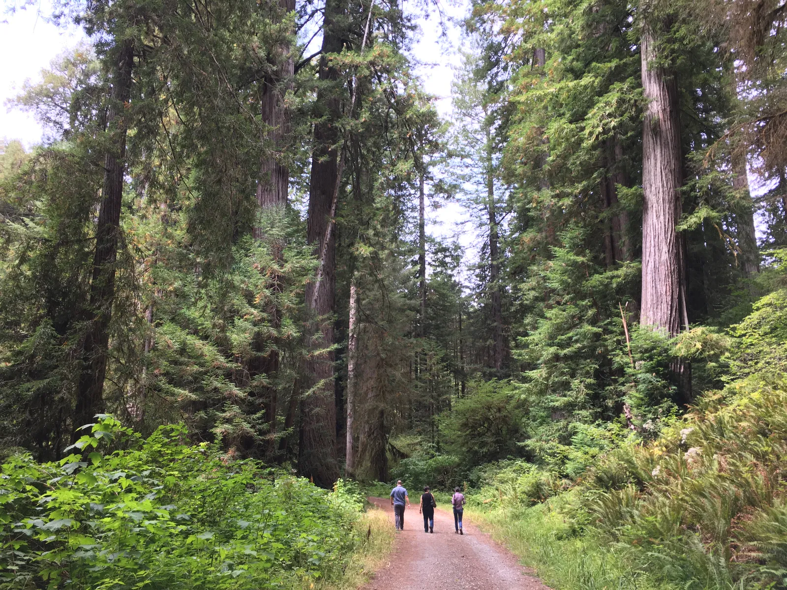
The trail starts gently along a fork of Lost Man Creek, winding through genuine old-growth redwood groves for the first couple miles before the character shifts completely. You're riding the bones of Geneva Road, a former logging route that carved through what was heavily clearcut in the 1960s. The forest you'll see for most of the climb is second-growth — younger trees filling in where giants once stood.
This isn't single-track mountain biking. The converted logging road is wide enough for comfortable riding, but the 3,000-foot climb to Holter Ridge is steady work. The trail was designed for both hikers and cyclists, with several salmon-friendly bridges installed in the 1990s spanning creek crossings. The engineering is solid, but the grades are real.
The full loop requires completing the circuit via Bald Hills Road and Highway 101 — a 20½-mile ride that puts you on pavement with logging trucks and tourist traffic. Many riders opt for the out-and-back option instead, turning around at the Holter Ridge connection to Bald Hills Road for a 22-mile round trip that skips the highway exposure.
What to Expect
The Lost Man Creek picnic area serves as your starting point, with parking, restrooms, and bike racks. The first mile follows the creek fork through some of the park's most impressive old-growth stands — this section justifies the ride even if you turn around early.
Once you leave the creek drainage, the climb begins in earnest through second-growth forest. The logging history is evident but not ugly; these forests are recovering well after decades of regrowth. The wide road bed makes for predictable footing, though fallen trees and seasonal washouts can create obstacles between maintenance cycles.
At Holter Ridge, you'll connect with Bald Hills Road. This is decision time: continue the loop by heading south on Bald Hills Road to Highway 101, or turn around for the out-and-back option. The loop completion involves about 6½ miles on Bald Hills Road followed by a stretch on Highway 101 back to the trailhead.
Tips & Logistics
Plan for a moderate two to eight-hour outing depending on your pace and route choice. The Holter Ridge section has seasonal logging closures from mid-June through mid-November, effectively blocking the full loop during peak summer months — check current conditions before committing to the full circuit.
If you're completing the loop, treat the Highway 101 portion seriously. Visibility gear and lights are recommended even in daylight. The road carries significant truck traffic, and coastal fog can reduce visibility quickly.
Water is available at the trailhead, but there are no reliable sources along the route. The climb is substantial enough to require planning, especially in warmer months. Paper maps are recommended since cell coverage is spotty to nonexistent once you leave the highway corridor.
The out-and-back option eliminates the highway risk while still delivering the full climbing challenge and forest experience. For most riders, it's the better choice — all the reward with significantly less exposure.