Lost Horse Mine delivers Joshua Tree's backcountry without the navigation headaches. This moderate desert hike follows an old mining road to the park's best-preserved stamp mill, where you can loop back through open desert or retrace your steps. The payoff is solid history, decent elevation, and views across the Coachella Valley without the crowds that pack Skull Rock.
Trail Details
- 🏃Activities
- Hiking
- 🔁Trail Type
- loop
- 📏Distance
- 6.8 miles
- ⬆️Elevation Gain
- 900 ft
- 🪨Surface
- deep sand, hard pack dirt, uneven rocky surfaces
- 🌤️Best Seasons
- december, january, february, march, april, may, september, october, november
- 📍Location
- CA
- 🐕Dogs Allowed
- No
- 💵Fee
- Free
Overview
The trail splits into two experiences. Take the direct route and you'll cover 4 miles round-trip with 550 feet of climbing on what amounts to a wide, well-defined path to a fascinating piece of mining history. Opt for the full loop and you're looking at nearly 7 miles of varied desert terrain that includes cross-country navigation through Joshua tree forests and granite washes.
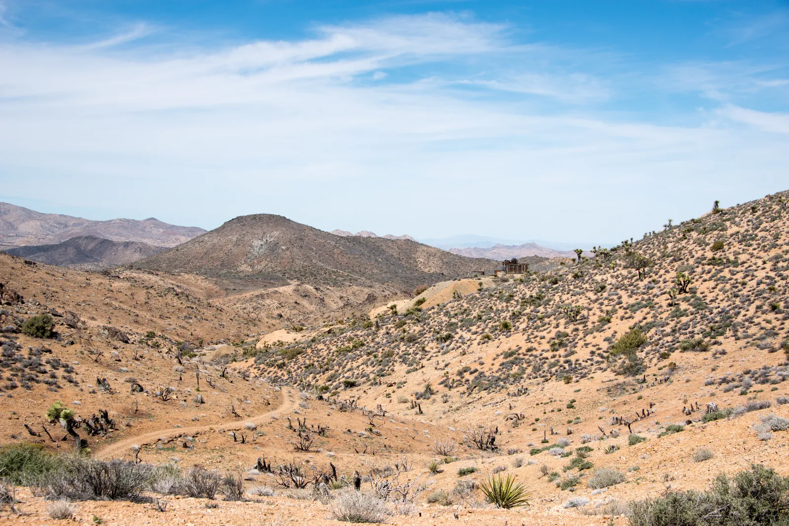
Both routes follow the same mining road for the first stretch, climbing gradually southeast from 4,600 feet to the mine site at 5,120 feet. The old roadbed makes for straightforward walking, though expect sections of deep sand that'll work your calves. This isn't technical hiking, but the desert doesn't coddle you either.
What to Expect
From the trailhead, the route heads through classic Mojave habitat — scattered Joshua trees, juniper, and the occasional desert willow tucked into washes. The climbing is steady but never punishing, with the steepest sections featuring installed rock steps. Terrain varies from hard-packed dirt to loose sand to uneven rocky stretches that require attention to foot placement.
The mine itself justifies the effort. Lost Horse operated from 1893 to 1936, producing over 9,000 ounces of gold during its run. The 10-stamp mill, hauled up here in 1895, remains largely intact behind protective fencing. The machinery is impressive enough, but the real draw is the setting — perched on a hillside with commanding views west toward the Coachella Valley and the San Bernardino Mountains beyond.
If you're doing the loop, the return follows a different route entirely. Instead of retracing the mining road, you'll head cross-country through more varied terrain, including sections where the path becomes less obvious. This portion requires basic desert navigation skills and adds about 2.5 miles to your day.
Tips & Logistics
Access requires a short drive on dirt road — 2.4 miles down Keys View Road from Park Boulevard, then a final mile on single-lane dirt to the trailhead. The road is passable for standard cars, but RVs and large vehicles can't make the turn.
The trailhead offers vault toilets and parking, but nothing else. No water, no shade, and no cell service. Plan accordingly.
Winter through early spring offers the best conditions, with December through May providing comfortable temperatures. Summer hiking here borders on masochistic — exposed desert at elevation with zero shade. Start early regardless of season, ideally before 9 AM.
Water requirements depend on your route and the season. Carry at least a liter for the basic out-and-back, two liters for the full loop. The desert will dehydrate you faster than you expect, especially if there's any wind.
Dogs aren't allowed on the trail, and the mining structures are fragile and fenced for safety. Resist any urge to climb on the equipment or duck under barriers. The machinery has survived more than a century in the desert; help it survive a few more decades.
The loop option requires confidence with map and compass. While the route is generally well-cairned, sections cross open desert where the path becomes intermittent. If you're new to desert navigation, stick with the out-and-back until you've built some experience reading this terrain.