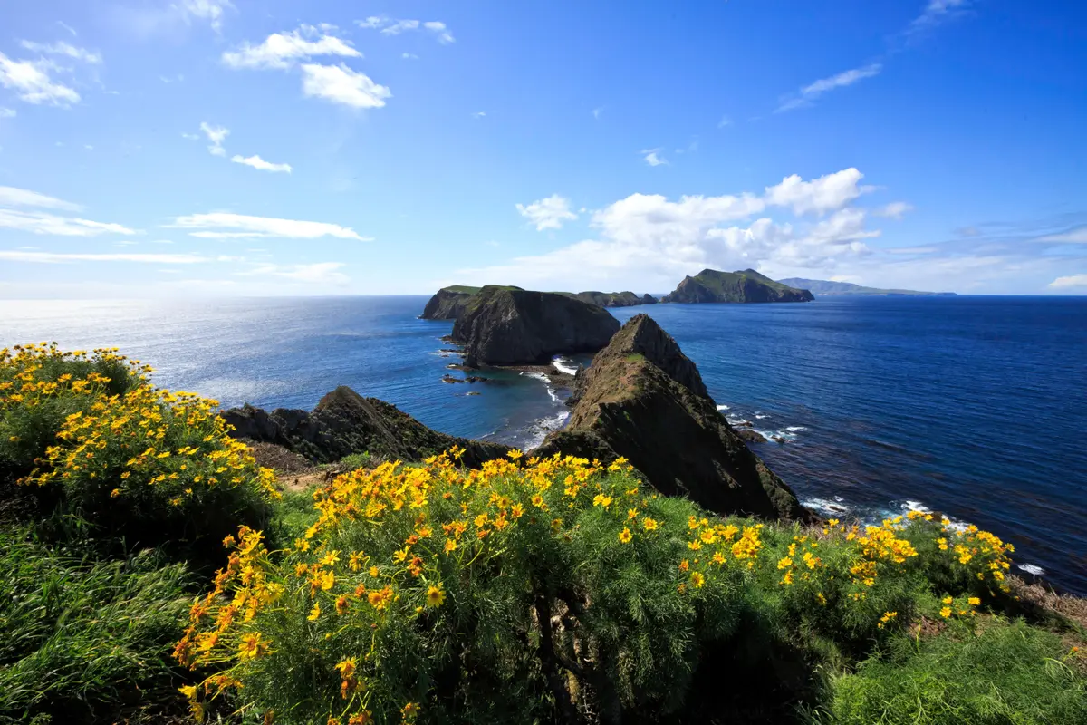
Lobo Canyon cuts a narrow slot through Santa Rosa Island's sandstone cliffs, ending at a secluded beach where wind and water have carved the rock into honeycomb patterns. The 9-mile round trip from the boat dock is as much about the journey as the destination — a coastal road walk across the island's interior grasslands before dropping into one of the Channel Islands' most dramatic geological features.
Trail Details
- 🏃Activities
- Hiking
- 📊Difficulty
- Hard
- 🔁Trail Type
- out and back
- 📏Distance
- 9 miles
- 📍Location
- CA
- 🐕Dogs Allowed
- No
- 💵Fee
- Free
Overview
This trail divides into two distinct experiences. The first half follows Coastal Road and Smith Highway across Santa Rosa's windswept interior — open grassland punctuated by island scrub, with views of the mainland mountains on clear days. The payoff comes at mile 4.5, where the landscape suddenly drops into Lobo Canyon, a narrow gorge carved into thick-bedded sandstone and white tuffaceous siltstone.
The canyon itself runs just 1.5 miles from the road to the sea, but those miles pack in the island's signature geology. Vertical sandstone walls rise on both sides, sculpted into tafoni formations — the honeycomb weathering patterns that make Channel Islands rock so distinctive. A year-round stream runs through the canyon bottom, supporting riparian vegetation that contrasts sharply with the island's otherwise arid character. The trail ends at a small beach where the canyon meets the Pacific.
What to Expect
The road walk dominates this hike's character. Four and a half miles of dirt road sounds tedious, but Santa Rosa's interior has its own appeal — rolling grasslands that turn green after winter rains, scattered groves of island oaks, and the constant presence of the mainland coast across the channel. The island fox, endemic to the Channel Islands and about the size of a house cat, sometimes appears along this stretch.
The canyon section requires different skills. The trail drops steeply from the road into the gorge, then follows the creek bed over rocks and through riparian growth. The sandstone walls narrow as you descend, creating a slot canyon effect in places. The stream runs year-round, fed by island springs, but crossing points can be slippery after rain.
Wind defines conditions here more than temperature. Santa Rosa sits fully exposed to Pacific weather systems, and sustained winds of 20-30 mph are normal. The canyon offers some shelter, but the road walk crosses open terrain where gusts can push you sideways. Fog rolls in without warning, reducing visibility to yards.
Tips & Logistics
Rangers sometimes provide rides to the trailhead, cutting the hike to about 4 miles round trip. Ask at the dock when you arrive — availability depends on staffing and vehicle needs. Even with a ride, plan for the full 9-mile distance in case transport isn't available.
Water is your primary constraint. No reliable sources exist along the route, and the canyon creek isn't suitable for drinking without filtration. Carry enough for the full distance, plus extra for delays or weather changes. The combination of wind and sun creates higher water needs than the mileage suggests.
The signed coastal route between Lobo Canyon and Cow Canyon protects sensitive resources. Stay on designated paths and don't shortcut between waypoints. The Park Service takes biosecurity seriously here — check your gear for invasive seeds before boarding the ferry.
Weather windows matter more than seasons. March through November offers the most reliable boat service, but winter trips can be spectacular if you catch a calm period. Check Island Packers' schedule early — Santa Rosa runs less frequently than Santa Cruz, and weather cancellations are common. Plan for potential overnight stays if return trips get scrubbed.