Lembert Dome rises 800 feet above Tuolumne Meadows like a granite whale's back, offering one of the most accessible summit experiences in Yosemite's high country. The payoff is a 360-degree view of the Cathedral Range, with the polished granite of the Sierra Nevada stretching to the horizon. It's the kind of hike that converts people to the high country — steep enough to feel like an accomplishment, short enough to leave time for a picnic in the meadows below.
Trail Details
- 🏃Activities
- Hiking
- 📊Difficulty
- Moderate
- 🔁Trail Type
- out and back
- 📏Distance
- 3.8 miles
- ⬆️Elevation Gain
- 850 ft
- 📍Location
- CA
- 🐕Dogs Allowed
- No
- 💵Fee
- Free
Overview
This trail splits personality halfway through. The first 0.7 miles climb steeply through mixed forest, gaining elevation quickly on a well-defined path. Once you reach the base of Lembert Dome itself, the trail disappears onto bare granite. From there, it's 0.2 miles of scrambling up the dome's gradual eastern slope — a roche moutonnée shaped by ancient glaciers that once filled Tuolumne Meadows.
The geology lesson is written in the rock. Lembert Dome's asymmetrical profile tells the story of ice flow: the steep western face shows where glaciers plucked away chunks of granite, while the polished eastern slope shows the direction the ice traveled. You're climbing the path glaciers carved 20,000 years ago.
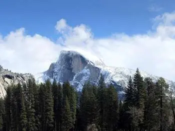
From the summit at 9,450 feet, the view spans from Mount Conness in the north to the Cathedral Range in the south. Tuolumne Meadows spreads below like a green carpet between granite domes, with the Tuolumne River meandering through subalpine grassland. On clear days, you can pick out familiar peaks: Cathedral, Unicorn, and the backside of Half Dome.
What to Expect
The forest section climbs relentlessly but stays manageable. You'll pass through lodgepole pine and mountain hemlock before emerging onto granite slabs. At the signed junction 0.75 miles in, Dog Lake branches left while Lembert Dome continues straight.
Once you hit bare rock, there's no marked trail. Pick the path of least resistance up the dome's eastern face. The granite offers good friction when dry, but becomes dangerously slippery when wet — this isn't a trail for rainy days. The scrambling requires attention but isn't technical; it's more like hiking up a tilted parking lot than rock climbing.
The summit plateau is surprisingly spacious, with room to spread out and multiple vantage points. The western edge drops off dramatically — the same cliff face the glaciers created. Exercise appropriate caution near the rim.
Tips & Logistics
Tioga Road access is the limiting factor. The road typically opens in late May or early June and closes with the first significant snow in late October or November. Check current conditions at 209/372-0200.
Park at the Dog Lake trailhead along Tioga Road. Bear boxes are available in the parking area — use them. Black bears are common in Tuolumne Meadows, and they've learned to associate cars with food. The outhouse at the trailhead handles the basics; running water is available at the Tuolumne Meadows Visitor Center about a mile west.
Start early in summer to avoid afternoon thunderstorms. Granite domes and lightning don't mix. The elevation means cooler temperatures even in July and August — bring layers.
For proper footwear, anything with decent grip will work for the forest section. The granite scrambling rewards shoes with sticky rubber soles. Don't attempt this in sandals or worn-out treads.
The trail can be done as part of a longer loop by returning via the Lembert Dome parking area, adding distance but variety. Dog Lake makes a worthy side trip if you have extra time and energy — it's only 1.3 miles from the trailhead and offers a completely different character than the dome summit.