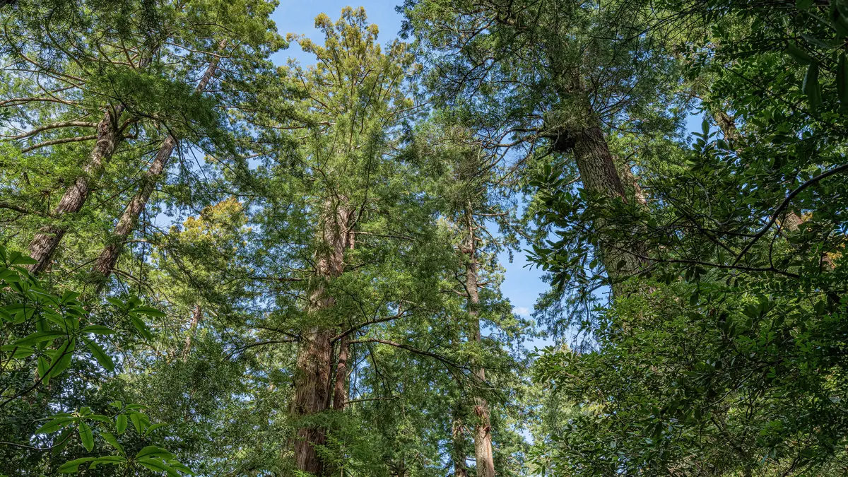
Stop #9 on the Lady Bird Johnson Nature Trail zeros in on what happens when giants fall. The 1.5-mile loop through this upland grove north of Orick isn't about the tallest trees — it's about the ecological afterlife of redwoods, where snags and fallen logs continue feeding the forest decades after they topple.
Trail Details
- 🏃Activities
- Hiking
- 🔁Trail Type
- out and back
- 📏Distance
- 1.5 miles
- 📍Location
- CA
- 🐕Dogs Allowed
- No
- 💵Fee
- Free
Overview
This is redwood education distilled into a gentle walk. The Lady Bird Johnson Grove sits at 1,200 feet above sea level, high enough to catch the fog that rolls in from the coast but not so high that you're dealing with serious elevation gain — just 101 feet over the entire loop. The trees here are relatively small by redwood standards, which makes the grove feel more intimate than the cathedral-like spaces you'll find closer to the coast.
Stop #9 is one of several interpretive stations along the trail, each focusing on a different aspect of redwood ecology. This one deals with death and decay — specifically how redwood snags become habitat for raptors, nesting sites for woodpeckers and owls, and food sources for the insects that form the base of the forest's food web. There's an unsteady leaning tree at the stop that demonstrates the process in real time.
What to Expect
The trail surface alternates between dirt and wooden boardwalks, staying at least six feet wide throughout. One bridge has enough slope that the trail isn't officially wheelchair accessible, though families with strollers generally manage fine. The mixed forest includes redwoods alongside other tall conifers, creating a canopy that stays fairly thick even in this upland setting.
Fog is common here, sometimes thick enough to muffle sound and reduce visibility to a few dozen yards. When it's clear, you're walking through dappled light filtered through multiple canopy layers. The dedication plaque to Lady Bird Johnson sits about half a mile into the loop — a bronze marker that's easy to miss if you're not looking for it.
The educational stops are numbered but not always obvious. Each has a small interpretive panel, though the real education happens by watching the forest itself. At Stop #9, look for woodpecker holes in the snags and listen for the tapping that means they're actively foraging.
Tips & Logistics
Access is via Bald Hills Road, about 3 miles from Highway 101. The road is narrow and winding with few places to turn around, so don't attempt it with an RV, trailer, or bus. The parking lot at the trailhead has limited capacity and fills up during summer weekends. No parking is allowed on Bald Hills Road itself.
Dogs aren't permitted on the trail. During summer months, rangers lead walks that start from the parking lot — worth timing your visit around if you want deeper context on what you're seeing.
The grove stays cool and damp year-round, with morning fog common even in summer. A light jacket is rarely a bad idea, even when it's warm down at sea level. The trail takes 30 minutes to an hour depending on how much time you spend at the interpretive stops.
Water and restrooms are available at the trailhead. The grove's elevation means it's often 10-15 degrees cooler than the coastal areas, which can be a relief during summer heat waves or an unpleasant surprise on overcast days.