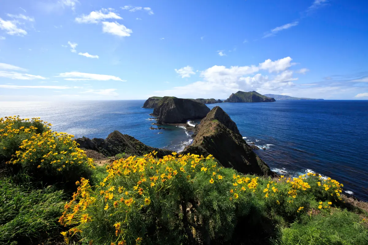
Johnson's Lee requires everything Channel Islands backcountry demands: serious fitness, careful logistics, and the ability to carry all your water for 27 miles. This strenuous trek to Santa Rosa Island's remote southwestern shore leads to a revegetated former Air Force radar site that now serves as the gateway to the park's only backcountry beach camping.
Trail Details
- 🏃Activities
- Hiking
- 📊Difficulty
- Hard
- 🔁Trail Type
- out and back
- 📏Distance
- 27 miles
- 🌤️Best Seasons
- august, september, october, november, december
- 📍Location
- CA
- 🐕Dogs Allowed
- No
- 💵Fee
- Free
Overview
The numbers tell the story: 27 miles round-trip via South Road, with considerable climbing to reach what was once a Cold War radar installation at 1,589-foot Vail Peak. From 1951 to 1963, this remote corner of Santa Rosa Island housed Air Force personnel who maintained radar, transmitting, and receiving facilities. The military infrastructure is gone, replaced by native vegetation, but the isolation remains absolute.
This isn't a trail for casual island visitors. The Park Service recommends it only for experienced, well-conditioned hikers, and that's not marketing speak. Between the distance, elevation gain, and complete water dependency, Johnson's Lee separates committed backpackers from day trippers. Your reward is access to backcountry beach camping along Santa Rosa's south shore — the only such opportunity in the Channel Islands system.
What to Expect
Two routes lead to Johnson's Lee: the 28-mile Main Road option and the 27-mile South Road route. Both demand the same fitness level and water-carrying capacity, but South Road shaves off a mile. The route follows established roads rather than narrow trails, which makes navigation straightforward but doesn't soften the physical demands.
Water Canyon Campground sits less than a quarter-mile from the turnoff — your last reliable water source before Clapp Spring, roughly 4 miles farther along the route. From there, you're committed to whatever you're carrying. The terrain includes significant climbing as you approach the former radar site at Vail Peak, then continues west along Wreck Road past Wreck Canyon Creek toward the island's south shore.
The destination itself reflects the military history: a cantonment area near shore where personnel once lived, connected to the radar facilities on the peak above. Today's hikers find revegetated slopes and access to beaches that see almost no human traffic outside the backcountry camping season.
Tips & Logistics
Backcountry beach camping operates from August 15 through December 31, requiring permits through the Park Service. This seasonal window aligns with Santa Rosa Island's most stable weather, though conditions remain unpredictable. Plan for wind, temperature swings, and potential fog banks that can roll in without warning.
Water planning is critical. Calculate your needs carefully — there's no resupply between Clapp Spring and the end of the route. Factor in cooking, cleaning, and the physical demands of the return trip with a potentially lighter but still substantial pack.
Getting to Santa Rosa Island requires either Island Packers boat service or Channel Islands Aviation flights. Both operate on limited schedules that become your hard constraints for trip planning. Weather delays are common, so build buffer days into your itinerary.
Consider the multi-day option: Ford Point sits about 9 miles from the pier, with Johnson's Lee adding another 8 miles round-trip from there. This breaks the distance into more manageable segments, though you'll still need to carry water for the entire trip. Water Canyon Campground provides a logical staging area, but remember it's still backcountry camping with all the usual restrictions.
The isolation that makes Johnson's Lee special also makes it unforgiving. Cell service doesn't exist, rescue options are limited, and the ferry won't wait for delayed hikers. Come prepared, or don't come at all.