Inspiration Point delivers the Channel Islands experience in concentrated form — ocean views in every direction, seabirds wheeling overhead, and the satisfying isolation of standing on a narrow ribbon of land 20 miles from the mainland. This easy walk on East Anacapa Island packs the archipelago's signature scenery into a manageable 1.5-mile round trip that anyone can handle, assuming they can climb the 150 steps from the ferry landing to reach the trailhead.
Trail Details
- 🏃Activities
- Hiking
- 📊Difficulty
- Easy
- 🔁Trail Type
- out and back
- 📏Distance
- 1.5 miles
- 📍Location
- CA
- 🐕Dogs Allowed
- No
- 💵Fee
- Free
Overview
East Anacapa is barely a quarter-mile wide at its widest point, which means ocean stretches away on both sides of you for most of this walk. The island's figure-eight trail system connects the visitor center to several viewpoints, with Inspiration Point offering the standout vista westward across the channel toward the larger islands in the chain. The terrain is surprisingly flat once you've climbed those initial stairs from the pier — the 347 feet of elevation gain listed for the full island loop is spread across gentle undulations rather than steep climbs.
The trail character depends entirely on the season. March and April bring the native coreopsis into bloom — tree-sized sunflowers that transform sections of the route into golden corridors. Outside flowering season, the landscape reads as coastal scrub and grassland, hardy vegetation that survives on whatever moisture the marine layer provides.
What to Expect
From the visitor center, the trail heads west across the island's flat interior toward the point. The path is well-defined but completely exposed — there's no shade anywhere on Anacapa, so the sun hits you directly. You'll pass the restored Fog Signal Building, a piece of the island's lighthouse history, before reaching the viewpoint.
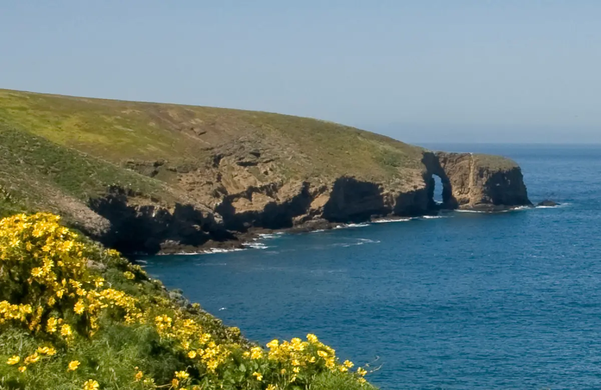
Inspiration Point itself looks west toward Middle and West Anacapa, separated by Cathedral Cove's dramatic sea cliffs. On clear days, the view extends to Santa Cruz Island and beyond. The trail continues past the point toward Pinniped Point, where California sea lions and harbor seals haul out on the rocks below.
If you take the longer loop route back instead of retracing your steps, you'll circle through the island's southern section where the coreopsis forest is thickest. The complete loop covers about 2 miles total across the island's trail system.
Tips & Logistics
Ferry logistics control everything about this hike. Island Packers runs boats from Ventura Harbor year-round to Anacapa, but winter service can be unreliable due to rough seas. The crossing takes about an hour each way. Book well ahead during peak season.
Getting from boat to trailhead requires a commitment to vertical travel — you'll climb a ladder from the ferry to the pier, then tackle those 150-plus steps to reach the island's flat top. Pack light but bring water for everyone in your group. The island has no natural water sources, and the exposed conditions dehydrate you faster than you'd expect.
Timing matters for wildlife viewing. Seabirds nest on the island from March through June, when you're most likely to see brown pelicans, western gulls, and other species. The coreopsis bloom typically peaks in March and April, though timing varies with winter rainfall.
Wear sturdy shoes with good grip — the trail surface is fine, but the clifftop viewpoints can be wind-buffeted, and the park strictly enforces staying back from cliff edges. A hat and sunscreen are non-negotiable given the complete lack of shade. The payoff for dealing with ferry schedules and exposure is having one of California's most distinctive island landscapes largely to yourself, at least compared to mainland trail traffic.