Glen Aulin follows the Tuolumne River downstream from the meadows through a series of granite cascades and pools, trading the high country's open views for intimate streamside walking. At 6.5 miles round-trip with minimal elevation change, it's one of the more accessible waterfall hikes in Yosemite's alpine zone. The payoff is a collection of falls and granite sculptures that feel more remote than they actually are.
Trail Details
- 🏃Activities
- Hiking
- 📊Difficulty
- Moderate
- 🔁Trail Type
- out and back
- 📏Distance
- 11 miles
- ⬆️Elevation Gain
- 800 ft
- 📍Location
- CA
- 🐕Dogs Allowed
- No
- 💵Fee
- Free
Overview
This trail runs along the same route as the Tuolumne River, descending gradually through granite country toward the Grand Canyon of the Tuolumne. The walking is pleasant rather than punishing — mostly wide gravel path with some narrow, rocky sections mixed in. You'll cross the river twice on bridges, pass the historic curiosities of Soda Springs and Parsons Memorial Lodge, then follow the water as it begins its serious descent toward the Valley far below.
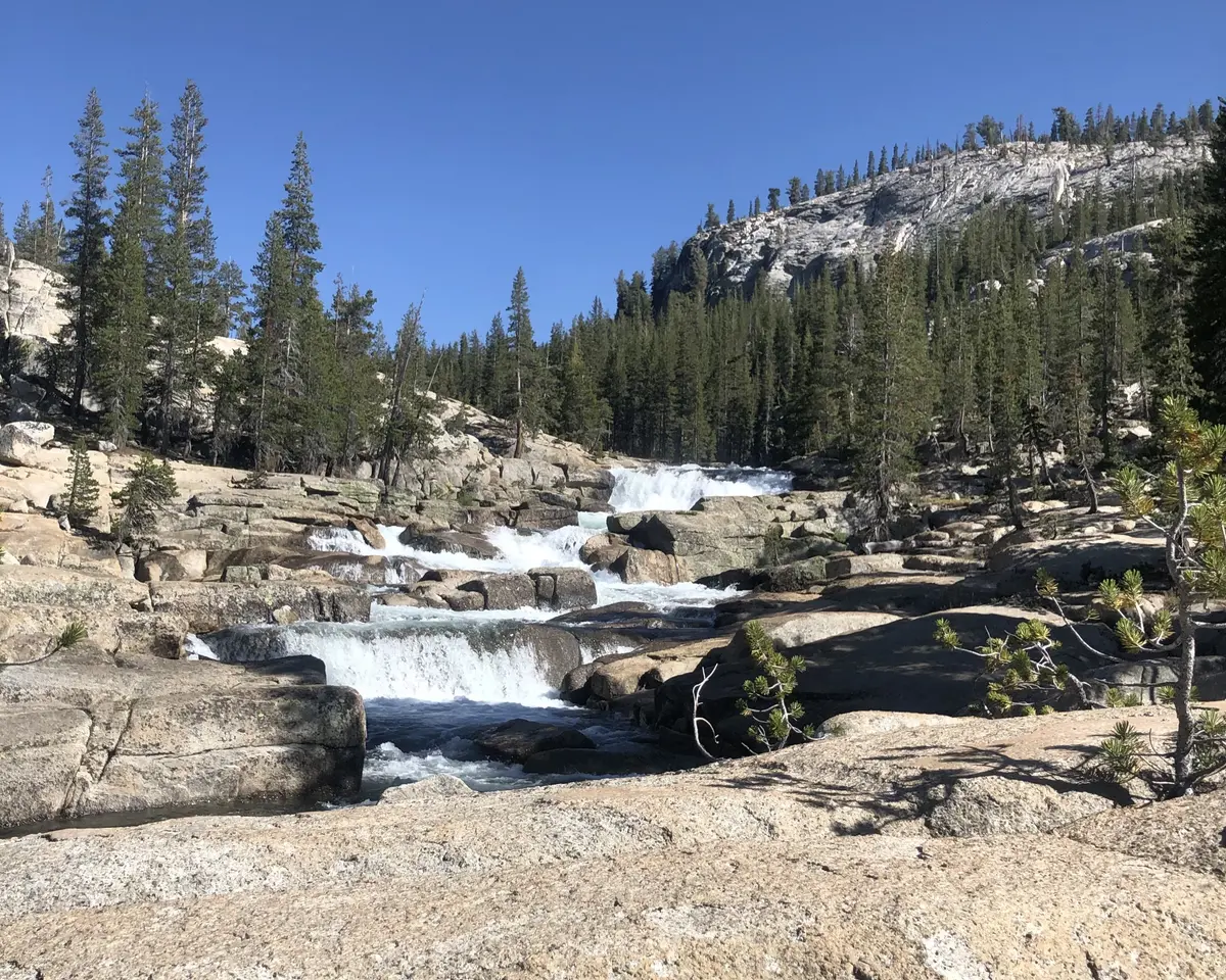
Glen Aulin sits at the head of a granite gorge where the river has carved a series of pools and cascades. The name means "valley beautiful" in Scottish Gaelic, which gives you the general idea. It's also a High Sierra Camp, so expect to see backpackers and the occasional flush toilet alongside the wilderness experience.
What to Expect
The trail starts flat through Tuolumne Meadows at 8,600 feet, following either from the central trailhead near the visitor center (with a scenic river bridge crossing) or from the Lembert Dome parking area just off Tioga Road. The first stretch passes Soda Springs, where carbonated water bubbles up through the granite — a 19th-century tourist attraction that still draws crowds.
After the meadows, the trail enters mixed forest and granite terrain. Tuolumne Fall and White Cascade appear at the four-mile mark, with Glen Aulin itself another mile and a half beyond. The final mile includes a moderately strenuous descent of 450 feet as the trail drops toward the camp and the main collection of falls and pools.
Stream crossings are part of the experience here. Early season means high, cold, swift water that can make unbridged crossings genuinely dangerous. The NPS recommends turning back if crossings look unsafe, which is sound advice when dealing with snowmelt-charged granite streams.
Tips & Logistics
Tioga Road access is the critical constraint. The road typically opens in late May or early June and closes with the first significant snow in October or November, making this a summer-and-fall-only proposition. Overnight parking on Tioga Road ends October 15 regardless of snow conditions.
Day hikers need only the park entrance fee. Overnight stays require wilderness permits, which book up to 24 weeks in advance and disappear quickly. Bears are common in this area and tend to hang around Tuolumne Meadows, so standard Sierra food storage applies.
The trail connects to longer routes heading deeper into the Tuolumne drainage — you can extend this to an 8.2-mile one-way trek to Waterwheel Falls if you're feeling ambitious. It's also part of the Pacific Crest Trail system, so expect to encounter long-distance hikers along with day users.
Parking fills early at both trailheads during peak season. The Lembert Dome lot is generally easier to access, while the central trailhead offers roadside parking near the visitor center if the main areas are full.
For current road conditions and closure information, the park service runs a phone line at 209/372-0200 (press 1, then 1). Worth checking before making the drive up from the Valley, especially in shoulder seasons when Tioga Road status can change quickly.