The Gaylor Lakes Trail delivers high-country payoff with minimal commitment. Starting at nearly 10,000 feet beside Tioga Pass, this 2.6-mile round-trip hike drops into a granite bowl holding Middle Gaylor Lake, with an optional extension to Upper Gaylor Lake for those wanting more alpine scenery.
Trail Details
- 🏃Activities
- Hiking
- 📊Difficulty
- Moderate
- 🔁Trail Type
- out and back
- 📏Distance
- 2.6 miles
- ⬆️Elevation Gain
- 500 ft
- 📍Location
- CA
- 🐕Dogs Allowed
- No
- 💵Fee
- Free
Overview
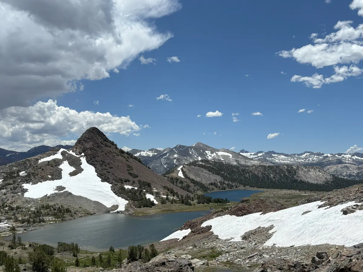
This is high-altitude hiking made accessible. The trail begins at 9,950 feet, which means you're already in the thin air of the Sierra crest before you take your first step. The route follows a brief but steep climb to a ridgeline, then drops 200 feet into the Gaylor Lakes basin — a classic glacial cirque ringed by granite peaks and dotted with scattered whitebark pines.
The payoff comes quickly. At 1.1 miles, you reach Middle Gaylor Lake, a clear alpine tarn that reflects the surrounding granite. For many, this is enough — a satisfying taste of the high country without the commitment of a major Sierra trek. But the trail doesn't end here. Continue another mile round-trip to Upper Gaylor Lake for a slightly more remote feel and additional mountain views.
The terrain is quintessential Sierra Nevada: polished granite slabs, scattered boulders, and that particular high-altitude light that makes everything appear sharper. Weather changes fast at this elevation, so what starts as a calm morning can turn into an afternoon thunderstorm with little warning.
What to Expect
The trail wastes no time getting to business. From the trailhead parking area, you climb steeply for about half a mile to reach the ridge crest at 0.55 miles. This is the workout portion — gain most of your elevation in a short burst, then enjoy the descent into the basin.
Once over the ridge, the character changes completely. You drop into the Gaylor Lakes cirque, where the granite opens up and the lake appears below. The trail to Middle Gaylor Lake is straightforward from here, following obvious paths across the granite and around the shoreline.
If you continue to Upper Gaylor Lake, expect another mile of gentle terrain through the same granite landscape. The upper lake sits in a slightly different basin, offering a change of perspective on the surrounding peaks.
Along the way, keep an eye out for remnants of the Great Sierra Mine, which operated from 1881 to 1884. The ruins add a historical element to what is otherwise a purely natural experience.
Tips & Logistics
Timing matters more here than on most Yosemite trails. Tioga Road typically opens in late May or early June and closes with the first significant snowfall in October or November. Even when the road is open, snow can linger in the basin well into July. Mid-July through late September offers the most reliable conditions.
The trailhead sits right next to the Tioga Pass entrance station, making it one of the most accessible high-country hikes in the park. Parking is limited to about a dozen spots, with overflow parking about a tenth of a mile south on Tioga Road. Vault toilets and food storage lockers are available at the trailhead.
The altitude hits some people harder than others. Starting at nearly 10,000 feet means you're already in thin air, and even a moderate hike can feel more challenging than expected. Take breaks, drink water, and don't push if you're feeling the effects of altitude.
No overnight camping is allowed in the Gaylor Lakes area — this is day hiking only. Water is available at the lakes, but treat it before drinking. Weather can change quickly at this elevation, so bring layers even on warm days. Afternoon thunderstorms are common in summer, making early starts the smart play.