The Four Mile Trail connects Yosemite Valley to Glacier Point via 4.8 miles of relentless switchbacks, gaining 3,400 feet along the way. Despite the name promising four miles, you'll earn every step of those extra 0.8 miles — plus the full round trip back down. This is the classic Valley-to-rim grunt, trading sweat for some of the most comprehensive views in the park.
Trail Details
- 🏃Activities
- Hiking
- 📊Difficulty
- Hard
- 🔁Trail Type
- out and back
- 📏Distance
- 9.6 miles
- ⬆️Elevation Gain
- 3,200 ft
- 📍Location
- CA
- 🐕Dogs Allowed
- No
- 💵Fee
- Free
Overview
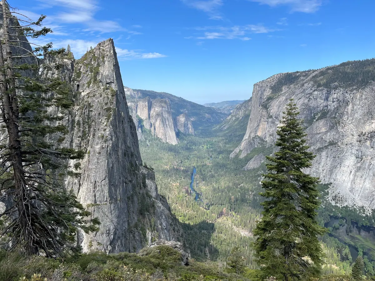
This trail does one thing exceptionally well: it gets you from the Valley floor to Glacier Point under your own power. The route climbs the south wall through a series of long switchbacks, emerging at one of Yosemite's most famous viewpoints. Unlike the drive up Glacier Point Road, you'll have earned the perspective — Half Dome, the Valley's full granite amphitheater, and the High Sierra spreading east.
The character here is steady uphill work through mixed forest, with the payoff coming in increments. Early sections offer glimpses through the trees; higher up, the exposure increases and the views open. By the final approach to Glacier Point, you're walking along clifftops with the entire Valley spread 3,200 feet below.
What to Expect
The trail wastes no time getting steep. From the trailhead on Southside Drive, switchbacks begin immediately and maintain a consistent grade for the duration. The first mile climbs through oak and pine, with occasional openings that frame Yosemite Falls across the Valley.
Around the three-mile mark, a short spur leads to Union Point — worth the few extra minutes for a preview of what's coming. The views here take in El Capitan, Cathedral Rocks, and the full sweep of the Valley, but Glacier Point still offers the superior perspective.
The final stretch to Glacier Point traverses more exposed terrain with expansive views of Half Dome, Tenaya Canyon, and the Clark Range. The trail terminates at the developed Glacier Point area, complete with restrooms, railings, and crowds — a jarring transition from the relative solitude of the climb.
Coming down presents its own challenges. The sustained descent puts significant stress on knees and ankles, and the switchbacks that seemed endless going up feel even longer on the return. Trekking poles earn their keep on this section.
Tips & Logistics
The trail typically opens in late May and closes with the first significant snow, usually November or December. Spring opening depends on snowpack and can extend into June in heavy snow years. Check current conditions before heading out — winter closures are absolute.
Start early. This is a full-day commitment for most hikers, and afternoon thunderstorms are common in summer. The 6+ hour average assumes reasonable fitness; plan accordingly if you're not a regular hiker.
Water is critical. There are no reliable sources along the route, so carry what you need for the entire trip. Three liters minimum in summer heat, more if you're a heavy sweater or slow climber. The snack stand at Glacier Point operates summer only and shouldn't be counted on.
The trailhead is accessible via the free Valley shuttle (stop 11), which runs roughly every 20-30 minutes during operating hours. There's no shuttle service back from Glacier Point, so this is strictly an out-and-back hike unless you've arranged pickup or are comfortable hitchhiking down Glacier Point Road.
Dogs aren't permitted, and bear spray is prohibited in Yosemite. Standard Sierra precautions apply: check weather, inform someone of your plans, and be prepared for afternoon thunderstorms in summer.
The trail sees heavy use during peak season, but the sustained climb tends to spread people out naturally. Weekdays and early starts offer the best chance for relative solitude, at least until you reach Glacier Point's crowds.