The Fortynine Palms Oasis sits in the overlooked northern reaches of Joshua Tree, accessible via its own entrance road rather than the park's main gates. This 3-mile round trip climbs through classic Mojave Desert terrain to one of the region's few year-round water sources — a green pocket of California fan palms that bighorn sheep depend on for survival.
Trail Details
- 🏃Activities
- Hiking
- 📊Difficulty
- Hard
- 🔁Trail Type
- out and back
- 📏Distance
- 3 miles
- ⬆️Elevation Gain
- 300 ft
- ⬇️Elevation Loss
- 300 ft
- 🪨Surface
- dirt, sand, and rock
- 🌤️Best Seasons
- december, january, february, march, april, may, september, october, november
- 📍Location
- CA
- 🐕Dogs Allowed
- No
- 💵Fee
- Free
Overview
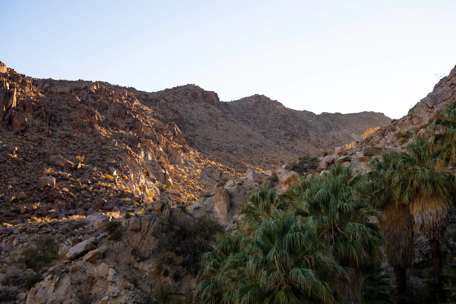
The trail to Fortynine Palms follows an old mining route, threading between weathered granite outcrops and desert washes to reach a hidden oasis fed by underground springs. Unlike Joshua Tree's more famous short walks, this hike demands some effort — the path climbs over steep ridges with loose rock steps, then drops into a canyon where palm fronds mark the presence of water in an otherwise waterless landscape.
What sets this trail apart is its isolation from the park's main visitor flow. The separate access road off Highway 62 means you're not competing with the crowds heading to Skull Rock or Cholla Cactus Garden. The oasis itself has been shaped by more than a century of human history — miners originally planted some of these palms as markers for the water source, though the spring itself is ancient, formed along fault lines that channel groundwater to the surface.
What to Expect
The trailhead sits at the end of Canyon Road with basic facilities — a primitive toilet and a posted thermometer that serves as your heat warning system. The path immediately begins working upward through mixed desert terrain of dirt, sand, and scattered rock. Expect loose footing on the steeper sections where informal rock steps help with the ascent.
The high point comes at about 0.8 miles, offering views back toward the Twentynine Palms area before the trail descends toward the oasis. The final approach follows a wash into the canyon where the palms become visible — a startling patch of green in the beige and gray desert palette. The oasis sits 1.5 miles from the trailhead, fed by springs that create the only reliable surface water for miles in any direction.
Wildlife signs are common along the route, particularly bighorn sheep tracks and scat. These animals depend entirely on the oasis during dry periods, which explains the strict prohibition against entering the water source area itself. The trail ends at a viewing area where you can observe the palms and listen for the sound of running water without disturbing the ecosystem.
Tips & Logistics
The trail operates on seasonal restrictions tied directly to wildlife needs. It's open fall through spring but closes during summer months when bighorn sheep require undisturbed access to the water source. Even when open, summer hiking here is discouraged — there's no shade anywhere on the route and temperatures regularly exceed 100°F.
October through May offers the best hiking window, with winter months providing the most comfortable conditions. If you do venture out during shoulder season heat, the 9 AM cutoff mentioned in park guidelines isn't arbitrary — temperatures climb fast once the sun gains strength.
Water is critical since you won't find any along the route (the oasis is off-limits). Plan for more than you think you'll need, especially during warmer months. Cell service is spotty to nonexistent, so download offline maps before heading out.
The trailhead requires displaying either a current parks pass or park entry receipt on your dashboard, though this access road doesn't require paying the main park entrance fee if you're only visiting the oasis. Pets aren't allowed on the trail, reflecting the sensitive nature of the wildlife habitat you're hiking through.