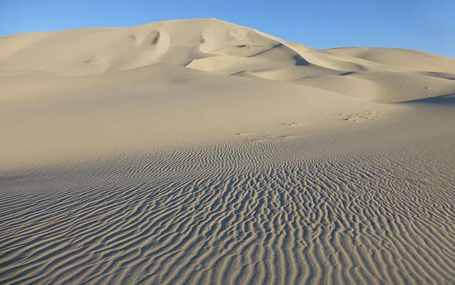
The Eureka Dunes rise 680 feet from the floor of Eureka Valley — the tallest sand dunes in California and an ecological island where endemic beetles and rare plants exist nowhere else on earth. This isn't a hike in any traditional sense, but rather a sand slog to the top of a natural landmark that took millennia to build and minutes for off-road vehicles to scar permanently.
Trail Details
- 🏃Activities
- Hiking
- 📊Difficulty
- Moderate
- 🔁Trail Type
- out and back
- 📏Distance
- 3 miles
- ⬆️Elevation Gain
- 700 ft
- 📍Location
- CA
- 🐕Dogs Allowed
- No
- 💵Fee
- Free
Overview
Eureka Valley sits at 3,000 feet elevation, a remote basin northwest of Death Valley proper where the Last Chance Mountains rise 4,000 feet above the valley floor. The dunes occupy just 3 miles by 1 mile of this enclosed space, but they're an anomaly in the desert Southwest — tall enough to generate their own weather patterns, wet enough to support species found nowhere else.
There's no trail, just the path of least resistance up loose sand that gives way with every step. The ascent gains about 620-700 feet over roughly a mile and a half of trudging, with each step forward costing you half a step back. The payoff is a ridge walk along sand that shifts and reshapes with every wind, plus views across Eureka Valley to peaks that most Death Valley visitors never see.
What to Expect
The approach follows whatever route looks most climbable from the primitive campground. Sand conditions vary dramatically — sometimes firm enough for decent purchase, sometimes so loose you're swimming uphill. Early morning offers the best sand stability before the sun turns the surface into an oven.
The dunes receive more precipitation than most Death Valley locations because they sit at the western base of mountains that capture passing storms. This extra moisture supports Eureka dunegrass, Eureka Dunes Evening Primrose, and Shining Milkvetch — three plant species that exist only on these dunes. Five species of endemic beetles live here too, invisible but critical parts of an ecosystem that took thousands of years to develop.
From the highest accessible ridges, Eureka Valley stretches out below like a cupped hand holding sand. The isolation is complete — no cell service, no other hikers on most days, just wind patterns that have been sculpting this landscape since the Pleistocene.
Tips & Logistics
Getting here requires commitment. From Stovepipe Wells, it's 86 miles total with the final 42 miles on graded dirt and sand roads that demand high-clearance four-wheel drive. The route from Grapevine is similar distance but different character — 2.7 miles north on Ubehebe Crater Road, then 43 miles on graded dirt.
October through May is the only reasonable window. Summer temperatures hit 120°F with no shade and no margin for error. Even in cooler months, bring multiple days of water and food in case your vehicle breaks down or gets stuck. There's no cell service and no one coming to find you quickly.
Seven primitive campsites offer concrete picnic tables, fire rings, and a pit toilet. This is one of the few Death Valley backcountry experiences where car camping makes sense — the drive is half the adventure, and sunrise on the dunes justifies the effort of getting here.
Sandboarding is prohibited, and for good reason. Recent off-road vehicle incidents damaged rare plant communities that can't recover on human timescales. Stay off the dunes with anything mechanical, including mountain bikes. This is fragile habitat masquerading as playground equipment.
The standard park entrance fee applies, but given the drive time and fuel costs, the $30 vehicle fee is the least of your expenses. Bring everything you need from civilization — the nearest services are hours away on roads that can wash out without warning.