The California Riding and Hiking Trail cuts a 37.5-mile line across the entire width of Joshua Tree National Park, delivering the desert's full spectrum in a single multi-day trek. This is Joshua Tree's only true long-distance route — a point-to-point journey from the Mojave's Joshua tree forests down to the spare Colorado Desert flats, with no water along the way and navigation that actually requires paying attention.
Overview
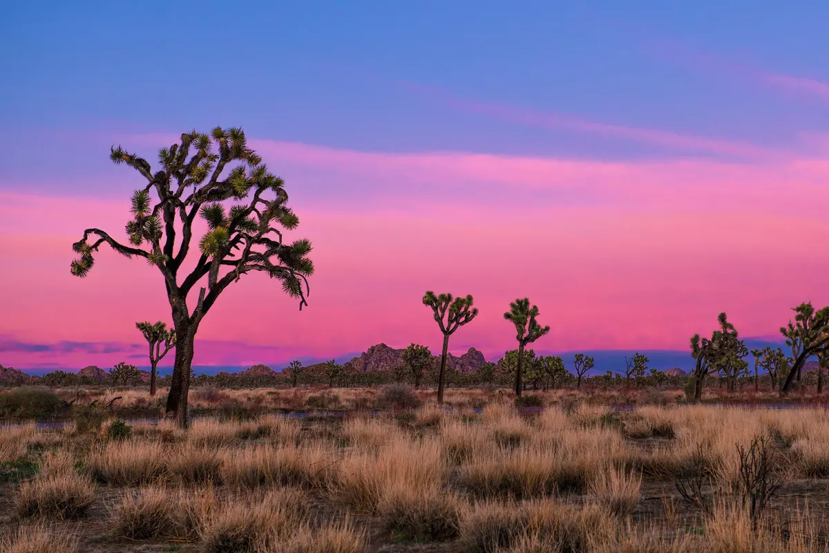
The CRHT runs lengthwise across Joshua Tree, typically hiked west to east from Black Rock Campground to the North Entrance Backcountry Lot. You'll start among the park's signature Joshua trees and granite boulder piles, climb over Quail Mountain — the park's 5,816-foot high point — then descend into increasingly sparse desert as you head toward Twentynine Palms.
The trail is well-marked with signs and mile markers, but don't mistake good signage for an easy walk. This is desert backpacking at its most fundamental: carry all your water, navigate open terrain, and respect the fact that there's no bailout once you're committed. Most hikers complete it in 3½ days, though 4-5 days makes more sense if you're not racing.
What to Expect
The elevation profile tells the story. Westbound hikers face the biggest climb early — gaining over 3,000 feet before reaching Quail Mountain — then ride a series of ups and downs before the long descent to the eastern terminus. The reverse direction spreads the climbing out more evenly but still involves significant elevation change.
Navigation stays straightforward on the marked trail, but the terrain shifts dramatically as you cross ecological zones. The western sections wind through classic Joshua Tree country — those famous twisted trees scattered among house-sized granite boulders. Past Juniper Flats, roughly 10 miles from the 8-mile marker, the landscape opens up and the Joshua trees thin out, replaced by the starker beauty of creosote and desert scrub.
The trail crosses several roads, which becomes important for water logistics. These road crossings are your only opportunity to cache supplies, since the trail itself offers no water sources. Plan accordingly.
Tips & Logistics
Water dominates every decision. Joshua Tree's standard recommendation of one gallon per person per day isn't a suggestion — it's survival math. In cooler months, 3 liters might suffice; when temperatures climb, bump it to 5 liters. That's potentially 40 pounds of water alone for a multi-day trip. Smart hikers cache water at road crossings to avoid carrying the full load.
Permits are required and obtained through recreation.gov or at the headquarters in Twentynine Palms. No quotas apply, but get them sorted before you arrive.
The shuttle logistics are straightforward but non-negotiable. Most people leave a car at the North Entrance and arrange taxi or rideshare service to Black Rock Campground for the start. The alternative — hiking it as an out-and-back — defeats the point of a traverse.
Timing matters. Late fall through spring offers the best conditions. Summer turns the exposed sections into a furnace, with temperatures exceeding 120°F. Winter can be surprisingly cold at elevation, especially around Quail Mountain. Plan hiking for early morning and late afternoon, avoiding midday sun.
This isn't a beginner's desert introduction, but experienced backpackers will find the CRHT a genuine taste of Joshua Tree's backcountry without the navigation complexity of true cross-country routes. Just remember: the desert doesn't negotiate on water.