The descent from Emerald Ridge to Redwood Creek drops you 580 feet through some of the darkest, densest old-growth forest in the park system. This isn't a casual afternoon walk — the trail is steep, the creek crossings are real, and you'll need a backcountry permit just for the privilege of hiking down to the water and back up.
Trail Details
- 🏃Activities
- Hiking
- 🔁Trail Type
- point to point
- 📏Distance
- 1.5 miles
- ⬇️Elevation Loss
- 580 ft
- 🪨Surface
- loose dirt and gravel
- 📍Location
- CA
- 🐕Dogs Allowed
- No
- 💵Fee
- Free
Overview
Starting from the Tall Trees Trailhead, you'll walk a quarter-mile before veering south onto the actual Emerald Ridge Trail. The forest closes in immediately — dense canopy of ancient redwoods mixed with rhododendrons, tanoaks, huckleberry, and ferns carpeting the understory. This is what people mean when they talk about cathedral light filtering through the trees, though the effect here leans more toward perpetual dusk than stained glass.
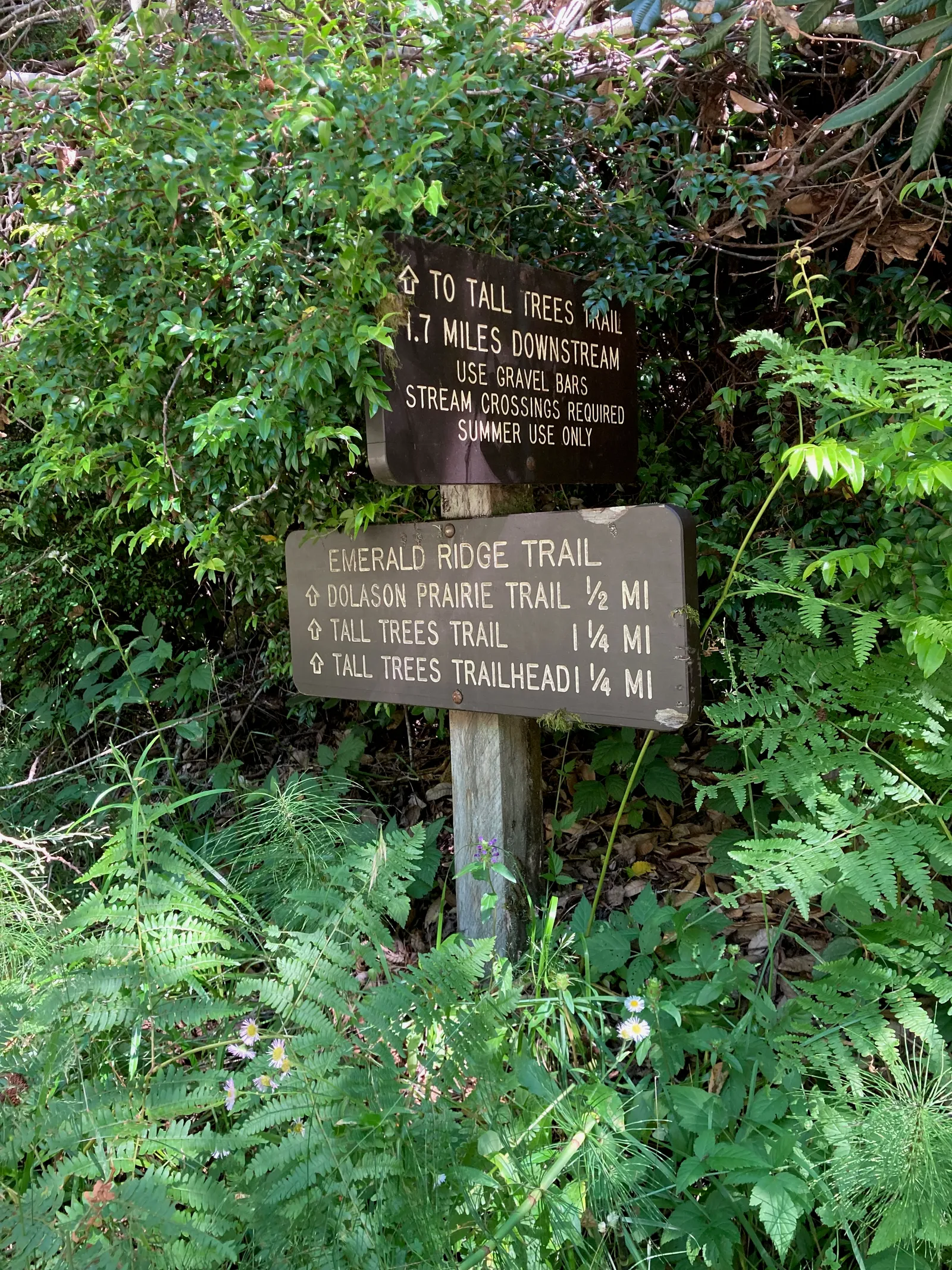
The trail wastes no time with gentle switchbacks. It drops abruptly through loose dirt and gravel, the kind of surface that keeps you honest on the descent and makes you work on the way back up. At 0.9 miles, you'll hit the junction with Dolason Prairie Trail — a useful landmark for navigation since specific waypoints down here aren't always obvious.
Creek Crossings
Redwood Creek is the real commitment. Depending on season and recent weather, you might cross the water up to six times, with depths ranging from ankle-deep to knee-deep. The water runs cold and fast even in summer, and your boots will take days to dry afterward. This is strictly a late spring through summer proposition — attempting creek crossings during high water season is asking for trouble.
Orange ribbons tied to trees mark key exit points, including the Tom McDonald Creek junction, though these markers fade over time. The creek itself meanders through gravel bars where dispersed backcountry camping is allowed with proper permits, minimum quarter-mile from any grove.
Tips & Logistics
You need a free backcountry day pass from any visitor center, which comes with the gate combination for Bald Hills Road access. The Tall Trees Trailhead parking holds about six cars, so early starts help. No RVs or trailers — the road won't accommodate them.
Bring a map and don't rely on phone navigation. Cell coverage is essentially nonexistent once you drop into the creek drainage. The loose surface and steep grade make trekking poles useful, especially for the climb back out.
If you're planning to make this part of a longer loop, the complete circuit via Dolason Prairie Trail runs 5.5 miles with moderate difficulty. The park service recommends hiking clockwise, starting with the Emerald Ridge descent. Given the creek crossings and the ankle-punishing ascent back to the ridge, that routing makes sense — get the technical water crossings done while your feet are still dry and your energy is high.
The forest down here is genuinely old and genuinely quiet in a way that's increasingly rare. No crowds, no interpretive signs, just you and trees that were here centuries before the park existed. That solitude comes with responsibility — stay on developed trails, pack out everything you bring in, and check with rangers about current conditions before heading down.