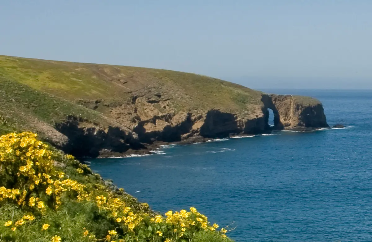
East Point Trail stretches 14.6 miles across Santa Rosa Island's windswept interior to the island's easternmost tip, making it the longest walk in Channel Islands National Park. This is backcountry hiking stripped to its essence: no shade, no reliable water beyond Clapp Spring, and constant exposure to Pacific winds that can hit with surprising force.
Trail Details
- 🏃Activities
- Hiking
- 📊Difficulty
- Hard
- 🔁Trail Type
- out and back
- 📏Distance
- 16 miles
- 📍Location
- CA
- 🐕Dogs Allowed
- No
- 💵Fee
- Free
Overview
The numbers tell part of the story — 12 miles round-trip to East Point proper, with the Ford Point extension pushing the total to nearly 20 miles and over 3,000 feet of elevation gain. But the real character of this trail comes from what's missing: trees (except for those rare Torrey pines), streams, and any shelter from the elements that define Santa Rosa Island.
This is high-commitment hiking where the ferry schedule dictates everything. Miss the boat back to Ventura, and you're spending an unplanned night on the island. The trail rewards careful planning and punishes overconfidence, but delivers an experience unavailable anywhere on the California mainland.
What to Expect
The route follows roads and trails across the island's rolling grasslands and coastal terraces. Past the Torrey Pine grove — one of only two native populations of these trees in the world — the trail continues another 4 miles to East Point itself. Here, brackish marshes meet sandy beaches, and the tidepools reveal marine life shaped by thousands of years of isolation.
The eastern tip hosts a botanical rarity: munchkin dudleya, a succulent that exists nowhere else on earth. The Park Service has fenced the three small colonies (roughly 3,200 plants total) to protect them from non-native herbivores, a reminder that every step here is through habitat that took millennia to develop.
Wind defines the experience. Santa Rosa sits fully exposed in the Santa Barbara Channel, and sustained winds of 20-30 mph are normal, with gusts that can knock you off balance. The island's position also means weather can change quickly — clear mornings can turn to fog-shrouded afternoons with little warning.
Tips & Logistics
Water strategy is critical. Clapp Spring, located just off Sierra Pablo Road, is the only reliable source beyond the developed areas near the ranger station. Carry more than you think you need — the combination of wind, sun, and no shade creates conditions that sap water faster than typical mainland hikes.
Seasonal restrictions matter for route planning. From March 1 through September 15, the back beaches and dunes north of East Point are closed for seabird breeding. This doesn't affect the main trail to East Point, but limits exploration options at the destination.
The ferry schedule from Ventura Harbor governs everything. Island Packers doesn't run trips every day, and weather can cancel crossings with little notice. Build buffer time into your trip planning, and confirm departure times well before heading to the harbor.
Gear considerations are different from mainland hiking. Expect no shade for the entire route, so sun protection is mandatory. Wind protection is equally important — lightweight shells that handle steady wind without overheating are better than heavy jackets. Trekking poles help with stability in gusting conditions.
Pack out all trash. There are no waste facilities beyond the developed areas, and biosecurity rules mean nothing leaves the island except what you brought with you. This includes organic waste like apple cores and banana peels.
The remoteness that makes East Point special also means self-sufficiency is non-negotiable. Cell service is nonexistent, rescue logistics are complex, and your margin for error is smaller than on mainland trails. Come prepared, or don't come at all.