This 10-mile descent from the Bald Hills meadows to the heart of the ancient redwood groves is the park's most direct route from prairie to primeval forest. You'll drop 2,500 feet through ecological zones that shift from open grassland to second-growth timber to cathedral-quiet old growth, passing a 19th-century barn that marks how recently this landscape was ranched rather than protected.
Trail Details
- 🏃Activities
- Hiking
- 🔁Trail Type
- out and back
- 📏Distance
- 10 miles
- ⬇️Elevation Loss
- 2,500 ft
- 📍Location
- CA
- 🐕Dogs Allowed
- No
- 💵Fee
- Free
Overview
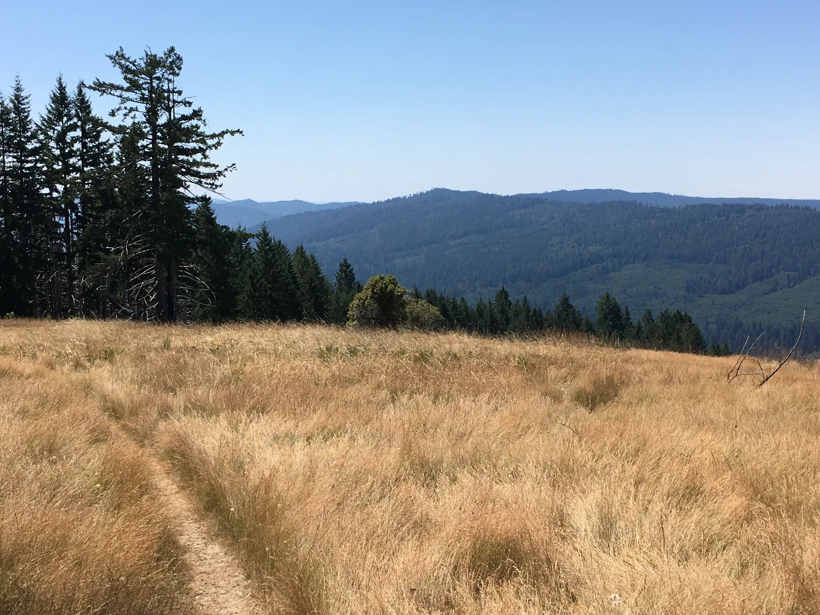
The trail starts above the fog line at 2,420 feet, where the Bald Hills spread out in golden grassland that feels more like Montana than coastal California. From the Dolason parking area, you're looking down into a drainage that holds some of the park's most remote old-growth stands — trees you can't reach any other way without a multi-day backpack on Redwood Creek.
The route is straightforward but not casual. You'll spend the first few miles on open slopes with distant ocean views, then switchback into increasingly dense forest as you lose elevation. By the time you reach the bottom, you're walking among redwoods that were mature when the barn you passed was still housing cattle. The turnaround point connects with the Tall Trees Trail, giving you access to some of the park's most significant groves before the steep climb back out.
What to Expect
The descent starts easy through prairie country, where the historic barn serves as the first major landmark. The structure is a reminder that this entire drainage was private ranch land until the 1960s — the National Park Service is still managing the transition from pasture back to forest in some areas.
As you drop elevation, the trail enters second-growth redwood stands before reaching old-growth forest near the bottom. The switchbacks get steeper as you descend, and the return climb is genuinely strenuous — plan your turnaround time accordingly. The trail surface is generally well-maintained, but expect muddy conditions in winter and early spring.
At the bottom, you'll hit the connection with Tall Trees Trail, which accesses some of the park's champion trees. This junction marks your turnaround point unless you're planning a longer route that connects to Redwood Creek Trail — though that adds significant mileage and complexity.
Tips & Logistics
The trailhead sits 11.2 miles up Bald Hills Road from Highway 101. From Orick, drive north 1.1 miles past the Redwood Creek bridge, then turn onto Bald Hills Road. The parking area includes restrooms and picnic tables — use them, because this is your last infrastructure until you return.
Bring all your water. There are no reliable sources along the route, and the 5-6 hour round trip in open country means you'll need more than usual. The NPS specifically warns against relying on online maps for navigation here, so carry a proper park trail map. Cell coverage is nonexistent once you drop below the ridgeline.
The trail is open year-round, but spring through fall offers the best conditions. Winter hiking means muddy trails and limited daylight for the return climb. Start early regardless of season — you don't want to be grinding uphill in the afternoon heat, and the prairie section offers no shade.
Dogs aren't allowed, and you're required to stay on the developed trail to protect habitat. The park notes that this route travels deep into backcountry bear habitat, so standard wildlife precautions apply. The trailhead's elevation puts you above the marine layer that often shrouds the coast, making this one of the park's better spots for clear views and night sky observation if you're camping in the area.