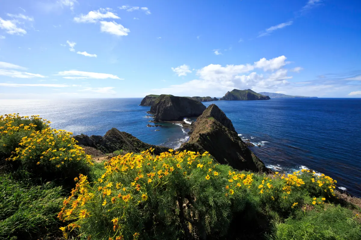
The Del Norte Trail reaches an overlook 700 feet above the northeast coast of Santa Cruz Island, offering one of the more accessible viewpoints from Prisoners Harbor. It's a 3-mile round-trip that combines a walk up the island's historic Navy Road with a short trail section to a coastal vista — a solid choice for day hikers who want island views without committing to the longer backcountry routes.
Trail Details
- 🏃Activities
- Hiking
- 📊Difficulty
- Moderate
- 🔁Trail Type
- out and back
- 📏Distance
- 3 miles
- 📍Location
- CA
- 🐕Dogs Allowed
- No
- 💵Fee
- Free
Overview
This hike splits into two distinct sections. The first mile and a half follows Navy Road, a gravel route that climbs 600 feet from Prisoners Harbor through canyon and ridge country. The road still sees daily vehicle traffic from island operations, so you'll share the route with trucks and maintenance crews. At the Del Norte Trail junction, you leave the road for a quarter-mile trail that leads to the overlook itself.
The character here is quintessential Santa Cruz Island — rolling hills covered in coastal scrub, with the kind of big-sky openness that comes from being surrounded by ocean. The Navy Road section feels workmanlike rather than wilderness-like, but that's the trade-off for getting elevation without technical trail building. The final trail section to the overlook has more of a backcountry feel.
What to Expect
The Navy Road climbs steadily but not brutally from sea level to about 600 feet. The NPS rates this section as strenuous, which reflects the sustained uphill grade rather than technical difficulty. The surface is graded gravel, so footing is straightforward.
At the one-mile mark, look for the Del Norte Trail junction where you branch off the road. The final quarter-mile to the overlook drops you onto single-track trail that feels more remote than the road approach. The overlook itself sits at about 700 feet above sea level and provides views of the northeast coast — the island's more sheltered side, away from the prevailing northwest winds.
Tips & Logistics
Water is critical. There's no reliable water source along this route, and the elevation gain combined with often-windy conditions can dehydrate you faster than expected. Carry more than you think you need.
Winter and spring hikers face a potential creek crossing at Canada del Puerto right in Prisoners Harbor. The crossing can involve fast-moving water up to two feet deep, so waterproof boots or a willingness to get wet feet become part of the equation during these seasons.
The gravel road sees regular vehicle traffic, so stay alert and step aside when you hear engines. Island operations don't stop for hikers.
Since you're dependent on the Island Packers ferry schedule, build buffer time into your plans. The boats don't wait, and missing your return crossing means an unplanned overnight on the island. Check the ferry departure times before you start hiking and work backward from there.
This overlook works well as part of a longer day on Santa Cruz Island if you're taking a later ferry back to Ventura. It's substantial enough to feel like a real hike but won't consume your entire island time if you want to explore Scorpion Anchorage or other areas accessible from Prisoners Harbor.
The northeast coast views are different from what most visitors see at Scorpion Anchorage on the island's south side. This overlook faces the more protected waters of the Santa Barbara Channel, where you might spot marine mammals or seabirds working the kelp forests below.