Darwin Falls offers Death Valley's rarest commodity: water that flows year-round. The 18-foot cascade tucked into a narrow canyon represents one of only a handful of permanent waterfalls in the park. What makes this hike notable isn't the destination alone—it's the transition from open desert wash to slot canyon oasis, compressed into a short but rewarding walk.
Trail Details
- 🏃Activities
- Hiking
- 📊Difficulty
- Moderate
- 🔁Trail Type
- out and back
- 📏Distance
- 7 miles
- ⬆️Elevation Gain
- 450 ft
- 📍Location
- CA
- 🐕Dogs Allowed
- No
- 💵Fee
- Free
Overview
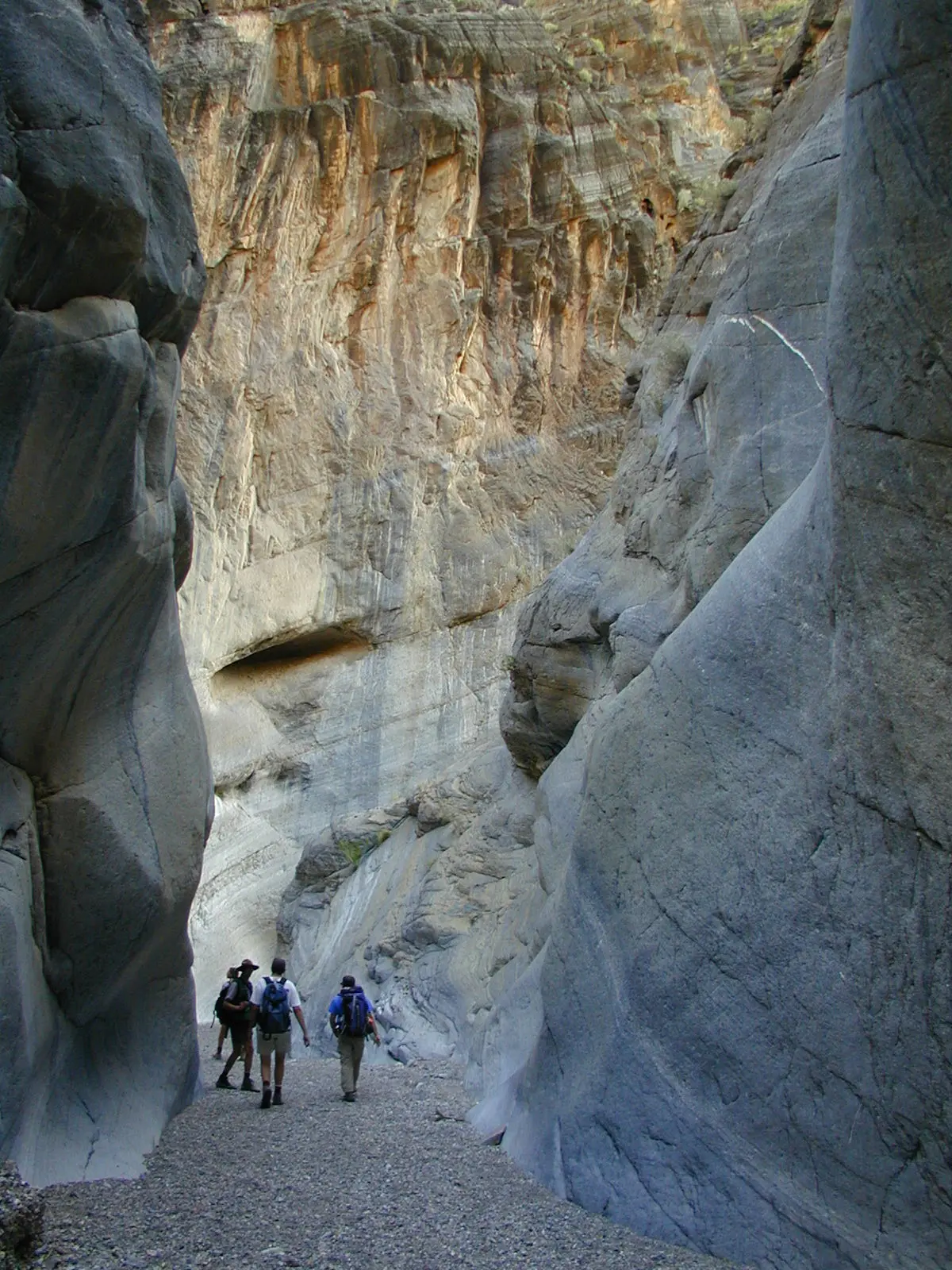
The character of this trail shifts dramatically as you progress. You'll start in a wide, gravelly wash with zero shade and the familiar Death Valley vastness stretching in all directions. Within half a mile, the canyon walls begin to close in, vegetation appears, and you're suddenly navigating stream crossings and scrambling over slick rocks in what feels like a different ecosystem entirely.
This isn't a maintained trail. There are no blazes, no signs, no obvious path beyond following the canyon bottom. Navigation is straightforward—stick to the wash—but the terrain demands attention as you move from easy walking to careful rock hopping.
Current Access Reality
Darwin Falls Road was destroyed by flooding in 2023, adding 2.5 miles each way to what was previously a 2-mile round trip. You'll now park on the shoulder of Highway 190 and walk up the wash to reach the former trailhead. This means the total distance is 7 miles with 450 feet of elevation gain, not the shorter version you'll see in older guidebooks.
The park plans major repairs over the next 12-18 months, but until then, factor the road walk into your time and energy budget. The extra distance transforms this from a quick jaunt into a moderate half-day commitment.
What to Expect
The first portion follows a wide desert wash with loose gravel underfoot. No elevation gain here, just steady forward progress with the Panamint Range rising ahead. This section offers no shade, so early starts matter.
As the canyon narrows, the terrain becomes more complex. Thick vegetation crowds the route, requiring some bushwhacking. Stream crossings become frequent—actual flowing water, a surreal experience in Death Valley context. Large, slick rocks create obstacles that require careful foot placement and occasional use of hands for balance.
The falls themselves are divided into upper and lower sections with a combined height around 80 feet. The main 18-foot drop is what most visitors photograph. The water is spring-fed and crystal clear, creating pools that look inviting but are off-limits—this water supplies Panamint Springs Resort.
Tips & Logistics
Start early. The no-shade desert wash portion becomes brutal after 10 AM in warmer months. Winter and spring offer the best conditions, with moderate temperatures and potentially higher water flow.
Park on the Highway 190 shoulder as close to the wash entrance as safely possible. No facilities exist at the access point; the nearest restrooms are at Panamint Springs Resort, about a mile east.
Bring more water than the distance suggests—the road walk and canyon scrambling create more exertion than the mileage implies. Sturdy shoes with good grip are essential for the slick rock sections near the falls.
The route is unmarked but navigation is simple: follow the wash upstream. When in doubt, stay in the canyon bottom. Respect the "hike only where previous route exists" guidance to protect this fragile riparian zone.
This trail works well as a winter alternative when higher elevation hikes are snowed out. The permanent water and sheltered canyon create a microclimate that remains comfortable when the broader Death Valley experience becomes punishing.