The Cottonwood-Marble Canyon Loop strings together three separate canyon systems into Death Valley's premier backcountry circuit. This 26-mile route through roadless desert terrain demands solid navigation skills and self-sufficiency, but rewards with marble narrows, seasonal springs, and the kind of solitude that comes from traveling where few others venture.
Trail Details
- 🏃Activities
- Hiking
- 📊Difficulty
- Expert
- 🔁Trail Type
- loop
- 📏Distance
- 26 miles
- ⬆️Elevation Gain
- 3,900 ft
- 📍Location
- CA
- 🐕Dogs Allowed
- No
- 💵Fee
- Free
- 📋Permit Required
- Yes
Overview
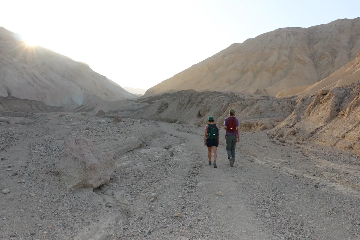
This isn't a trail in any conventional sense. The route follows dirt roads, washes, and canyon bottoms through terrain that sees maybe a few dozen backpackers each year. You'll navigate by GPS and topo map, ford sandy washes, and scramble past chokestones in narrow marble corridors. The experience feels more like exploration than hiking.
The loop connects Cottonwood Canyon, Marble Canyon, and Deadhorse Canyon into a logical circuit. Most people hike it clockwise over two to three nights, starting and ending at the junction of Cottonwood and Marble Canyon roads. The terrain is classic Death Valley backcountry: exposed, rugged, and unforgiving of poor decisions.
What to Expect
From the road junction, the route climbs toward a saddle, then drops northeast into densely vegetated canyon country. Marble Canyon delivers the route's signature feature: narrows with black and white striped walls in zebra-like patterns. The upper narrows, less than a mile from the road intersection, showcase these striped marble walls most dramatically.
The middle narrows, located 2.5 miles down canyon, are the most impressive section of the entire loop. Here you'll encounter the route's main technical obstacle: a chokestone that requires backtracking 300 feet up canyon to find the bypass trail on the eastern wall.
Water availability defines the experience. Three seasonal springs may be flowing, most reliably from December through March. Cottonwood Springs, located in Cottonwood Canyon around mile 11, is considered the most reliable water source along the entire loop. A third spring exists in the Deadhorse Canyon area. Outside of winter and spring months, assume these sources will be dry and carry accordingly.
The route gains 3,882 feet of elevation with a high point at 5,059 feet. The climbing is steady rather than steep, but the desert environment amplifies the effort. Sandy washes, loose rock, and constant sun exposure make this more demanding than the numbers suggest.
Tips & Logistics
Getting to the trailhead requires commitment. The approach road starts with four miles of deep sand that eliminates most standard vehicles, followed by increasingly challenging terrain that demands high-clearance 4WD after mile eight. The final 2.1 miles to the canyon junction feature steep drops into deep washes with gravel and loose boulders.
Currently, Cottonwood Canyon Road remains closed due to flooding, which may affect access and route conditions. Check current road status before committing to the drive.
Permits are required for overnight camping but cost nothing. Pick them up during business hours at Furnace Creek Visitor Center or Stovepipe Wells Ranger Station, get them online, or use the 24-hour self-service drop box outside Stovepipe Wells Ranger Station.
Plan for fall through spring travel. Summer temperatures routinely exceed 100 degrees, making this route dangerous at best. Even in cooler months, carry more water than you think you'll need — the desert has a way of increasing consumption.
Navigation gear is non-negotiable. Few signs exist in the backcountry, and washes can look remarkably similar when you're tired. Bring detailed topographic maps, a GPS device, and consider a satellite communicator for emergencies. Open fires are prohibited, but gas stoves are allowed.
Camp at least 100 feet from any water source, and remember that what looks like solid ground in a wash can become a torrent during flash floods. Check weather conditions not just for your location, but for the surrounding mountains where storms can send water rushing through seemingly dry canyons hours later.