Corkscrew Peak offers a pure Death Valley backcountry experience: no trail, no shade, no forgiveness for poor planning. The 5,784-foot summit sits in the northern reaches of the park, demanding cross-country navigation skills and serious heat management.
Trail Details
- 🏃Activities
- Hiking
- 📊Difficulty
- Hard
- 🔁Trail Type
- out and back
- 📏Distance
- 7.3 miles
- ⬆️Elevation Gain
- 3,080 ft
- 📍Location
- CA
- 🐕Dogs Allowed
- No
- 💵Fee
- Free
Overview
This is Death Valley hiking distilled to its essence. The route follows a wash system for the first two miles before breaking onto open slopes for a punishing final ascent. With over 3,100 feet of elevation gain compressed into 3.5 miles, the grade is relentless, particularly in the final stretch where most of the climbing happens.
The peak doesn't appear on many hiking lists, which means you're likely to have it to yourself. The tradeoff is complete self-reliance. There's no established trail to follow, no water sources to count on, and no shade to escape the desert sun. Navigation happens by GPS, topo map, and terrain reading. The margin for error shrinks as the temperature climbs.
What to Expect
The trailhead sits along Daylight Pass Road, about 20 minutes from Stovepipe Wells. Look for a pulloff on the left with a sign pointing toward the peak. The route starts by following a wash system that gradually narrows as you gain elevation.
Around the two-mile mark, watch for an arrow made of stacked rocks on the left side of the wash. This marks your exit point up a steep but manageable wall. Miss this turn, and you'll find yourself in increasingly difficult terrain with no clear way forward.
Once out of the wash, the character changes completely. The final two miles cover the bulk of the elevation gain across open slopes and scree fields. The terrain becomes looser and steeper as you climb, with the last third of a mile presenting the most technical challenges. Expect rock scrambling and careful foot placement on unstable surfaces.
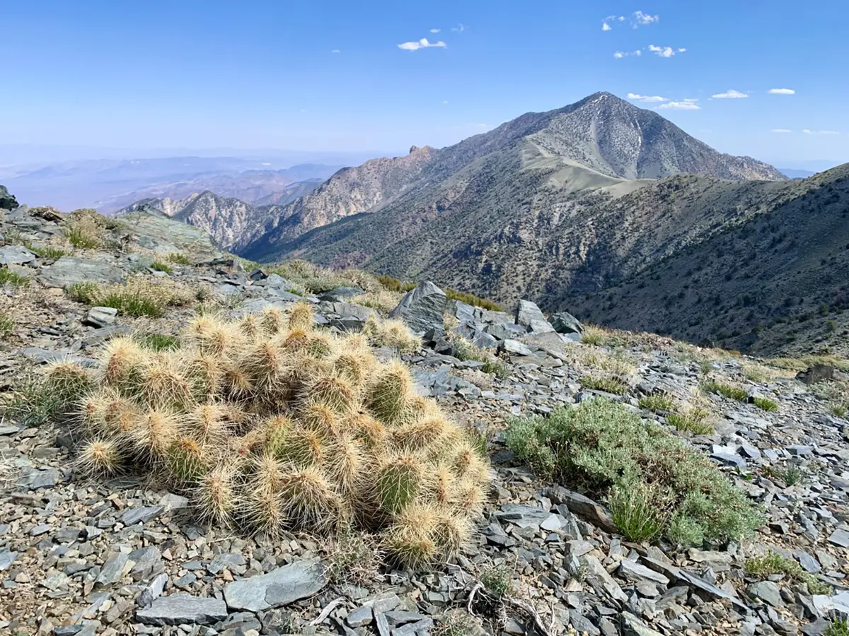
The summit rewards with expansive views across Death Valley's northern reaches, but the real satisfaction comes from completing a route that demands everything the desert can teach about preparation and respect.
Tips & Logistics
Timing is everything. Avoid this peak entirely from May through September unless you enjoy flirting with heat exhaustion. Even in winter, start early. The complete lack of shade means afternoon temperatures can become dangerous even on mild days.
Water requirements are serious: plan on 3-4 liters per person as a minimum, more if conditions are warm or you're a heavy sweater. There's no water anywhere along the route, and dehydration happens faster than most people expect in the desert air.
No permits are required for day hiking, but inform someone of your plans. Cell service is nonexistent, and the route's obscurity means you could wait a long time for another hiker to come along.
Navigation tools are essential. Download offline maps to your phone and carry a paper backup. The wash system can be confusing on the descent, and the rock arrow marking the exit point isn't always obvious from above.
High-clearance vehicles handle Daylight Pass Road without trouble, but check current conditions. Desert roads wash out regularly, and what's passable one week may be impassable the next.
The peak's difficulty comes not from technical climbing but from the desert environment itself. Heat, isolation, and navigation challenges separate this from typical hiking. Come prepared for all three.