This section of the California Coastal Trail traces the old highway grade along bluffs north of Crescent City, offering an easy walk to Enderts Beach and a challenging climb for those continuing south. The name "Last Chance Grade" refers to the former highway's precarious perch above the Pacific — a route abandoned after decades of landslides and erosion claimed too much pavement.
Trail Details
- 🏃Activities
- Hiking
- 🔁Trail Type
- point to point
- 📍Location
- CA
- 🐕Dogs Allowed
- No
- 💵Fee
- Free
Overview
The trail splits personality depending on how far you push it. Most people treat this as a gentle 1.6-mile round trip to Enderts Beach, dropping 200 feet through coastal scrub to reach tide pools and sea stacks. But the real trail keeps going south for 13 miles to Damnation Creek, climbing 2,800 feet as it follows the abandoned highway corridor through increasingly wild terrain.
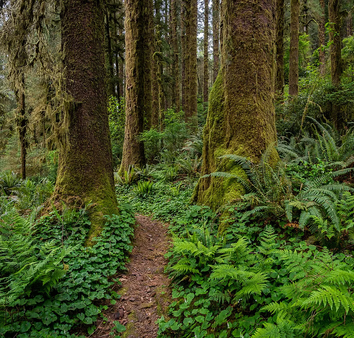
The first mile delivers classic Northern California coast: windswept bluffs, salt air, and views that stretch to Oregon on clear days. After the beach turnoff, the character shifts. You're walking on the ghost of US-101, the roadbed still visible but slowly being reclaimed by ferns and alder. This isn't cathedral redwood forest — you're in the transition zone where coastal prairie meets forest edge.
What to Expect
From the Crescent Beach Overlook trailhead, the path descends gently through grassland and coastal scrub. After a third of a mile, you'll hit the junction for Enderts Beach — a spur trail that drops 200 feet to the ocean. The beach itself is worth the detour: tide pools at low tide, sea stacks offshore, and often seals hauled out on the rocks.
The main trail continues south, and here's where it earns its keep. The route climbs steadily along the old highway grade, gaining elevation as it curves inland. After crossing Nickel Creek, you're committed to a proper workout. The trail can be overgrown in places, and erosion is ongoing — this isn't manicured park infrastructure. Mountain bikes are allowed and recommended if you're planning the full distance, though the initial beach section stays busy with foot traffic.
Rock falls are a legitimate concern along the cliff sections. The same geological instability that killed the highway continues to reshape the trail, and seasonal closures happen when winter storms knock down trees or trigger slides.
Tips & Logistics
Park at the end of Enderts Beach Road, 1.8 miles west of US-101. The turnoff is about half a mile north of where the highway exits the forest approaching Crescent City. The trailhead has parking for cars and RVs, plus vault toilets and trash cans.
Dogs aren't allowed on any park trails, and staying on the developed trail isn't just good practice — it's required to protect fragile coastal habitat. The erosion that claimed the highway will eventually claim parts of the trail too, so don't shortcut around damaged sections.
Weather matters more than elevation suggests. Coastal fog can roll in fast, and winter storms make the upper sections genuinely unpleasant. Late spring through early fall offers the most reliable conditions, though the beach section works year-round if you dress for wind.
If you're only going to Enderts Beach, sneakers are fine. The longer route demands real hiking boots — the old highway surface is broken and uneven, and wet conditions turn everything slippery. Water isn't available along the route, so carry what you need.
The trail intersection with Damnation Creek marks a natural turnaround point for day hikers, roughly 6.5 miles from the trailhead. Beyond that, you're entering backcountry that requires overnight permits and serious preparation.