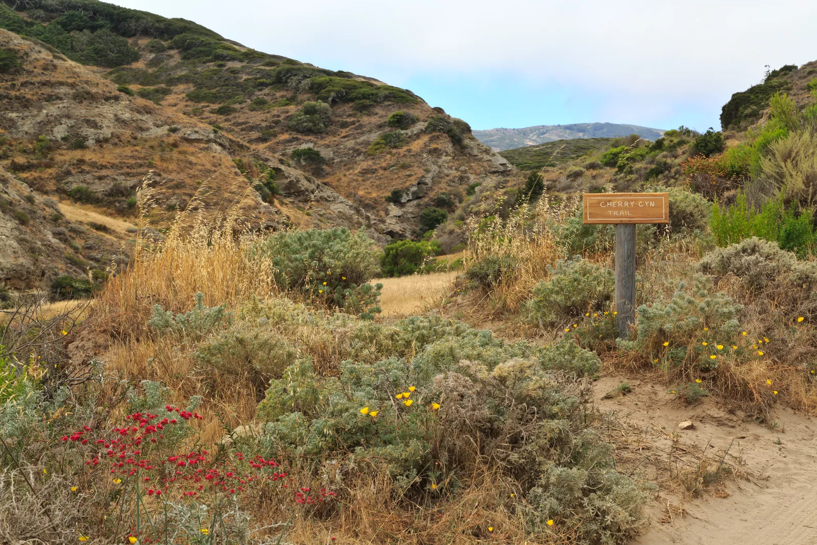
Cherry Canyon cuts a riparian groove through the coastal terrace of Santa Rosa Island, linking the pier to ridgetop views of Becher's Bay in a 3.5-mile loop. This is one of the few Channel Islands hikes that offers shade in its lower reaches — a seasonal creek bed lined with vegetation before the trail climbs out to exposed clifftop walking.
Trail Details
- 🏃Activities
- Hiking
- 📊Difficulty
- Moderate
- 🔁Trail Type
- loop
- 📏Distance
- 3.5 miles
- 📍Location
- CA
- 🐕Dogs Allowed
- No
- 💵Fee
- Free
Overview
The trail follows Santa Rosa's only significant canyon drainage, winding through what passes for lush vegetation on these wind-scoured islands. The seasonal creek creates a microclimate that supports riparian plants uncommon elsewhere on Santa Rosa, making the canyon feel almost mainland-like until you climb out onto the coastal terrace.
From there, the character shifts entirely. The route becomes a ridgetop walk with the Pacific stretching toward Santa Cruz Island, the coastline dropping away to beaches that see more elephant seals than people. It's this contrast — sheltered canyon to exposed clifftop — that defines the experience.
What to Expect
The trail starts from the pier and heads inland through the canyon bottom. The seasonal creek runs intermittently, supporting vegetation that provides actual shade, a commodity on these islands. The route bends up and down small hills as it follows the drainage, nothing steep but steady walking.
As the canyon widens, the trail begins its climb toward the coastal terrace. This section offers no shade, and the sun reflects off the light-colored soil. The ascent includes a series of switchbacks that lift you out of the canyon entirely onto the ridgeline above.
Once you crest the hill, the payoff arrives: sweeping views toward Santa Cruz Island and down to Becher's Bay. The trail includes two picnic benches at this viewpoint — about the only trail furniture you'll find on the Channel Islands. From here, the route follows the ridgeline and cliff edges back toward the trailhead, keeping those coastal views as you complete the loop.
Tips & Logistics
Water is the primary consideration. The seasonal creek isn't reliable, and there are no water sources along the trail itself. Fill up at the spigots near the Historic Ranch area or at the Water Canyon Campground before starting. Given the exposed nature of the ridgetop section, carry more water than the 3.5-mile distance might suggest.
The boat ride from Ventura Harbor takes 2-2.5 hours each way, so this makes sense as part of a day trip or overnight stay. Ferry schedules dictate your timing more than trail conditions do. The trail itself is accessible year-round, but Santa Rosa's weather can be unpredictable, especially the wind on the exposed sections.
Sun protection matters here. The ridgetop portion offers zero shade, and the island's light-colored soil reflects heat. Start early if you're visiting during warmer months, though Santa Rosa's marine climate keeps temperatures moderate compared to mainland areas.
Other trails branch off Cherry Canyon, connecting to Black Mountain, the campground, and Water Canyon beach. These connections make it possible to extend the hike or create different loop options using Telephone and Soledad roads if you want more distance.
The loop option via the coastal road provides variety on the return, though both routes end up covering similar terrain. The canyon approach offers the most interesting walking, while the road return is more direct but less scenic.