Carrington Point pushes hikers across Santa Rosa Island's windswept interior to a rocky promontory where sea lions gather below sea arches carved by Pacific swells. The 8-mile round-trip traverse is one of the Channel Islands' more demanding day hikes, made trickier by ferry schedules that leave little margin for dawdling.
Trail Details
- 🏃Activities
- Hiking
- 📊Difficulty
- Hard
- 🔁Trail Type
- out and back
- 📏Distance
- 8 miles
- 📍Location
- CA
- 🐕Dogs Allowed
- No
- 💵Fee
- Free
Overview
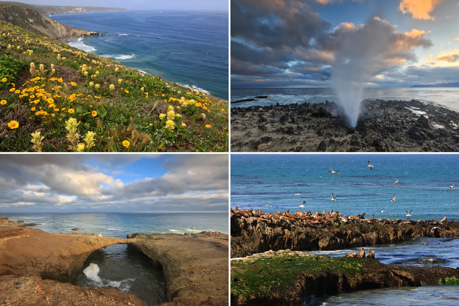
Santa Rosa Island doesn't coddle visitors. The second-largest Channel Island sits 26 miles offshore, exposed to Pacific weather systems that can turn a calm morning into an afternoon of punishing wind. Carrington Point amplifies this raw character — a hike that crosses the island's rolling grasslands and canyons to reach a dramatic coastal overlook where the ocean has sculpted arches and blowholes into the rocky shore.
The route covers nearly 1,000 feet of elevation gain over terrain that shifts from gentle rises to steep, exposed sections. Spring and summer bring wildflowers to the grasslands but also the strongest winds, which can make the final approach to the point genuinely challenging. What you're hiking toward is a convergence of the island's endemic species — soft-leaved island paintbrush grows here and nowhere else on earth — and its most dynamic coastal features.
What to Expect
The trail begins near the pier and immediately establishes its character: rolling terrain across open grassland with little shade or shelter from wind. The path is generally well-defined but can be steep in sections, demanding steady effort rather than technical skill. Most hikers find the middle portions of the route the most pleasant, where gentle grades allow for a sustainable pace across the island's interior.
Carrington Point itself rewards the effort with multiple attractions concentrated in a relatively small area. Sea lions and seals congregate on the rocky shores below, while the point's signature blowhole sends spray skyward when swells hit the right angle. The sea arch — carved by centuries of wave action — frames views back toward Santa Cruz Island and the Santa Barbara coastline. On clear days, the visibility extends to the mainland mountains.
Wildlife encounters are likely but unpredictable. The endangered island paintbrush blooms in early summer, adding splashes of red to the coastal bluffs. Seabirds nest on the offshore rocks, and the sound of barking sea lions carries up from the water. The endemic island fox may make an appearance, though these cat-sized predators are more commonly seen at dawn and dusk.
Tips & Logistics
Island Packers operates the only regular ferry service to Santa Rosa Island, and the schedule drives everything about this hike. Day-trip boats typically depart the island around 4 PM, leaving hikers with roughly five hours ashore — tight timing for an 8-mile hike that takes most people 3.5 to 4 hours. Factor in any time spent at the point itself, and the math gets uncomfortable for slower hikers or anyone who wants to linger.
Camping overnight solves the time pressure but requires advance reservations and hauling gear across the channel. The island's backcountry sites are primitive — no water, no facilities — so campers carry everything in and pack everything out.
Water is the critical logistical consideration. Santa Rosa Island has no reliable freshwater sources along the Carrington Point route, so hikers carry all the water they'll need for the day. In windy conditions, dehydration happens faster than expected. Plan on more water than a mainland hike of similar distance would require.
Wind protection matters more than temperature regulation. Even on warm days, the point can be brutally exposed to Pacific gusts. A windbreaker or light shell often proves more valuable than layers for warmth. The terrain doesn't demand specialized footwear, but the rocky coastal areas can be slippery when wet from spray.
Check ferry schedules and weather forecasts together — Santa Rosa Island trips cancel more frequently than sailings to Santa Cruz Island due to rougher seas and more challenging landing conditions.