This is the Channel Islands' most exclusive trail — a ranger-escorted six-mile round-trip to San Miguel Island's eastern tip, where four species of pinnipeds haul out in numbers that can reach into the hundreds. The hike exists because of unexploded ordnance; the payoff exists because you'll have front-row seats to one of California's largest marine mammal rookeries.
Trail Details
- 🏃Activities
- Hiking
- 📊Difficulty
- Hard
- 🔁Trail Type
- out and back
- 📏Distance
- 6 miles
- 📍Location
- CA
- 🐕Dogs Allowed
- No
- 💵Fee
- Free
- 📋Permit Required
- Yes
Overview
Cardwell Point sits at the far end of San Miguel Island's most restricted zone, where Navy bombing practice from decades past left behind ordnance that makes solo exploration illegal. The upshot: every hike here comes with a ranger guide and a group small enough that the experience feels more like a private tour than a crowded trail day.
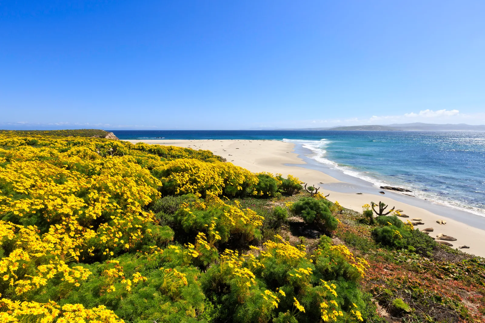
The route heads east from Cuyler Harbor across San Miguel's characteristic terrain — wind-sculpted grassland and coastal sage scrub, with views that stretch across the Santa Barbara Channel to Santa Rosa Island. This is raw island hiking: no shade, no water sources, and weather that can shift from calm to punishing in the span of an hour. The island fox might dart across the trail ahead of you, a reminder that you're in one of California's most isolated ecosystems.
What to Expect
The trail starts at Cuyler Harbor Beach, where Island Packers drops day hikers via skiff — there's no dock here, just a wet landing on sand. From there, it's three miles of rolling terrain to the point, with the rookery as your destination.
The real show happens at trail's end, where elephant seals, California sea lions, northern fur seals, and harbor seals gather in numbers that vary by season but can be genuinely massive. Elephant seals alone can number in the hundreds, sprawled across the beach in a scene that feels more like Alaska than Southern California. The cacophony is as impressive as the sight — barking, roaring, and the occasional territorial clash that sends animals scattering.
Near the point, you'll also spot the wreck of the USS Tortuga, a Navy dock landing ship that ran aground and now serves as a landmark visible from the trail. The juxtaposition — military remnant and marine mammal refuge — captures San Miguel's split identity as former bombing range and current wildlife sanctuary.
Tips & Logistics
San Miguel operates on a different schedule than the other Channel Islands. Island Packers runs only one or two day trips per year due to the nine-hour round-trip ferry ride from Ventura, which includes stops at other islands. When trips do run, they fill quickly — this is bucket-list territory for most California hikers.
The island is only open when Park Service personnel are present, and you'll need to complete a liability waiver and permit through Island Packers before boarding. Weather cancellations are common; San Miguel sits in the path of Pacific storms and frequently deals with fog, wind, and rough seas that scrub trips entirely.
Once you're on island, guided hike departure times get announced during visitor orientation — the ranger sets the pace and schedule, not your personal timeline. Bring layers for wind and temperature swings, sun protection for exposed hiking, and more water than you think you need. There are no refill options on San Miguel.
The strenuous rating reflects both distance and conditions rather than technical difficulty. The terrain is walkable, but three miles of island exposure can feel much longer when wind is pushing against you and there's nowhere to hide from sun or weather.
This isn't a hike you do on a whim. It requires advance planning, weather luck, and the willingness to work around constraints that don't exist anywhere else in the California trail system. The payoff is access to one of the state's most remote and remarkable wildlife spectacles.