The Boy Scout Trail cuts an 8-mile line across Joshua Tree's high desert, connecting the busy Keys West area to the remote Indian Cove campground. It's one of the park's few designated backpacking corridors, which means established campsites instead of the usual desert free-for-all, but also some of the longest shade-free miles you'll find in the Mojave.
Trail Details
- 🏃Activities
- Hiking
- 📏Distance
- 8 miles
- 🪨Surface
- dirt trail with hard packed and sandy sections, rocks
- 🌤️Best Seasons
- january, february, march, april, may, june, july, august, september, october, november, december
- 📍Location
- CA
- 🐕Dogs Allowed
- No
- 💵Fee
- Free
Overview
This isn't your typical Joshua Tree scramble through boulder piles. The Boy Scout Trail follows an actual trail for its entire 8-mile length, threading between the park's signature granite formations on a route that drops roughly 1,200 feet from the Keys West trailhead down to Indian Cove. Most hikers tackle it as a long day hike — 16 miles round-trip — but the designated backcountry campsites make it the park's primary overnight backpacking option.
The trail's character shifts as you move east. The first three miles roll fairly flat through classic high Mojave terrain: Joshua trees, juniper, and those house-sized granite domes that make navigation interesting. Around the 5-mile mark, the descent begins in earnest, dropping most of that elevation in about a mile and a half. By the time you reach Indian Cove, you're solidly in Colorado Desert country — lower, hotter, and more austere.
What to Expect
The surface alternates between hard-packed dirt and sandy washes, with the usual desert obstacles: scattered rock, thorny vegetation, and the occasional need to pick your way around or over granite slabs. Don't expect continuous tread like you'd find in the Sierra — this is still desert hiking, where the route sometimes becomes more of a general direction than a defined path.
Water doesn't exist along this route, and shade is essentially theoretical. The trail crosses open desert for most of its length, with only occasional relief near larger rock formations. Cell service is spotty to nonexistent, so download maps and let someone know your plans.
Navigation is straightforward in good weather — the trail is generally well-marked and the terrain obvious — but Joshua Tree's granite landscape can become disorienting in poor visibility. The park's signature rock piles all start to look similar when you're tired, and GPS can be unreliable among the formations.
Tips & Logistics
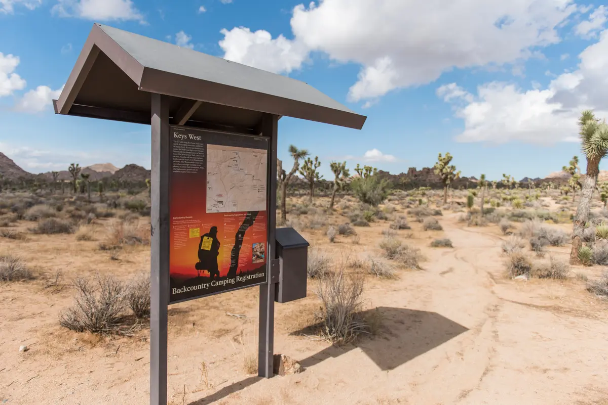
The Keys West trailhead sits about 6.5 miles past the West Entrance Station along Park Boulevard. Parking fills early during popular seasons, so arrive before dawn if you're day-hiking. Indian Cove has a much smaller lot on the receiving end.
Timing matters more here than on shorter desert trails. November through February offers the most reasonable temperatures, with March and April adding wildflowers to the equation. May through September is genuinely dangerous — temperatures routinely exceed 100°F with no shade relief. The park actively discourages hiking this trail during late spring, summer, and early fall.
Backpackers need permits ($6 for up to 12 people, up to 14 nights) and must use the designated campsites — no dispersed camping allowed in the Boy Scout Zone. Permits can be reserved up to six months ahead, which is smart during peak season.
Carry more water than you think you need. The standard desert recommendation is one gallon per person per day, but on a 16-mile day with significant sun exposure, that's barely adequate. Plan for at least 1.5 gallons for the round-trip, more if temperatures are high or you're moving slowly.
A shuttle hike from Keys West to Indian Cove cuts the distance in half but requires two vehicles or a pickup arrangement. Given the logistics involved and the character of the terrain, most people find the out-and-back format works fine — you'll see the desert from a different angle on the return trip.