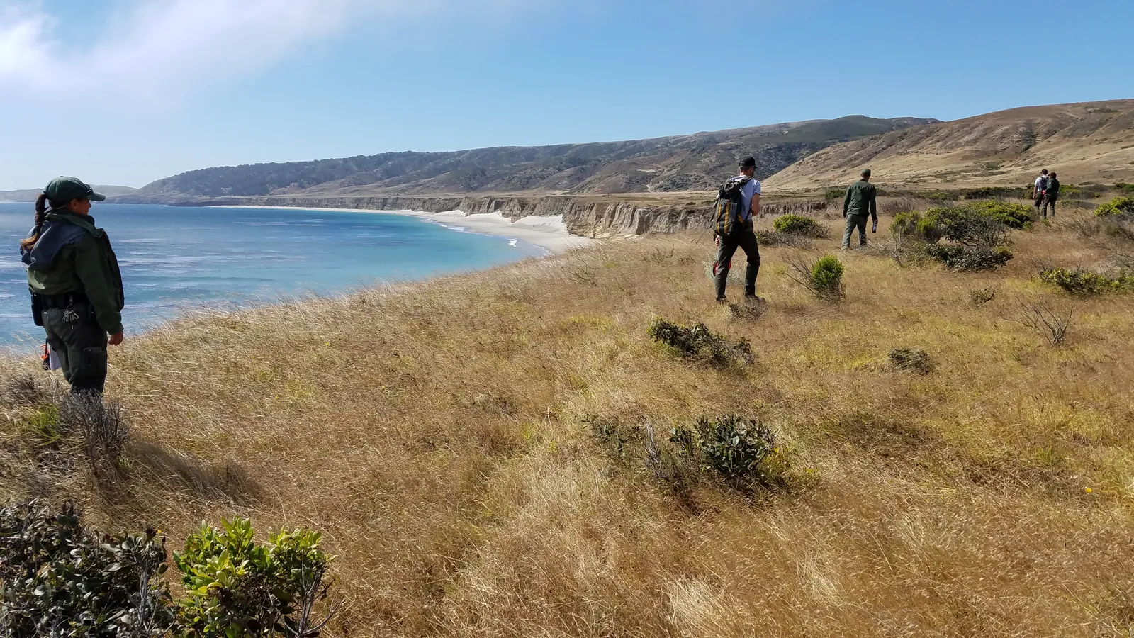
Becher's Bay offers one of the gentlest introductions to Santa Rosa Island's coastal terrain, following a marine terrace above the island's protected landing. This short walk delivers expansive views of the Santa Barbara Channel and neighboring islands without the commitment of longer island routes.
Trail Details
- 🏃Activities
- Hiking
- 📊Difficulty
- Easy
- 🔁Trail Type
- out and back
- 📏Distance
- 2 miles
- 📍Location
- CA
- 🐕Dogs Allowed
- No
- 💵Fee
- Free
Overview
The trail traces the marine terrace east of Becher's Bay pier, taking advantage of the relatively flat topography that makes Santa Rosa Island more approachable than its neighbors. You'll walk above white-sand beaches with views stretching to Carrington and Skunk Points, the mainland coast on clear days, and the Torrey pine forest that makes Santa Rosa unique among the Channel Islands.
The route passes the historic Vail and Vickers Ranch site, remnants of the island's ranching era that ended when the National Park Service took over. The bay itself offers some respite from the northwest winds that hammer much of the island, making this a reasonable choice even when conditions elsewhere turn brutal.
What to Expect
The path follows the elevated marine terrace, keeping you above the immediate coastline while maintaining ocean views throughout. The terrain is straightforward — no technical sections or significant elevation changes to manage. You'll pass a dirt airstrip, a reminder that boat access isn't the only way onto these islands, though it's how most visitors arrive.
Water Canyon appears along the route, though like most island drainages, it flows seasonally at best. The coastal views include Water Canyon Beach below and extend to the neighboring islands on clear days. The Torrey pine forest provides a striking backdrop — these trees exist naturally in only two places on earth: here and around San Diego.
Wind is the constant companion. Even in Becher's Bay's relatively protected setting, expect steady breezes. On rougher days, this becomes an asset rather than a hindrance, as the marine terrace offers more shelter than the island's exposed ridges and points.
Tips & Logistics
Island Packers runs the ferry service from Ventura Harbor to Santa Rosa Island, with Becher's Bay serving as the main landing point. The crossing takes roughly 3 hours, and schedules vary significantly by season. Book early — space is limited and weather can scrub trips with little notice.
Water is critical. There are no reliable sources on the island, and the combination of wind and sun creates dehydrating conditions even on mild days. Carry more than you think you need, especially if you're extending this walk into longer island exploration.
The ranch buildings near Becher's Bay remain off-limits unless you've arranged a specific tour beforehand. Stick to designated trails and respect the restoration work happening across the island. The island fox population is recovering from near-extinction, and human disturbance can set back years of conservation effort.
Seasonal closures affect back beaches and sand dunes from March through mid-September for seabird breeding. The coastal trail itself typically remains open, but check current regulations before departure since nesting patterns can shift closure boundaries.
Pack out everything, secure food from birds and foxes, and watch for poison oak and ticks. The isolation that makes these islands special also means self-sufficiency isn't optional — it's the price of admission to one of California's most pristine coastal environments.