The Bajada Nature Trail is Joshua Tree's gateway to the Colorado Desert — a quarter-mile loop that showcases plants adapted to extremes most desert hikers never see. Located near the park's southern entrance, this flat walk sits well below the Joshua tree country, offering a chance to understand the hotter, drier desert that covers the park's eastern half.
Trail Details
- 🏃Activities
- Hiking
- 📊Difficulty
- Easy
- 📏Distance
- 0.25 miles
- 🪨Surface
- sand
- 🌤️Best Seasons
- october, november, december, january, february, march, april, may
- 📍Location
- CA
- 🐕Dogs Allowed
- No
- 💵Fee
- Free
Overview
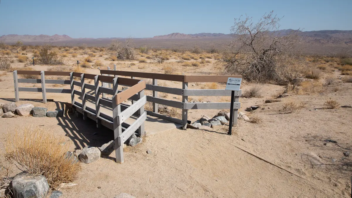
This isn't the Joshua Tree of Instagram photos. The Bajada sits in the Colorado Desert, the hottest and driest desert in North America, where creosote and desert ironwood have evolved strategies for surviving conditions that would kill the signature Joshua trees 2,000 feet uphill. The trail meanders through this landscape on hard-packed sand, with a short boardwalk section and three benches placed for contemplation rather than rest.
The experience takes 15 to 30 minutes depending on how often you stop to read the desert. After wet winters, February and March can deliver wildflower displays that transform the seemingly barren ground into something unexpectedly vibrant. Most of the year, though, the beauty here is subtler — the architecture of adaptation, plants pared down to essentials.
What to Expect
The trail offers little to no shade, which is the point. This is desert as laboratory, a place to understand how life persists when conditions seem impossible. The 5 feet of elevation change barely registers, but the transition from parking lot to trail involves some level changes that can be tricky depending on weather conditions.
Deep sand sections might challenge some wheelchairs despite the generally accessible design. The loop format means you can turn around anytime, though completing the circuit gives the full picture of this particular desert community. The boardwalk section provides a different perspective on the terrain, elevating you just enough to see patterns in the vegetation.
Tips & Logistics
Access couldn't be simpler: take I-10 to exit 168, then drive 1.5 miles north on Cottonwood Springs Road to the trailhead. The location sits outside the park's fee area, so no entrance fee applies, though that may change. Coordinates for GPS users: 33.681238, -115.801784.
Winter, spring, and fall are the recommended seasons, but "recommended" here means survivable rather than comfortable. Even in January, bring water and sun protection. Dawn and dusk hiking can work well, especially in the shoulder seasons when midday temperatures climb above reasonable levels.
The parking area accommodates both cars and RVs, with an information kiosk that provides context for what you're seeing. Service animals are welcome on leash, but pets and emotional support animals are not permitted.
This trail works best as an educational experience rather than exercise. Bring curiosity about plant adaptation, desert ecology, and the stark beauty of environments that don't try to please. The Bajada teaches patience — learning to see complexity in apparent simplicity, finding the remarkable in a landscape that initially looks empty.