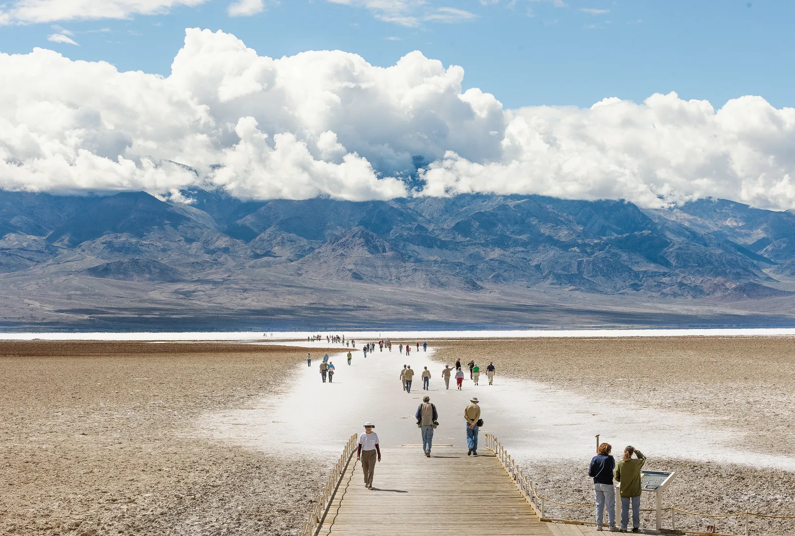
Badwater Basin is the lowest point in North America, 282 feet below sea level, on the floor of Death Valley off Badwater Road. A boardwalk leads onto a wide plain of salt flats, where a shallow lake can form for a few weeks after heavy rain before evaporating back to salt.
Details
- Type
- Point of Interest
- Accessibility
- Limited accessibility
Last verified: 6/13/2026
Overview
The salt at Badwater is mostly sodium chloride, table salt, left behind as water draining into the basin evaporates in the heat. Repeated flooding and drying push it into honeycomb ridges across the valley floor. The name comes from a surveyor whose mule would not drink the water here; it is not poisoned, just too salty to drink.
What to See
A boardwalk crosses the spring-fed pool near the parking area, then the salt flats open west toward the Panamint Range. Walk out far enough and you reach the polygon salt patterns. On the cliff behind the parking lot, look for the small "Sea Level" sign high above, which marks how far below it you are standing.
Know Before You Go
Summer surface temperatures on the salt can top 180°F and there is no shade, so visit in the cooler months or early in the day. After rare heavy rains a temporary lake (sometimes called Lake Manly) forms, but boating and flotation devices are prohibited. Carry water.