Indian Springs sits on the South Yuba River three miles west of Big Bend, where mature cedar and pine provide solid shade at 5,600 feet. The campground serves as a base camp for OHV enthusiasts and river rats, with direct access to Fordyce 4x4 trails and a popular swimming hole right alongside camp.
Campground Details
- ⛺Type
- Group
- 🏕️Total Sites
- 35
- 💵Fee per Night
- $24
- 📋Reservations
- Reservation Required
- 🏔️Elevation
- 5,600 ft
- 📍GPS
- 39.32958, -120.56928
- 🌤️Best Seasons
- spring, fall
- 🐾Pets Allowed
- No
- 📞Phone
- 530-478-6253
- 🗺️Address
- CA
Amenities
The Camp
The 35 sites spread along the north bank of the South Yuba River under a canopy of mature cedar and pine. A handful are walk-to tent sites for those who want some buffer from their neighbors. Each site comes with the standard picnic table and fire ring setup, plus vault toilets and drinking water throughout the campground.
The real draw here is proximity to the South Yuba River, which runs right past camp and offers rainbow trout fishing for those willing to work for it. The swimming hole next to the campground gets popular on warm days — expect company during peak season.
What to Know
Indian Springs requires reservations and runs unstaffed, so sort out any issues beforehand. The $24 per night fee covers single-family sites. Spring and fall are the designated seasons, which means summer can get hot and winter access may be limited.
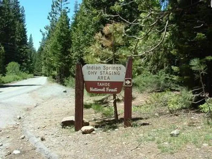
The adjacent Indian Springs OHV Staging Area means this campground caters heavily to the off-road vehicle crowd. If you're not into the sound of ATVs and dirt bikes, consider other options. If you are, you're in the right place — the popular Fordyce 4x4 jeep trail launches from here.
Nearby
The historic California Emigrant Trail passes nearby for those interested in Gold Rush-era history. Beyond the OHV trails, the area offers hiking and biking options, though specifics aren't detailed for this location.
Donner Lake sits 19 miles east via Interstate 80 if you want a change of scenery. The route follows historic Route 40 (Lincoln Highway) past China Wall, Rainbow Bridge, and other points of interest. Trailheads for Donner Summit PCT, Loch Leven, and Castle Peak are accessible from this corridor, along with the Alpha and Omega Scenic Overlook.