The Manzanita Lake Trail circles a shallow volcanic lake at 5,890 feet in 1.7 miles, with direct views of Lassen Peak and Chaos Crags across the water. It's the easiest walk in the park — nearly flat, accessible whenever the main road is open — and one of the better birdwatching loops in Northern California.
Overview
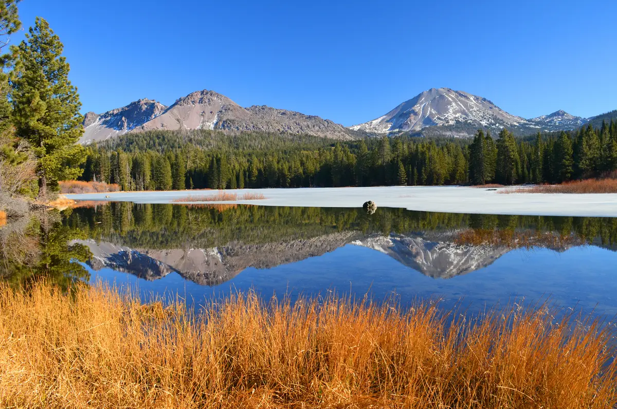
Manzanita Lake sits just inside the park's northwest entrance, formed by a landslide from Chaos Crags that dammed the drainage. The trail rings the lake on firm dirt, gaining almost no elevation. The western shore gives the best views of Lassen Peak reflected in the water, especially at sunset.
What to Expect
The loop starts from either the Manzanita Lake Day Use Area or Loomis Plaza near the park entrance. The surface is firm dirt with some exposed tree roots and rock — manageable for most footwear, but not stroller-accessible despite the flat grade. The lake's marshy edges attract a good mix of waterbirds. The surrounding forest holds songbirds, raptors, black-tailed deer, Douglas squirrels, and golden-mantled ground squirrels.
Tips & Logistics
The trail is accessible whenever the Lassen Volcanic Highway is open, typically late May or June through October or November. Snow is possible through April in heavy years. Sunset is the most popular time to walk the western shore for alpenglow on Lassen Peak — arrive 30 minutes early to find parking. No permit required. There's limited shade on the lake's south and west shores.