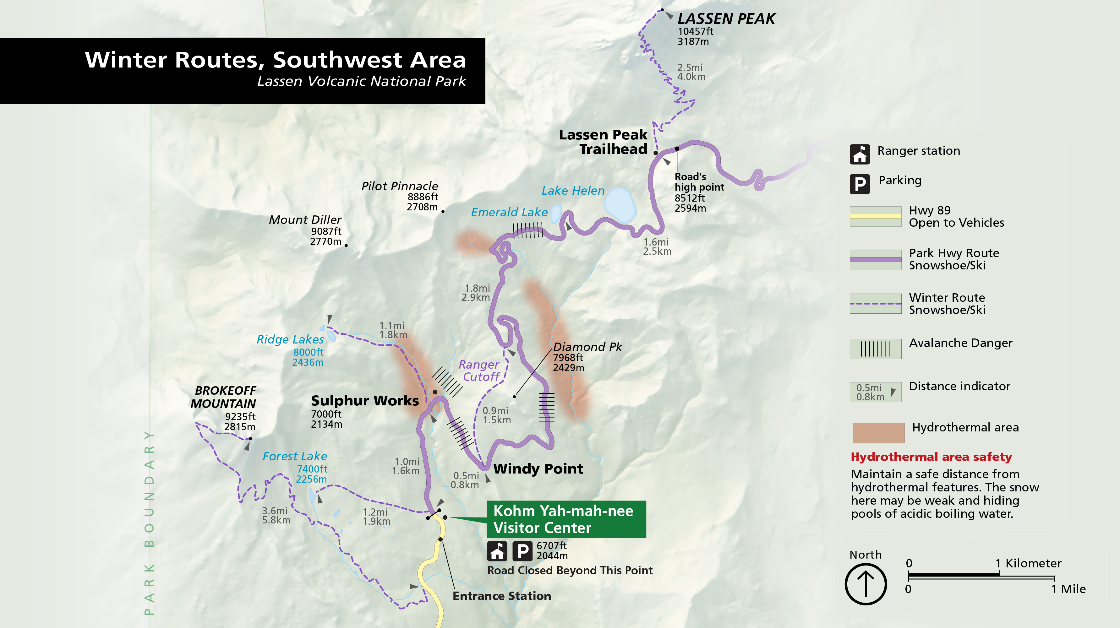
The Southwest Area Winter Routes are oversnow ski and snowshoe routes starting from the Kohm Yah-mah-nee Visitor Center, at about 6,700 feet. This part of the park gets the most snow and has steeper terrain than the Manzanita Lake side.
Details
- Type
- Point of Interest
- Accessibility
- Limited accessibility
Overview
When the park highway closes for winter, roughly December through April, vehicle access is limited to the Southwest and Manzanita Lake Areas. The Southwest routes start from the parking area in front of the Kohm Yah-mah-nee Visitor Center, at about 6,700 feet, the snowiest part of the park. The terrain is steeper than the Manzanita Lake side and carries a greater avalanche risk.
The Routes
A beginner route runs 2 miles round trip to the Sulphur Works hydrothermal area (6,700 to 7,000 feet). Intermediate routes include Ridge Lakes and Diamond Peak, each 4 miles round trip (6,700 to 8,000 feet). Advanced routes include Brokeoff Mountain, 7 miles round trip (6,650 to 9,250 feet), and Lassen Peak, 17 miles round trip (6,700 to 10,457 feet) and typically a three-day trip. Routes are traveled on skis or snowshoes.