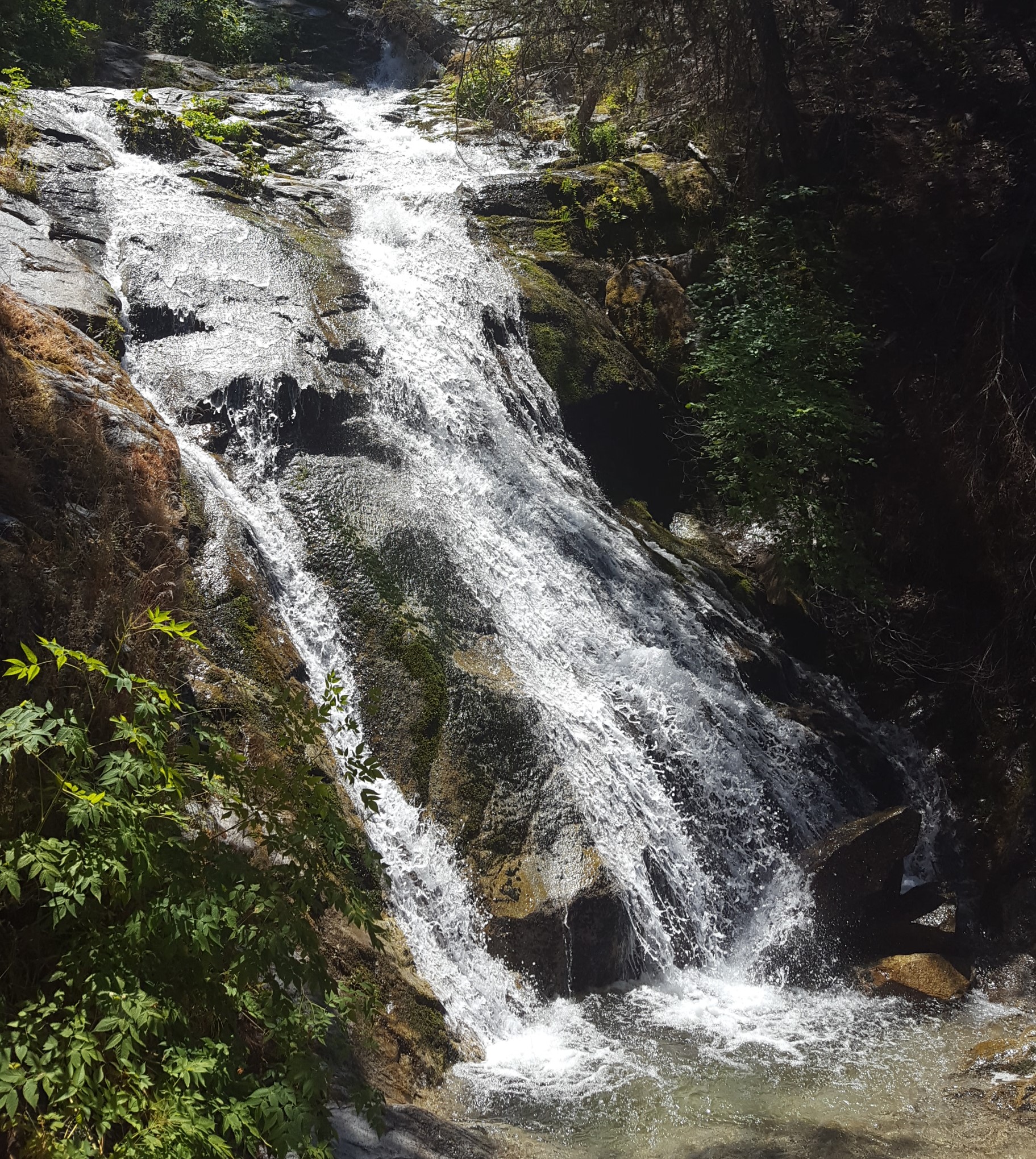
Whiskeytown Falls is a three-tiered, 220-foot cascade, the tallest waterfall in Whiskeytown National Recreation Area, reached by the 3.4-mile round-trip James K. Carr Trail.
Details
- Type
- Waterfall
- Accessibility
- Limited accessibility
Overview
Whiskeytown Falls drops 220 feet in three tiers and ranks as the park's tallest waterfall. The trail to reach it runs 3.4 miles round trip, climbing from about 2,200 to 2,900 feet, and is rated strenuous and steep. The final 0.2 miles narrows to a dirt path threaded with rocks and roots.
History
The path is named for James K. Carr, a reclamation engineer from Shasta County who served as Undersecretary of the Interior under President Kennedy and pushed for the creation of Whiskeytown National Recreation Area. The trail was built and formally opened to the public in 2006. It closed after the 2018 Carr Fire and reopened on Valentine's Day of 2020.
Know Before You Go
The immediate trail corridor burned lightly to moderately in the Carr Fire, and downed trees can still appear along the route. To reach the trailhead, drive west from the visitor center 9 miles on Highway 299 to Crystal Creek Road, turn left, and continue 4 miles to the small paved parking lot on the left.