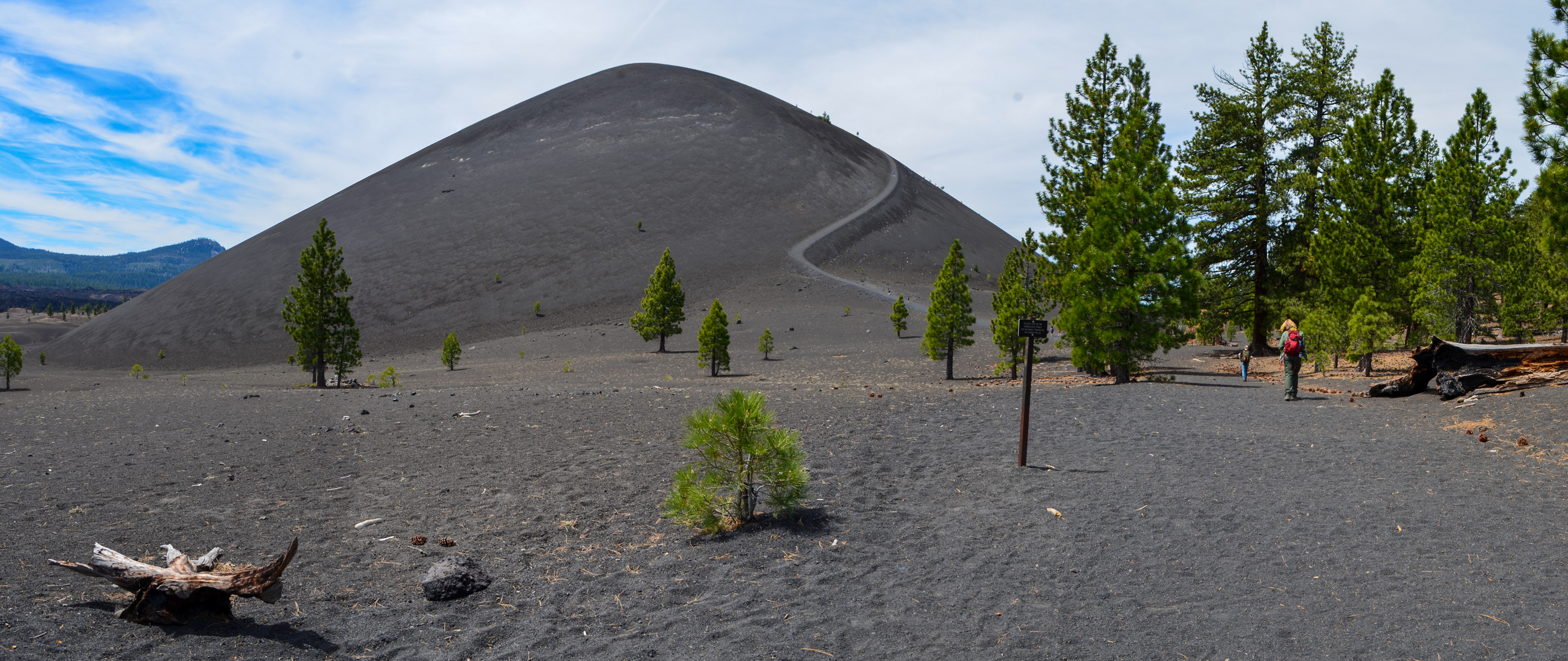
The Cinder Cone Trail climbs from the Butte Lake Day Use Area to the base and summit of Cinder Cone, a volcano in the northeast corner of the park that erupted around 1650. The route follows part of the Nobles Emigrant Trail.
Details
- Type
- Trailhead
- Accessibility
- Limited accessibility
The Trail
From the Butte Lake parking area, the round trip to the base of Cinder Cone is 2.4 miles and the round trip to the summit is 4 miles, with about 846 feet of elevation change. Loose, sand-like cinders make the climb to the summit slow and tiring. An additional trail continues down into the crater at the top.
What to See
Cinder Cone stands about 700 feet above its base and erupted around 1650. The summit gives views of the Painted Dunes, the Fantastic Lava Beds (the volcano's lava flow), Lassen Peak, Snag Lake, and Prospect Peak. The Cinder Cone Trail follows a portion of the Nobles Emigrant Trail, which is part of the California National Historic Trail.
Know Before You Go
The trailhead is reached by a six-mile dirt road off Highway 44. There is no shade on the cone and no water on the route, and the season runs roughly June through November.